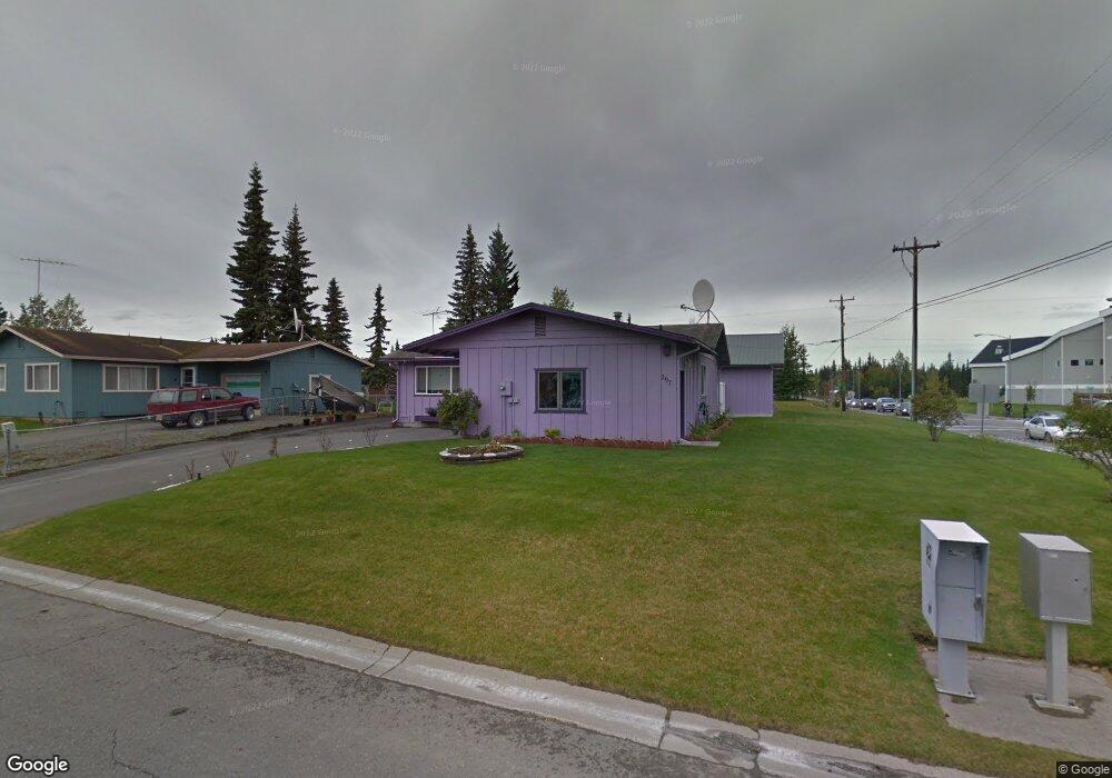
297 Adamson Cir Soldotna, AK 99669
Estimated Value: $163,000 - $304,618
3
Beds
1
Bath
1,024
Sq Ft
$246/Sq Ft
Est. Value
About This Home
This home is located at 297 Adamson Cir, Soldotna, AK 99669 and is currently estimated at $252,405, approximately $246 per square foot. 297 Adamson Cir is a home located in Kenai Peninsula Borough with nearby schools including Redoubt Elementary School, Skyview Middle School, and Soldotna High School.
Ownership History
Date
Name
Owned For
Owner Type
Purchase Details
Closed on
Aug 20, 2018
Sold by
Stewart Richard W and Stewart Vicki J
Bought by
Mcclure Adam M
Current Estimated Value
Home Financials for this Owner
Home Financials are based on the most recent Mortgage that was taken out on this home.
Original Mortgage
$104,700
Outstanding Balance
$90,928
Interest Rate
4.5%
Mortgage Type
New Conventional
Estimated Equity
$161,477
Purchase Details
Closed on
Mar 28, 2017
Sold by
Stewart Vicki J
Bought by
Stewart Richard W
Create a Home Valuation Report for This Property
The Home Valuation Report is an in-depth analysis detailing your home's value as well as a comparison with similar homes in the area
Home Values in the Area
Average Home Value in this Area
Purchase History
| Date | Buyer | Sale Price | Title Company |
|---|---|---|---|
| Mcclure Adam M | -- | First American Title | |
| Stewart Richard W | -- | None Available |
Source: Public Records
Mortgage History
| Date | Status | Borrower | Loan Amount |
|---|---|---|---|
| Open | Mcclure Adam M | $104,700 |
Source: Public Records
Tax History Compared to Growth
Tax History
| Year | Tax Paid | Tax Assessment Tax Assessment Total Assessment is a certain percentage of the fair market value that is determined by local assessors to be the total taxable value of land and additions on the property. | Land | Improvement |
|---|---|---|---|---|
| 2025 | $1,268 | $229,500 | $31,900 | $197,600 |
| 2024 | $634 | $205,000 | $31,100 | $173,900 |
| 2023 | $1,141 | $189,200 | $28,300 | $160,900 |
| 2022 | $1,083 | $184,600 | $26,900 | $157,700 |
| 2021 | $1,015 | $175,000 | $21,600 | $153,400 |
| 2020 | $970 | $167,300 | $21,600 | $145,700 |
| 2019 | $688 | $170,600 | $19,600 | $151,000 |
| 2018 | $1,015 | $172,800 | $19,600 | $153,200 |
| 2017 | $911 | $166,400 | $19,600 | $146,800 |
| 2016 | $885 | $161,300 | $19,600 | $141,700 |
| 2015 | $1,143 | $157,000 | $19,600 | $137,400 |
| 2014 | $1,143 | $155,900 | $19,600 | $136,300 |
Source: Public Records
Map
Nearby Homes
- 265 Charity Cir
- 327 Knight Dr
- 386 W Corral Ave
- 35868 Everwell Place
- 35856 Everwell Place
- 35840 Everwell Place
- 169 N Brentwood St
- 35839 Irons Ave
- 35841 Irons Ave
- 000 Ridgewood Dr
- 35870 Glory St
- 366 Diane Ln
- L42 N Aspen Dr
- 235 N Aspen Dr
- 256 Upper Rosian Dr
- 253 Upper Rosian Dr
- 36050 Irons Ave
- 150 S Leibrock St
- 190 Trumpeter Ave
- 36060 Greenridge St
- 291 Adamson Cir
- L9 B2 Vine
- 391 W Marydale Ave
- L7 B1 W Marydale Ave
- L4 B4 Vine
- 287 Adamson Cir
- 298 Adamson Cir
- 292 Adamson Cir
- 298 W Marydale Ave
- 292 Adamson Cir
- 303 W Marydale Ave
- L5 B2 Marydale
- L4 B2 Marydale
- 290 W Marydale Ave
- 285 Adamson Cir
- L6 B2 Marydale
- L3 B2 Marydale
- 288 Adamson Ct
- 303 W Vine Ave
- 284 Adamson Ct