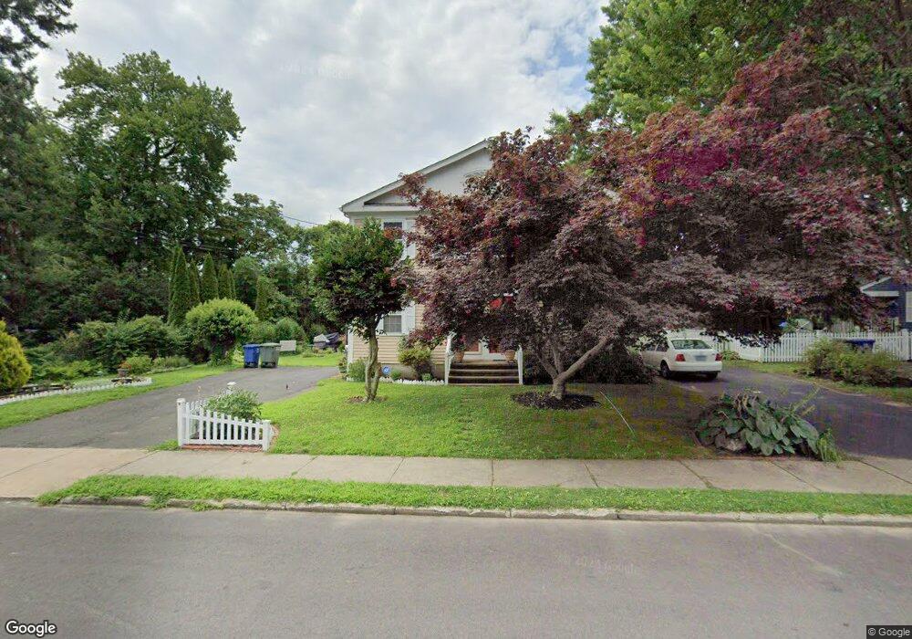
297 Brewster St Bridgeport, CT 06605
Black Rock NeighborhoodEstimated Value: $426,000 - $470,000
3
Beds
2
Baths
1,344
Sq Ft
$334/Sq Ft
Est. Value
About This Home
This home is located at 297 Brewster St, Bridgeport, CT 06605 and is currently estimated at $448,881, approximately $333 per square foot. 297 Brewster St is a home located in Fairfield County with nearby schools including Black Rock School, Bassick High School, and Park City Prep Charter School.
Ownership History
Date
Name
Owned For
Owner Type
Purchase Details
Closed on
Jun 16, 1983
Bought by
Hunt David P and Hunt Blanca
Current Estimated Value
Create a Home Valuation Report for This Property
The Home Valuation Report is an in-depth analysis detailing your home's value as well as a comparison with similar homes in the area
Home Values in the Area
Average Home Value in this Area
Purchase History
| Date | Buyer | Sale Price | Title Company |
|---|---|---|---|
| Hunt David P | -- | -- |
Source: Public Records
Mortgage History
| Date | Status | Borrower | Loan Amount |
|---|---|---|---|
| Closed | Hunt David P | $12,200 | |
| Open | Hunt David P | $62,000 | |
| Closed | Hunt David P | $52,598 |
Source: Public Records
Tax History Compared to Growth
Tax History
| Year | Tax Paid | Tax Assessment Tax Assessment Total Assessment is a certain percentage of the fair market value that is determined by local assessors to be the total taxable value of land and additions on the property. | Land | Improvement |
|---|---|---|---|---|
| 2025 | $6,989 | $160,861 | $51,741 | $109,120 |
| 2024 | $6,989 | $160,861 | $51,741 | $109,120 |
| 2023 | $6,989 | $160,861 | $51,741 | $109,120 |
| 2022 | $6,989 | $160,861 | $51,741 | $109,120 |
| 2021 | $6,989 | $160,861 | $51,741 | $109,120 |
| 2020 | $7,094 | $131,390 | $58,390 | $73,000 |
| 2019 | $7,094 | $131,390 | $58,390 | $73,000 |
| 2018 | $7,144 | $131,390 | $58,390 | $73,000 |
| 2017 | $7,144 | $131,390 | $58,390 | $73,000 |
| 2016 | $7,144 | $131,390 | $58,390 | $73,000 |
| 2015 | $6,053 | $143,440 | $46,620 | $96,820 |
| 2014 | $6,053 | $143,440 | $46,620 | $96,820 |
Source: Public Records
Map
Nearby Homes
- 65 Ellsworth St Unit 302
- 69 Ellsworth St Unit 102
- 48 Bywater Ln Unit 48
- 222 Ellsworth St
- 20 Haddon St Unit 3
- 26 Rowsley St Unit 3
- 34 Hanford Ave
- 23 Harborview Place
- 2773 Fairfield Ave Unit 3
- 320 Lake Ave
- 506 Courtland Ave Unit 508
- 51 Princeton St
- 363 Lake Ave
- 185 Shell St
- 80 Fox St
- 166 Alfred St
- 165 Bennett St
- 105 Scofield Ave
- 115 Balmforth St
- 855 Brewster St Unit 857
- 299 Brewster St
- 315 Brewster St
- 283 Brewster St
- 402 Grovers Ave
- 317 Brewster St
- 294 Brewster St
- 272 Brewster St
- 326 Brewster St
- 310 Brewster St
- 328 Brewster St
- 324 Brewster St
- 24 Calderwood Ct
- 5 Calderwood Ct
- 266 Brewster St Unit 268
- 340 Brewster St
- 259 Brewster St Unit 261
- 5 Calderwood Ct
- 4 Calderwood Ct
- 7 Calderwood Ct
- 7 Calderwood Ct