Estimated Value: $187,000 - $210,551
3
Beds
1
Bath
904
Sq Ft
$218/Sq Ft
Est. Value
About This Home
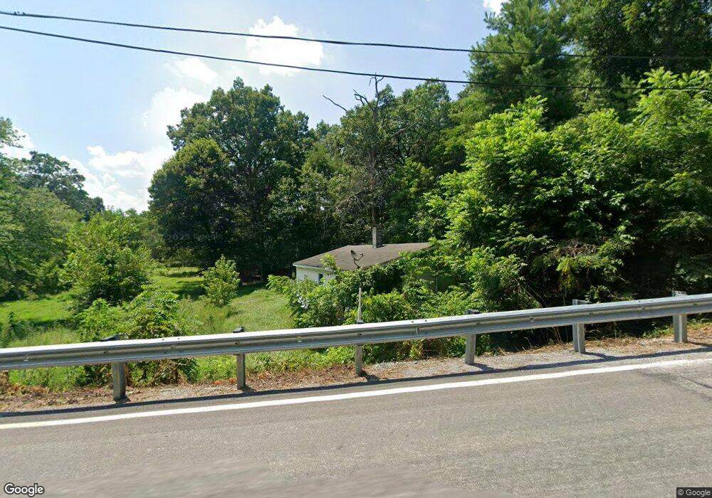
This home is located at 297 Miller Rd, Delta, PA 17314 and is currently estimated at $197,388, approximately $218 per square foot. 297 Miller Rd is a home located in York County with nearby schools including South Eastern Intermediate School, South Eastern Middle School, and Kennard-Dale High School.
Ownership History
Date
Name
Owned For
Owner Type
Purchase Details
Closed on
Jun 10, 2021
Sold by
Almoncy Shelby Jane A and Bright Kimberline L
Bought by
Commonwealth Of Pennsylvaia
Current Estimated Value
Purchase Details
Closed on
Apr 10, 2015
Sold by
Almoney Paul N and Almoney Shelby Jene A
Bought by
Almoney Paul N and Almoney Shelby Jene A
Purchase Details
Closed on
Jan 14, 2011
Sold by
Almoney Paul N and Almoney Shelby Jene A
Bought by
Almoney Paul N and Almoney Shelby Jene A
Purchase Details
Closed on
Sep 9, 1961
Bought by
Almoney Paul N and Shelby Jene A
Create a Home Valuation Report for This Property
The Home Valuation Report is an in-depth analysis detailing your home's value as well as a comparison with similar homes in the area
Home Values in the Area
Average Home Value in this Area
Purchase History
| Date | Buyer | Sale Price | Title Company |
|---|---|---|---|
| Commonwealth Of Pennsylvaia | -- | None Available | |
| Almoney Paul N | -- | None Available | |
| Almoney Paul N | -- | None Available | |
| Almoney Paul N | -- | None Available | |
| Almoney Paul N | $100 | -- |
Source: Public Records
Tax History Compared to Growth
Tax History
| Year | Tax Paid | Tax Assessment Tax Assessment Total Assessment is a certain percentage of the fair market value that is determined by local assessors to be the total taxable value of land and additions on the property. | Land | Improvement |
|---|---|---|---|---|
| 2025 | $2,443 | $81,120 | $37,700 | $43,420 |
| 2024 | $2,443 | $81,120 | $37,700 | $43,420 |
| 2023 | $2,443 | $81,120 | $37,700 | $43,420 |
| 2022 | $2,448 | $81,290 | $37,870 | $43,420 |
| 2021 | $2,367 | $81,290 | $37,870 | $43,420 |
| 2020 | $2,327 | $81,290 | $37,870 | $43,420 |
| 2019 | $2,318 | $81,290 | $37,870 | $43,420 |
| 2018 | $2,318 | $81,290 | $37,870 | $43,420 |
| 2017 | $2,318 | $81,290 | $37,870 | $43,420 |
| 2016 | $0 | $81,290 | $37,870 | $43,420 |
| 2015 | -- | $81,290 | $37,870 | $43,420 |
| 2014 | -- | $81,290 | $37,870 | $43,420 |
Source: Public Records
Map
Nearby Homes
- Parcel 859 Neill Run Rd
- 46 Corn Tassel Rd
- 216 Meadow Trail
- 267 Cook Rd
- 194 Cook Rd
- 76 Laurel Dr
- 8290 Woodbine Rd
- 45 Wenzel Rd
- 0 Dogwood Rd
- 0 Valley Ln
- 53 Dogwood Rd
- Lot C Bryansville Rd
- 63 Cherry Rd
- 556 Bair Rd
- 0 Highview Dr
- 55 Highfield Rd
- Lot 4 Ridge Rd
- 115 Highfield Rd
- 387 Garvine Mill Rd
- 2913 Whiteford Rd
- 5 Burns Rd
- 1 Burns Rd
- Lot B043 Miller Rd
- 349 Miller Rd
- 352 Miller Rd
- 28 Cardinal Trail
- 15 Cardinal Trail
- 37 Cardinal Trail
- 4 Bluebird Trail
- 6 Bluebird Trail
- 16 Bluebird Trail
- 47 Cardinal Trail
- 26 Bluebird Trail
- 55 Cardinal Trail
- 260 Miller Rd
- 0 Bluebird Trail
- 38 Bluebird Trail
- 255 Miller Rd
- 7 Bluebird Trail
- 48 Bluebird Trail