Estimated Value: $504,642 - $616,000
Studio
--
Bath
1,879
Sq Ft
$302/Sq Ft
Est. Value
About This Home
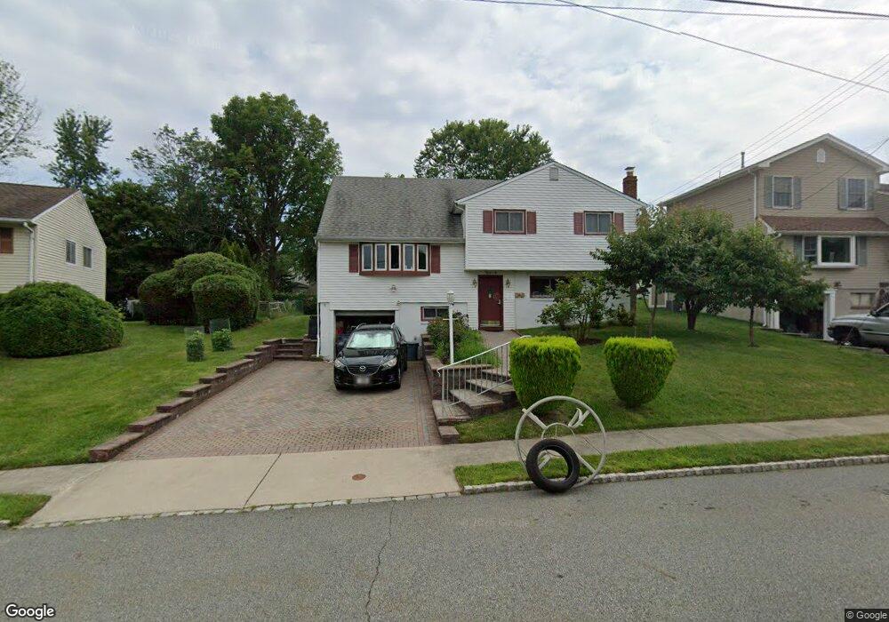
This home is located at 297 Perry St, Dover, NJ 07801 and is currently estimated at $567,161, approximately $301 per square foot. 297 Perry St is a home located in Morris County with nearby schools including Birchwood School, Copeland Middle School, and Divine Mercy Academy.
Ownership History
Date
Name
Owned For
Owner Type
Purchase Details
Closed on
Dec 7, 1998
Sold by
Nguyen Thomas Thang Huu
Bought by
Nguyen Diep Thi
Current Estimated Value
Purchase Details
Closed on
Jun 12, 1997
Sold by
Nguyen Thien and Nguyen Thuyla
Bought by
Nguyen Thomas Thang Huu
Home Financials for this Owner
Home Financials are based on the most recent Mortgage that was taken out on this home.
Original Mortgage
$135,000
Interest Rate
7.41%
Mortgage Type
Balloon
Create a Home Valuation Report for This Property
The Home Valuation Report is an in-depth analysis detailing your home's value as well as a comparison with similar homes in the area
Home Values in the Area
Average Home Value in this Area
Purchase History
| Date | Buyer | Sale Price | Title Company |
|---|---|---|---|
| Nguyen Diep Thi | -- | -- | |
| Nguyen Thomas Thang Huu | $160,000 | -- |
Source: Public Records
Mortgage History
| Date | Status | Borrower | Loan Amount |
|---|---|---|---|
| Closed | Nguyen Thomas Thang Huu | $135,000 |
Source: Public Records
Tax History
| Year | Tax Paid | Tax Assessment Tax Assessment Total Assessment is a certain percentage of the fair market value that is determined by local assessors to be the total taxable value of land and additions on the property. | Land | Improvement |
|---|---|---|---|---|
| 2025 | $10,210 | $423,400 | $240,200 | $183,200 |
| 2024 | $9,822 | $398,200 | $225,100 | $173,100 |
| 2023 | $9,822 | $374,300 | $210,500 | $163,800 |
| 2022 | $9,189 | $342,400 | $186,200 | $156,200 |
| 2021 | $9,189 | $323,800 | $174,400 | $149,400 |
| 2020 | $9,037 | $318,100 | $172,000 | $146,100 |
| 2019 | $8,864 | $310,700 | $167,200 | $143,500 |
| 2018 | $8,813 | $304,000 | $166,400 | $137,600 |
| 2017 | $8,857 | $283,700 | $151,200 | $132,500 |
| 2016 | $8,744 | $283,700 | $151,200 | $132,500 |
| 2015 | $8,681 | $283,700 | $151,200 | $132,500 |
| 2014 | $8,520 | $283,700 | $151,200 | $132,500 |
Source: Public Records
Map
Nearby Homes
- 248 Perry St
- 515 Herrick Dr
- 79 Highview Terrace
- 318 Daniel St
- 336 Mount Pleasant Ave
- 26 Stephen Place
- 15 Blakely Ave
- 11 Christopher St
- 26 Addison Ave
- 195 Mount Pleasant Ave
- 301 E McFarlan St -A and B
- 25 Flintlock Terrace
- 5 William Dr
- 18 Elycroft Ave
- 318 W Main St
- 4 Faesch Ct
- 31 Independence Way
- 61 Hemlock Rd
- 8 N Salem St
- 376 E Blackwell St
Your Personal Tour Guide
Ask me questions while you tour the home.