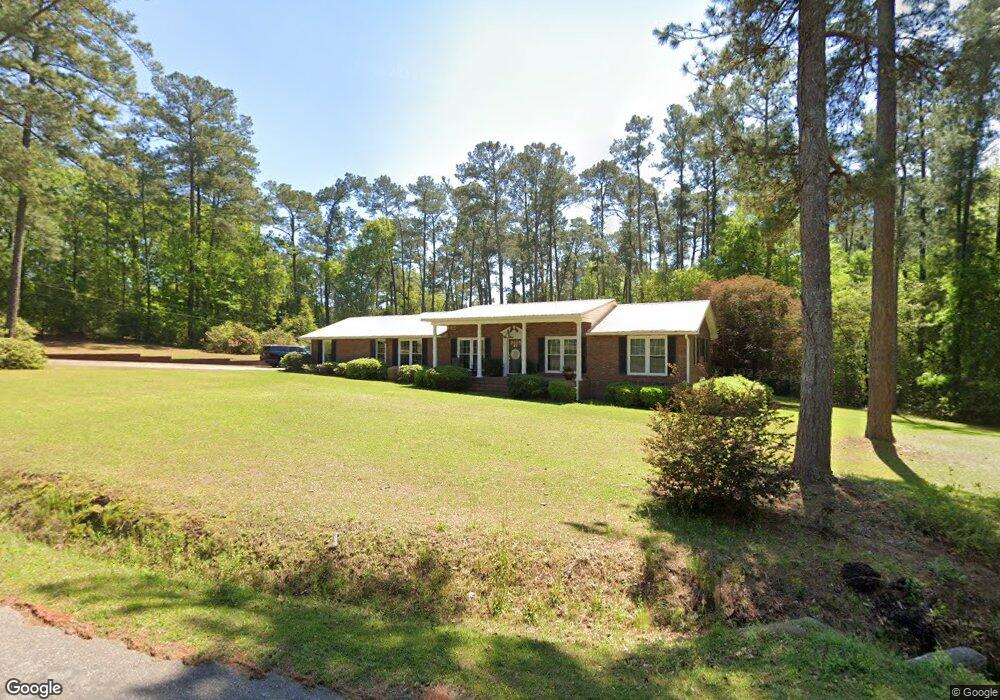
297 Rawson Cir SW Pelham, GA 31779
Estimated Value: $249,970 - $278,000
Studio
1
Bath
2,150
Sq Ft
$123/Sq Ft
Est. Value
About This Home
This home is located at 297 Rawson Cir SW, Pelham, GA 31779 and is currently estimated at $263,743, approximately $122 per square foot. 297 Rawson Cir SW is a home located in Mitchell County with nearby schools including Pelham Elementary School, Pelham City Middle School, and Pelham High School.
Ownership History
Date
Name
Owned For
Owner Type
Purchase Details
Closed on
Apr 3, 2017
Sold by
Snellgrove Carl Ray
Bought by
Snellgrove Michael Ray and Snellgrove Rebecca T
Current Estimated Value
Home Financials for this Owner
Home Financials are based on the most recent Mortgage that was taken out on this home.
Original Mortgage
$79,550
Outstanding Balance
$65,997
Interest Rate
4.1%
Mortgage Type
New Conventional
Estimated Equity
$197,746
Create a Home Valuation Report for This Property
The Home Valuation Report is an in-depth analysis detailing your home's value as well as a comparison with similar homes in the area
Home Values in the Area
Average Home Value in this Area
Purchase History
| Date | Buyer | Sale Price | Title Company |
|---|---|---|---|
| Snellgrove Michael Ray | $99,550 | -- |
Source: Public Records
Mortgage History
| Date | Status | Borrower | Loan Amount |
|---|---|---|---|
| Open | Snellgrove Michael Ray | $79,550 |
Source: Public Records
Tax History
| Year | Tax Paid | Tax Assessment Tax Assessment Total Assessment is a certain percentage of the fair market value that is determined by local assessors to be the total taxable value of land and additions on the property. | Land | Improvement |
|---|---|---|---|---|
| 2025 | $3,767 | $89,160 | $6,000 | $83,160 |
| 2024 | $3,769 | $89,160 | $6,000 | $83,160 |
| 2023 | $3,830 | $89,160 | $6,000 | $83,160 |
| 2022 | $3,367 | $75,920 | $6,000 | $69,920 |
| 2021 | $2,546 | $57,400 | $6,000 | $51,400 |
| 2020 | $2,445 | $57,400 | $6,000 | $51,400 |
| 2019 | $2,328 | $53,520 | $6,000 | $47,520 |
| 2018 | $2,420 | $53,520 | $6,000 | $47,520 |
| 2017 | $1,045 | $53,094 | $6,000 | $47,094 |
| 2016 | $1,044 | $53,094 | $6,000 | $47,094 |
| 2015 | $1,044 | $53,094 | $6,000 | $47,094 |
| 2014 | $1,044 | $53,094 | $6,000 | $47,094 |
| 2013 | $1,044 | $53,093 | $6,000 | $47,093 |
Source: Public Records
Map
Nearby Homes
- 277 Saunders St SW
- 354 Bennett St NW
- 297 Saunders St SW
- 410 Hollis St SW
- 277 Porter St SW
- 389 Stewart St SW
- 233 Cannon St NW
- 209 McDonald St SW
- 212 Hand Ave W
- 0 Old Pelham Rd Unit 10685078
- 210 Castleberry St NW
- 443 Stewart St SW
- 0 Old Ga Highway 3
- 0 111 North Hwy
- 0 Grady St SW
- 352 College St SW
- 589 Liberia St NW
- 653 Liberia St NW
- 199 Carroll St NE
- 3** Youngs Mill Rd
- 138 Aldridge St SW
- 126 Aldridge St SW
- 322 Rawson Cir SW
- 131 Aldridge St SW
- 349 Rawson Cir SW
- 14.45 ac Rawson Cir
- 229 Rawson Cir SW
- 133 N Legion Dr SW
- 541 Hand Ave W
- 201 Rawson Cir SW
- 529 Hand Ave W
- 00 Rawson Cir
- 569 Hand Ave W
- 0 Rawson Cir SW
- * Rawson Cir SW
- 145 Aldridge St SW
- 111 N Legion Dr SW
- 599 Hand Ave W
- 154 N Legion Dr SW
- 228 Rawson Cir SW
Your Personal Tour Guide
Ask me questions while you tour the home.