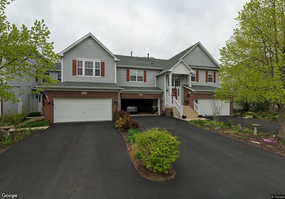
297 Ridge Rd North Aurora, IL 60542
Estimated Value: $339,000 - $362,000
2
Beds
--
Bath
2,114
Sq Ft
$166/Sq Ft
Est. Value
About This Home
This home is located at 297 Ridge Rd, North Aurora, IL 60542 and is currently estimated at $351,569, approximately $166 per square foot. 297 Ridge Rd is a home located in Kane County with nearby schools including Schneider Elementary School, Herget Middle School, and West Aurora High School.
Ownership History
Date
Name
Owned For
Owner Type
Purchase Details
Closed on
Jan 8, 2019
Sold by
Robison Suzan B
Bought by
Chicago Title Land Trust Companu and Trust Number 8002379908
Current Estimated Value
Purchase Details
Closed on
Mar 23, 2006
Sold by
Pryzeki Hilde
Bought by
Robison Suzan B
Home Financials for this Owner
Home Financials are based on the most recent Mortgage that was taken out on this home.
Original Mortgage
$50,000
Interest Rate
6.48%
Mortgage Type
Fannie Mae Freddie Mac
Purchase Details
Closed on
Nov 15, 2002
Sold by
Banbury Ridge Llc
Bought by
Pryzeki Hilde
Home Financials for this Owner
Home Financials are based on the most recent Mortgage that was taken out on this home.
Original Mortgage
$140,000
Interest Rate
6.25%
Mortgage Type
Purchase Money Mortgage
Create a Home Valuation Report for This Property
The Home Valuation Report is an in-depth analysis detailing your home's value as well as a comparison with similar homes in the area
Home Values in the Area
Average Home Value in this Area
Purchase History
| Date | Buyer | Sale Price | Title Company |
|---|---|---|---|
| Chicago Title Land Trust Companu | -- | Chicago Title Insurance Co | |
| Robison Suzan B | $248,000 | Atg | |
| Pryzeki Hilde | $230,000 | Chicago Title Insurance Co |
Source: Public Records
Mortgage History
| Date | Status | Borrower | Loan Amount |
|---|---|---|---|
| Previous Owner | Robison Suzan B | $50,000 | |
| Previous Owner | Pryzeki Hilde | $140,000 |
Source: Public Records
Tax History Compared to Growth
Tax History
| Year | Tax Paid | Tax Assessment Tax Assessment Total Assessment is a certain percentage of the fair market value that is determined by local assessors to be the total taxable value of land and additions on the property. | Land | Improvement |
|---|---|---|---|---|
| 2024 | $3,853 | $92,762 | $17,656 | $75,106 |
| 2023 | $4,171 | $82,117 | $16,666 | $65,451 |
| 2022 | $4,649 | $76,745 | $15,576 | $61,169 |
| 2021 | $4,783 | $71,095 | $14,772 | $56,323 |
| 2020 | $6,031 | $69,728 | $14,488 | $55,240 |
| 2019 | $5,114 | $67,259 | $13,975 | $53,284 |
| 2018 | $5,441 | $71,202 | $12,926 | $58,276 |
| 2017 | $5,602 | $76,463 | $10,164 | $66,299 |
| 2016 | $5,772 | $74,236 | $9,868 | $64,368 |
| 2015 | -- | $72,545 | $9,643 | $62,902 |
| 2014 | -- | $70,261 | $9,339 | $60,922 |
| 2013 | -- | $68,890 | $9,157 | $59,733 |
Source: Public Records
Map
Nearby Homes
- 254 Ridge Rd
- 273 Ridley St
- 215 Dee Rd
- 302 Dee Rd
- 105 April Ln Unit 2
- 114 Briar Ln Unit 2
- 509 Wingfoot Dr
- 719 Pinecreek Dr
- 616 Pinehurst Dr
- 203 Lilac Ln
- 202 Linn Ct Unit C
- 810 Columbia Cir Unit 3
- 122 E State St
- 148 N Lincolnway
- 925 Darwin St
- 355 Hilltop Dr
- 1316 Brandywine Cir Unit 4
- 451 Pheasant Hill Dr
- 1232 S Batavia Ave
- 344 Hilltop Dr