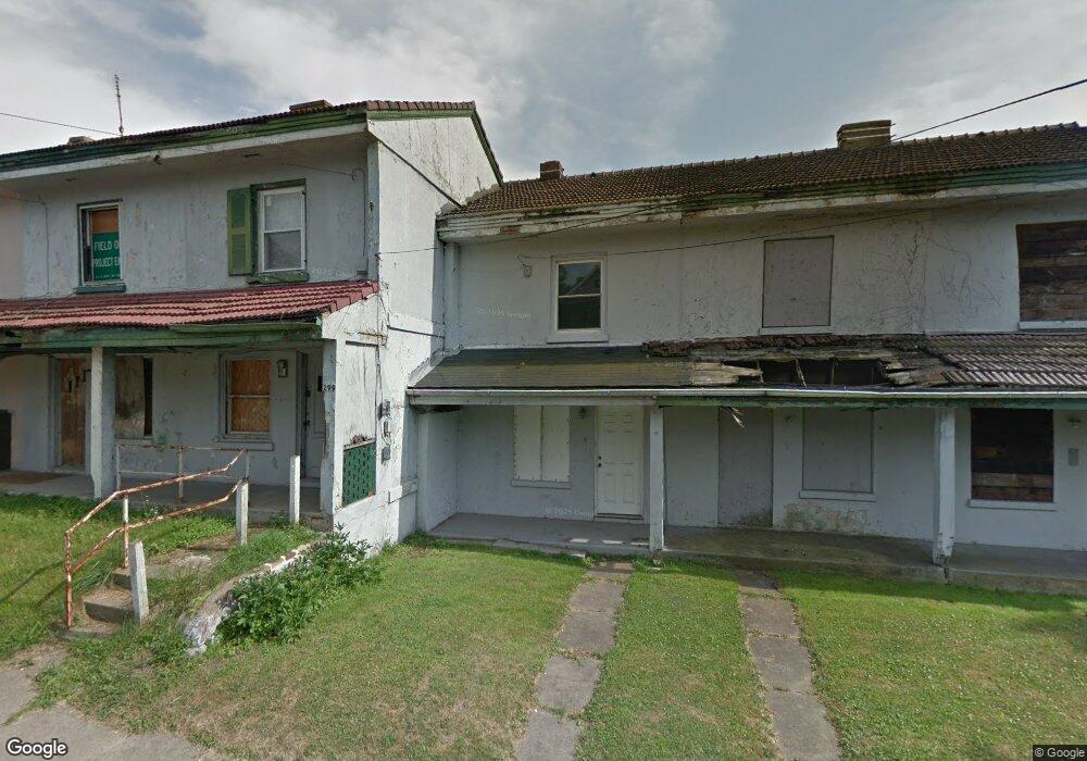
297 Robinson Rd Campbell, OH 44405
Estimated Value: $11,264 - $143,000
1
Bed
1
Bath
728
Sq Ft
$130/Sq Ft
Est. Value
About This Home
This home is located at 297 Robinson Rd, Campbell, OH 44405 and is currently estimated at $94,755, approximately $130 per square foot. 297 Robinson Rd is a home located in Mahoning County with nearby schools including Campbell Elementary School, Memorial High School, and Northeast Ohio Impact Academy.
Ownership History
Date
Name
Owned For
Owner Type
Purchase Details
Closed on
Dec 24, 2024
Sold by
Sheriff Of Mahoning County
Bought by
City Of Campbell
Current Estimated Value
Purchase Details
Closed on
Oct 24, 2005
Sold by
Iverson Investments Inc
Bought by
Brown James and Brown James E
Purchase Details
Closed on
Jul 27, 2005
Sold by
Greentree Investments Trumbull Cnty Inc
Bought by
Iverson Investments Inc
Purchase Details
Closed on
Jul 15, 2004
Sold by
Oakmont Properties
Bought by
Greentree Investments Of Trumbull County
Purchase Details
Closed on
Jan 3, 2000
Sold by
Malutic Steven M
Bought by
Oakmont Properties
Purchase Details
Closed on
Dec 2, 1999
Sold by
Berlin Patricia
Bought by
Malutic Stephen M
Purchase Details
Closed on
Apr 26, 1982
Bought by
Kostow Irene H
Create a Home Valuation Report for This Property
The Home Valuation Report is an in-depth analysis detailing your home's value as well as a comparison with similar homes in the area
Home Values in the Area
Average Home Value in this Area
Purchase History
| Date | Buyer | Sale Price | Title Company |
|---|---|---|---|
| City Of Campbell | -- | None Listed On Document | |
| City Of Campbell | -- | None Listed On Document | |
| City Of Campbell | -- | None Listed On Document | |
| Brown James | $5,900 | -- | |
| Iverson Investments Inc | $45,000 | -- | |
| Greentree Investments Of Trumbull County | -- | -- | |
| Oakmont Properties | $4,514 | -- | |
| Malutic Stephen M | $3,000 | -- | |
| Kostow Irene H | -- | -- |
Source: Public Records
Tax History
| Year | Tax Paid | Tax Assessment Tax Assessment Total Assessment is a certain percentage of the fair market value that is determined by local assessors to be the total taxable value of land and additions on the property. | Land | Improvement |
|---|---|---|---|---|
| 2025 | -- | $30 | $30 | -- |
| 2024 | -- | $30 | $30 | -- |
| 2023 | $2 | $30 | $30 | $0 |
| 2022 | $19 | $260 | $30 | $230 |
| 2021 | $18 | $260 | $30 | $230 |
| 2020 | $19 | $260 | $30 | $230 |
| 2019 | $21 | $230 | $30 | $200 |
| 2018 | $25 | $230 | $30 | $200 |
| 2017 | $20 | $230 | $30 | $200 |
| 2016 | $21 | $280 | $100 | $180 |
| 2015 | $22 | $280 | $100 | $180 |
| 2014 | $21 | $280 | $100 | $180 |
| 2013 | $20 | $280 | $100 | $180 |
Source: Public Records
Map
Nearby Homes
- 127 Blackburn St
- 204 Tremble Ave
- 151 Regent St
- 664 Tenney Ave
- 459 Tenney Ave
- 97 Rosary Dr
- 159 Piccadilly St
- 130 12th St
- 611 Matawan Dr
- 460 Devitt Ave
- 3307 Upland Ave
- 0 Penhale Ave
- 3343 Lawnview Ave
- 374 Tenney Ave
- 291 Struthers Liberty Rd
- 628 Matawan Dr
- 412 Whipple Ave
- 644 Chapel Ln
- 629 Hyatt Ave
- 653 Chapel Ln
- 299 Robinson Rd
- 295 Robinson Rd
- 293 Robinson Rd
- 291 Robinson Rd
- 289 Robinson Rd
- 305 Robinson Rd
- 303 Robinson Rd
- 287 Robinson Rd
- 307 Robinson Rd
- 285 Robinson Rd
- 309 Robinson Rd
- 311 Robinson Rd
- 2 Andrews Ave
- 4 Andrews Ave
- 6 Chambers St
- 8 Chambers St
- 14 Chambers St
- 16 Chambers St
- 10 Chambers St
- 12 Chambers St
Your Personal Tour Guide
Ask me questions while you tour the home.