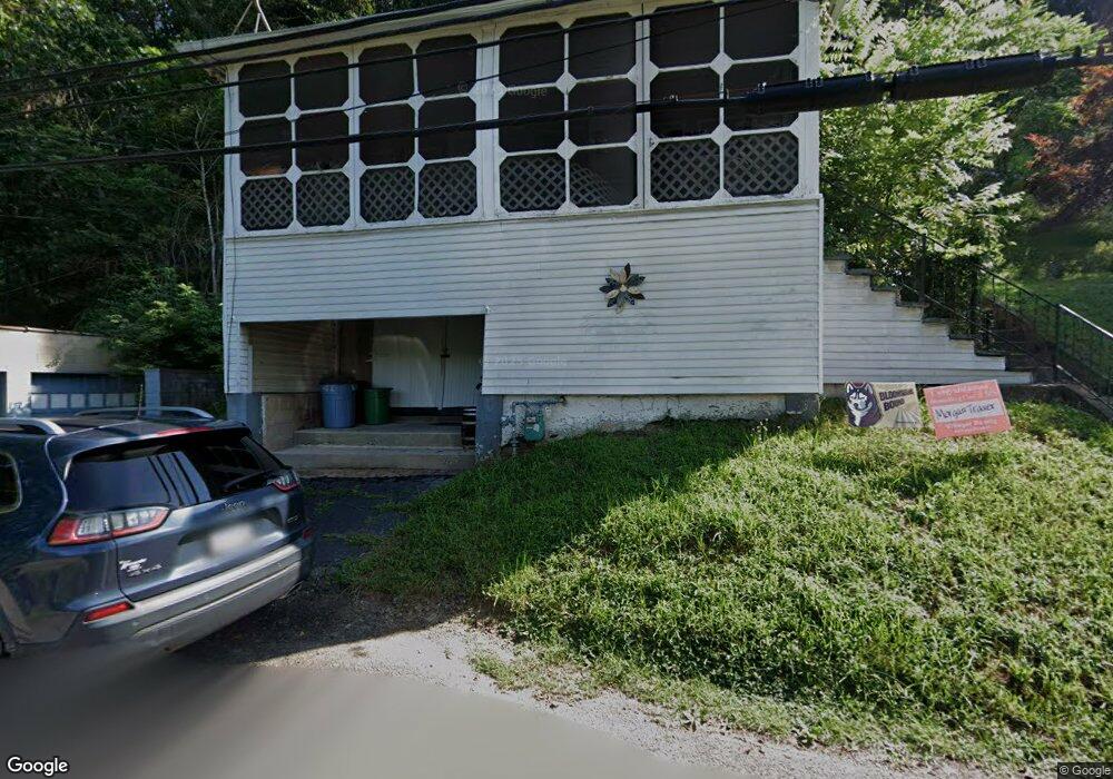
297 Summit Ave Bloomsburg, PA 17815
Estimated Value: $123,821 - $198,000
--
Bed
--
Bath
852
Sq Ft
$176/Sq Ft
Est. Value
About This Home
This home is located at 297 Summit Ave, Bloomsburg, PA 17815 and is currently estimated at $150,205, approximately $176 per square foot. 297 Summit Ave is a home located in Columbia County with nearby schools including W.W. Evans Memorial Elementary School, Bloomsburg Area Middle School, and Bloomsburg Area High School.
Ownership History
Date
Name
Owned For
Owner Type
Purchase Details
Closed on
Feb 25, 2014
Sold by
Balla Judith A
Bought by
Bowman Debra L
Current Estimated Value
Home Financials for this Owner
Home Financials are based on the most recent Mortgage that was taken out on this home.
Original Mortgage
$54,400
Outstanding Balance
$41,311
Interest Rate
4.39%
Mortgage Type
New Conventional
Estimated Equity
$108,894
Purchase Details
Closed on
Feb 29, 1988
Bought by
Balla Laszlo and Balla Judith A
Create a Home Valuation Report for This Property
The Home Valuation Report is an in-depth analysis detailing your home's value as well as a comparison with similar homes in the area
Home Values in the Area
Average Home Value in this Area
Purchase History
| Date | Buyer | Sale Price | Title Company |
|---|---|---|---|
| Bowman Debra L | $68,000 | None Available | |
| Balla Laszlo | $26,000 | -- |
Source: Public Records
Mortgage History
| Date | Status | Borrower | Loan Amount |
|---|---|---|---|
| Open | Bowman Debra L | $54,400 |
Source: Public Records
Tax History Compared to Growth
Tax History
| Year | Tax Paid | Tax Assessment Tax Assessment Total Assessment is a certain percentage of the fair market value that is determined by local assessors to be the total taxable value of land and additions on the property. | Land | Improvement |
|---|---|---|---|---|
| 2025 | $1,770 | $19,618 | $0 | $0 |
| 2024 | $1,740 | $19,618 | $5,889 | $13,729 |
| 2023 | $1,613 | $19,618 | $5,889 | $13,729 |
| 2022 | $1,554 | $19,618 | $5,889 | $13,729 |
| 2021 | $1,521 | $19,618 | $5,889 | $13,729 |
| 2020 | $1,458 | $19,618 | $5,889 | $13,729 |
| 2019 | $1,434 | $19,618 | $5,889 | $13,729 |
| 2018 | $1,401 | $19,618 | $5,889 | $13,729 |
| 2017 | $1,329 | $19,618 | $5,889 | $13,729 |
| 2016 | -- | $19,618 | $5,889 | $13,729 |
| 2015 | -- | $19,618 | $5,889 | $13,729 |
| 2014 | -- | $19,618 | $5,889 | $13,729 |
Source: Public Records
Map
Nearby Homes
- 402 Millville Rd
- LOT 1 Kressler Ave
- 527 Clover Ave
- 24 Millville Rd
- 123 William St
- 115 West St
- 375377 Fetterman Ave
- 179181 Railroad St
- Sweet Birch Plan at Oak Lane
- Black Cherry Plan at Oak Lane
- Blue Ridge Plan at Oak Lane
- Beacon Pointe Plan at Oak Lane
- White Oak Plan at Oak Lane
- 421 W Main St
- 225 W 3rd St
- 261 West St
- 61 E 3rd St
- 479 Drinker St
- 405 W 3rd St
- 518 W Main St
- 305 Summit Ave
- 223 Millville Rd
- 217 Millville Rd
- 225 Summit Ave
- 305 Millville Rd
- 221 Summit Ave
- 309 Millville Rd
- 217 Summit Ave
- 306 Millville Rd
- 407 Summit Ave
- 310 Millville Rd
- 19 Briar Ln
- 79 Briar Ln
- 405 Millville Rd
- 409 Millville Rd
- 207 Summit Ave
- 404 Millville Rd
- 415 Summit Ave
- 408 Millville Rd
- 412 Millville Rd