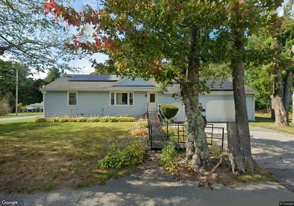
297 Whalom Rd Lunenburg, MA 01462
Estimated Value: $400,000 - $461,000
3
Beds
1
Bath
1,182
Sq Ft
$370/Sq Ft
Est. Value
About This Home
This home is located at 297 Whalom Rd, Lunenburg, MA 01462 and is currently estimated at $437,900, approximately $370 per square foot. 297 Whalom Rd is a home located in Worcester County with nearby schools including Lunenburg Primary School, Lunenburg High School, and St Bernards Elementary School.
Ownership History
Date
Name
Owned For
Owner Type
Purchase Details
Closed on
Jul 24, 2025
Sold by
Louis Ange D
Bought by
Ange Danelle Louis Lt and Louis
Current Estimated Value
Purchase Details
Closed on
Aug 31, 2007
Sold by
Feldman Shelley R and Robillard Shelley R
Bought by
Jean A Danelle
Home Financials for this Owner
Home Financials are based on the most recent Mortgage that was taken out on this home.
Original Mortgage
$261,870
Interest Rate
6.71%
Mortgage Type
Purchase Money Mortgage
Purchase Details
Closed on
May 27, 1987
Sold by
Robillard Ronald E
Bought by
Robillard S R
Create a Home Valuation Report for This Property
The Home Valuation Report is an in-depth analysis detailing your home's value as well as a comparison with similar homes in the area
Home Values in the Area
Average Home Value in this Area
Purchase History
| Date | Buyer | Sale Price | Title Company |
|---|---|---|---|
| Ange Danelle Louis Lt | -- | -- | |
| Ange Danelle Louis Lt | -- | -- | |
| Jean A Danelle | $266,000 | -- | |
| Jean A Danelle | $266,000 | -- | |
| Robillard S R | $50,000 | -- |
Source: Public Records
Mortgage History
| Date | Status | Borrower | Loan Amount |
|---|---|---|---|
| Previous Owner | Robillard S R | $215,508 | |
| Previous Owner | Robillard S R | $63,589 | |
| Previous Owner | Jean A Danelle | $261,870 |
Source: Public Records
Tax History Compared to Growth
Tax History
| Year | Tax Paid | Tax Assessment Tax Assessment Total Assessment is a certain percentage of the fair market value that is determined by local assessors to be the total taxable value of land and additions on the property. | Land | Improvement |
|---|---|---|---|---|
| 2025 | $5,596 | $389,700 | $107,800 | $281,900 |
| 2024 | $5,233 | $371,100 | $101,700 | $269,400 |
| 2023 | $5,140 | $351,600 | $91,400 | $260,200 |
| 2022 | $4,815 | $280,100 | $76,200 | $203,900 |
| 2020 | $4,414 | $243,600 | $76,500 | $167,100 |
| 2019 | $4,196 | $224,600 | $70,600 | $154,000 |
| 2018 | $3,875 | $196,700 | $73,600 | $123,100 |
| 2017 | $3,622 | $181,300 | $62,700 | $118,600 |
| 2016 | $3,649 | $186,100 | $63,300 | $122,800 |
| 2015 | $3,305 | $180,400 | $60,400 | $120,000 |
Source: Public Records
Map
Nearby Homes
- 26 Otis St
- 44 Hamlin St
- 3 Chase Ave
- 31 Park Ave
- 1479 Main St
- 195 Electric Ave
- 452 Hollis Rd
- 471 North St
- 200-365 Hollis Rd
- 165 Summer St Unit Lot 2
- 121 Morningside St Unit 121
- 29 Lakeview Ave
- 337 West St
- 77 Upland Ave
- 1084 Main St
- 77 Electric Ave
- 67 Bernice Ave
- 0 Summer St
- 51 Claflin St
- 40 Flaggler Rd