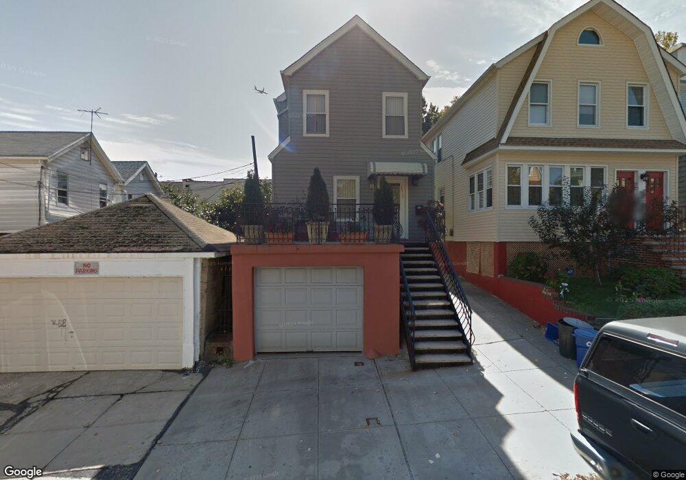
2970 Daniel St Bronx, NY 10461
Middletown-Pelham Bay NeighborhoodEstimated Value: $633,735 - $858,000
Studio
--
Bath
1,404
Sq Ft
$523/Sq Ft
Est. Value
About This Home
This home is located at 2970 Daniel St, Bronx, NY 10461 and is currently estimated at $733,934, approximately $522 per square foot. 2970 Daniel St is a home located in Bronx County with nearby schools including P.S. 71 Rose E Scala, Herbert H Lehman High School, and St. Theresa School.
Ownership History
Date
Name
Owned For
Owner Type
Purchase Details
Closed on
Aug 12, 2002
Sold by
Dimuro Eugene
Bought by
Rugova Rama and Rugova Hajrija
Current Estimated Value
Home Financials for this Owner
Home Financials are based on the most recent Mortgage that was taken out on this home.
Original Mortgage
$250,000
Outstanding Balance
$104,576
Interest Rate
6.39%
Estimated Equity
$629,358
Purchase Details
Closed on
Feb 16, 1999
Sold by
Infantino Josephine
Bought by
Dimuro Eugene
Home Financials for this Owner
Home Financials are based on the most recent Mortgage that was taken out on this home.
Original Mortgage
$106,750
Interest Rate
7.19%
Create a Home Valuation Report for This Property
The Home Valuation Report is an in-depth analysis detailing your home's value as well as a comparison with similar homes in the area
Home Values in the Area
Average Home Value in this Area
Purchase History
| Date | Buyer | Sale Price | Title Company |
|---|---|---|---|
| Rugova Rama | -- | -- | |
| Dimuro Eugene | $145,000 | The Judicial Title Ins Agenc |
Source: Public Records
Mortgage History
| Date | Status | Borrower | Loan Amount |
|---|---|---|---|
| Open | Rugova Rama | $250,000 | |
| Previous Owner | Dimuro Eugene | $106,750 |
Source: Public Records
Tax History
| Year | Tax Paid | Tax Assessment Tax Assessment Total Assessment is a certain percentage of the fair market value that is determined by local assessors to be the total taxable value of land and additions on the property. | Land | Improvement |
|---|---|---|---|---|
| 2025 | $5,284 | $27,884 | $5,436 | $22,448 |
| 2024 | $5,284 | $26,306 | $5,474 | $20,832 |
| 2023 | $5,040 | $24,818 | $5,029 | $19,789 |
| 2022 | $4,674 | $39,720 | $8,340 | $31,380 |
| 2021 | $4,927 | $36,060 | $8,340 | $27,720 |
| 2020 | $4,919 | $25,800 | $8,340 | $17,460 |
| 2019 | $4,586 | $25,800 | $8,340 | $17,460 |
| 2018 | $4,216 | $20,682 | $7,259 | $13,423 |
| 2017 | $3,978 | $19,512 | $6,488 | $13,024 |
| 2016 | $3,901 | $19,512 | $6,293 | $13,219 |
| 2015 | $2,220 | $19,365 | $7,345 | $12,020 |
| 2014 | $2,220 | $18,269 | $8,324 | $9,945 |
Source: Public Records
Map
Nearby Homes
- 2941 Middletown Rd
- 1623 Edison Ave
- 1517 Gillespie Ave
- 2874 Roberts Ave
- 1627 Pilgrim Ave
- 1617 Mahan Ave
- 2873 Roebling Ave
- 1725 Edison Ave Unit 4C
- 1725 Edison Ave Unit 5D
- 1725 Edison Ave Unit 2D
- 1711 Mahan Ave
- 1539 Hollywood Ave
- 2871 Zulette Ave
- 3036 Buhre Ave
- 2867 Zulette Ave
- 1600 Parkview Ave Unit 7C
- 2888 Wellman Ave
- 1619 Mulford Ave
- 3121 Middletown Rd
- 3121 Middletown Rd Unit 6H
- 2968 Daniel St
- 2966 Daniel St
- 1609 Crosby Ave
- 1611 Crosby Ave
- 1607 Crosby Ave
- 1613 Crosby Ave
- 2964 Daniel St Unit 2964 Daniel St. Bron
- 2964 Daniel St
- 2949 Middletown Rd
- 2947 Middletown Rd
- 2947 Middletown Rd Unit Building
- 2962 Daniel St
- 1605 Crosby Ave
- 2945 Middletown Rd
- 2951 Middletown Rd
- 2943 Middletown Rd
- 2955 Middletown Rd
- 2959 Middletown Rd
- 2967 Daniel St
- 2967 Daniel St Unit 2967A
Your Personal Tour Guide
Ask me questions while you tour the home.