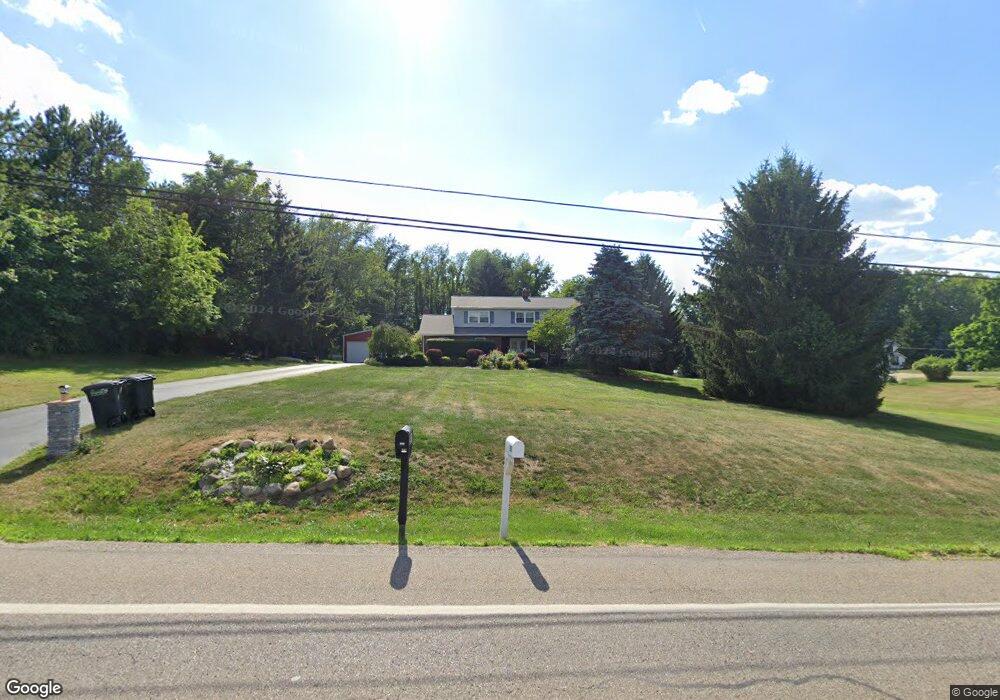
2971 State Route 43 Mogadore, OH 44260
Estimated Value: $342,000 - $411,000
3
Beds
3
Baths
2,513
Sq Ft
$149/Sq Ft
Est. Value
About This Home
This home is located at 2971 State Route 43, Mogadore, OH 44260 and is currently estimated at $374,415, approximately $148 per square foot. 2971 State Route 43 is a home located in Portage County with nearby schools including Suffield Elementary School, Field Middle School, and Field High School.
Ownership History
Date
Name
Owned For
Owner Type
Purchase Details
Closed on
Jun 22, 2006
Sold by
Corzine Douglas E and Corzine Marcia L
Bought by
Cockerham Constance D
Current Estimated Value
Home Financials for this Owner
Home Financials are based on the most recent Mortgage that was taken out on this home.
Original Mortgage
$190,800
Interest Rate
6.72%
Mortgage Type
Purchase Money Mortgage
Purchase Details
Closed on
Aug 4, 2001
Sold by
Twigg Shirley J
Bought by
Corzine Douglas E and Corzine Marcia L
Home Financials for this Owner
Home Financials are based on the most recent Mortgage that was taken out on this home.
Original Mortgage
$114,500
Interest Rate
7.03%
Create a Home Valuation Report for This Property
The Home Valuation Report is an in-depth analysis detailing your home's value as well as a comparison with similar homes in the area
Home Values in the Area
Average Home Value in this Area
Purchase History
| Date | Buyer | Sale Price | Title Company |
|---|---|---|---|
| Cockerham Constance D | $212,500 | Diamond Title | |
| Corzine Douglas E | $207,500 | Central Title |
Source: Public Records
Mortgage History
| Date | Status | Borrower | Loan Amount |
|---|---|---|---|
| Open | Kelly Constance D | $226,575 | |
| Closed | Kelly Constance | $100,000 | |
| Closed | Cockerham Constance D | $50,000 | |
| Closed | Kelly Constance D Cockerham | $178,313 | |
| Closed | Cockerham Constance D | $191,750 | |
| Closed | Cockerham Constance D | $190,800 | |
| Previous Owner | Corzine Douglas E | $200,800 | |
| Previous Owner | Corzine Douglas E | $65,150 | |
| Previous Owner | Corzine Douglas E | $114,500 |
Source: Public Records
Tax History Compared to Growth
Tax History
| Year | Tax Paid | Tax Assessment Tax Assessment Total Assessment is a certain percentage of the fair market value that is determined by local assessors to be the total taxable value of land and additions on the property. | Land | Improvement |
|---|---|---|---|---|
| 2024 | $5,369 | $123,060 | $23,660 | $99,400 |
| 2023 | $4,733 | $89,500 | $14,770 | $74,730 |
| 2022 | $4,771 | $89,500 | $14,770 | $74,730 |
| 2021 | $4,657 | $89,500 | $14,770 | $74,730 |
| 2020 | $3,960 | $70,530 | $14,770 | $55,760 |
| 2019 | $3,905 | $70,530 | $14,770 | $55,760 |
| 2018 | $3,067 | $62,020 | $14,770 | $47,250 |
| 2017 | $2,872 | $62,020 | $14,770 | $47,250 |
| 2016 | $2,847 | $62,020 | $14,770 | $47,250 |
| 2015 | $2,778 | $62,020 | $14,770 | $47,250 |
| 2014 | $2,690 | $62,020 | $14,770 | $47,250 |
| 2013 | $2,628 | $62,020 | $14,770 | $47,250 |
Source: Public Records
Map
Nearby Homes
- 3241 State Route 43
- 1489 Old Forge Rd
- 3434 Lawndale Dr
- 1330 Highpoint St
- 3517 Jameson Dr
- 1707 Old Forge Rd
- 2835 Sunnybrook Rd
- 1418 Arcadia Rd
- 3658 Elmhurst Ct
- 3579 Elmhurst Ct
- 3362 Sunnybrook Rd
- 3672 Elmhurst Ct
- 1125 Dussel Rd
- 596 Ticknor Rd
- 1811 Randolph Rd
- 1088 Irish Rd
- 3793 Ranfield Rd
- 0 Randolph Rd Unit 5112744
- 3946 Mctaggart Blvd
- 2662 Martin Rd
- 2961 State Route 43
- 2969 State Route 43
- 2948 State Route 43
- 2960 Robin Hill Ln
- 2947 State Route 43
- 2966 State Route 43
- 2990 State Route 43
- 2940 Robin Hill Ln
- 2992 Reservoir Dr
- 2982 N Reservoir Dr
- 3031 State Route 43
- 3018 State Route 43
- 2982 Reservoir Dr
- 1263 Squires Dr
- 3012 Reservoir Dr
- 1247 Squires Dr
- 3026 Reservoir Dr
- 2989 Reservoir Dr
- 2988 State Route 43
- 1223 Squires Dr