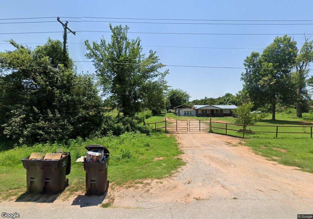
29715 Memorial Rd McLoud, OK 74851
Estimated Value: $139,000 - $223,000
3
Beds
1
Bath
1,388
Sq Ft
$132/Sq Ft
Est. Value
About This Home
This home is located at 29715 Memorial Rd, McLoud, OK 74851 and is currently estimated at $183,172, approximately $131 per square foot. 29715 Memorial Rd is a home located in Pottawatomie County with nearby schools including McLoud Intermediate School, McLoud Elementary School, and McLoud Junior High School.
Ownership History
Date
Name
Owned For
Owner Type
Purchase Details
Closed on
Jul 24, 2018
Sold by
Flak Brenda
Bought by
Miller Pamela and Miller Samuel
Current Estimated Value
Purchase Details
Closed on
Oct 16, 2013
Sold by
Secretary Of Veterans Affairs
Bought by
Flak Brenda
Purchase Details
Closed on
Mar 5, 2013
Sold by
Rhodes Valery A
Bought by
Secretary Of Veterans Affairs
Purchase Details
Closed on
Jul 26, 1996
Sold by
Smith Rick and Smith Donna
Bought by
Rhodes Valery
Purchase Details
Closed on
Sep 15, 1992
Sold by
Koerner Wilma and Koerner Lavern
Bought by
Smith Rick
Create a Home Valuation Report for This Property
The Home Valuation Report is an in-depth analysis detailing your home's value as well as a comparison with similar homes in the area
Home Values in the Area
Average Home Value in this Area
Purchase History
| Date | Buyer | Sale Price | Title Company |
|---|---|---|---|
| Miller Pamela | $47,792 | None Available | |
| Flak Brenda | $35,950 | First American Title | |
| Secretary Of Veterans Affairs | -- | None Available | |
| Rhodes Valery | $51,000 | -- | |
| Smith Rick | $35,000 | -- |
Source: Public Records
Tax History
| Year | Tax Paid | Tax Assessment Tax Assessment Total Assessment is a certain percentage of the fair market value that is determined by local assessors to be the total taxable value of land and additions on the property. | Land | Improvement |
|---|---|---|---|---|
| 2025 | $676 | $7,747 | $2,909 | $4,838 |
| 2023 | $639 | $7,026 | $2,520 | $4,506 |
| 2022 | $648 | $7,026 | $2,520 | $4,506 |
| 2021 | $842 | $7,026 | $2,520 | $4,506 |
| 2020 | $648 | $7,026 | $2,520 | $4,506 |
| 2019 | $680 | $7,151 | $2,520 | $4,631 |
| 2018 | $754 | $7,461 | $2,520 | $4,941 |
| 2017 | $771 | $7,528 | $2,520 | $5,008 |
| 2016 | $690 | $7,523 | $2,520 | $5,003 |
| 2015 | $636 | $7,165 | $2,520 | $4,645 |
| 2014 | $636 | $7,165 | $2,520 | $4,645 |
Source: Public Records
Map
Nearby Homes
- 13310 Fishmarket Rd
- 57 Country Creek Dr
- 126 Pickard Dr
- 3850 Fishmarket Rd
- 29 Walker Ln
- 10701 Eastway
- 0 E 1140 Rd Unit 1176402
- 0 E 1140 Rd Unit 1135043
- 9400 Megans Way
- 9408 Megans Way
- 9500 Megans Way
- 21608 SE 95th St
- 10828 Eastway
- 9517 Megans Way
- 13420 Juneberry Dr
- 13438 Juneberry Dr
- 13446 Juneberry Dr
- 31041 Elderberry Dr
- 31057 Elderberry Dr
- 13445 Juneberry Dr
- 29712 Memorial Rd
- 29811 Memorial Rd
- 29889 Memorial Rd
- 131 Rolling Hills Rd
- 29901 Memorial Rd
- 29903 Memorial Rd
- 106 Rolling Hills Rd
- 29909 Memorial Rd
- 120 Rolling Hills Rd
- 13014 Fishmarket Rd
- 0 Rolling Hills Rd
- 13260 Fishmarket Rd
- 130 Rolling Hills Rd
- 13301 Fishmarket Rd
- 29411 Memorial Rd
- 13211 Fishmarket Rd
- 1 Country Creek Dr
- 143 Rollings Hills Rd
- 29404 Memorial Rd
- 29711 Memorial Rd
Your Personal Tour Guide
Ask me questions while you tour the home.