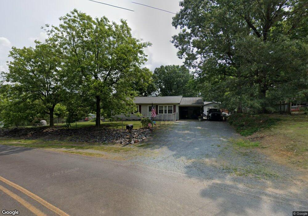
29718 Jay Rd Albemarle, NC 28001
Estimated Value: $208,000 - $237,000
3
Beds
1
Bath
950
Sq Ft
$233/Sq Ft
Est. Value
About This Home
This home is located at 29718 Jay Rd, Albemarle, NC 28001 and is currently estimated at $221,084, approximately $232 per square foot. 29718 Jay Rd is a home located in Stanly County with nearby schools including Millingport Elementary School, North Stanly Middle School, and North Stanly High School.
Ownership History
Date
Name
Owned For
Owner Type
Purchase Details
Closed on
Jan 26, 2021
Sold by
Pearson Opal M and Pearson Opal B
Bought by
Powell Jerry Lee and Powell Virginia Grey
Current Estimated Value
Purchase Details
Closed on
Mar 23, 2015
Sold by
Pearson Opal M and Treece Opal M
Bought by
Pearson Opal M
Create a Home Valuation Report for This Property
The Home Valuation Report is an in-depth analysis detailing your home's value as well as a comparison with similar homes in the area
Purchase History
| Date | Buyer | Sale Price | Title Company |
|---|---|---|---|
| Powell Jerry Lee | $135,000 | None Available | |
| Pearson Opal M | -- | None Available |
Source: Public Records
Tax History
| Year | Tax Paid | Tax Assessment Tax Assessment Total Assessment is a certain percentage of the fair market value that is determined by local assessors to be the total taxable value of land and additions on the property. | Land | Improvement |
|---|---|---|---|---|
| 2025 | $826 | $135,333 | $33,200 | $102,133 |
| 2024 | $570 | $80,218 | $20,972 | $59,246 |
| 2023 | $644 | $77,004 | $18,911 | $58,093 |
| 2022 | $644 | $77,004 | $18,911 | $58,093 |
| 2021 | $642 | $77,004 | $18,911 | $58,093 |
| 2020 | $327 | $62,545 | $16,605 | $45,940 |
| 2019 | $326 | $62,545 | $16,605 | $45,940 |
| 2018 | $482 | $62,545 | $16,605 | $45,940 |
| 2017 | $482 | $62,545 | $16,605 | $45,940 |
| 2016 | $429 | $59,569 | $13,837 | $45,732 |
| 2015 | $504 | $59,569 | $13,837 | $45,732 |
| 2014 | $523 | $59,569 | $13,837 | $45,732 |
Source: Public Records
Map
Nearby Homes
- 27740 Taylor Ln
- Vacant Biles Rd Unit 4
- 20809 Biles Rd
- 24132 N Carolina 73
- 03 Ramsey Rd
- 25683 April Ln
- 20956 Old Mill Rd
- 30291 C Red Hill Rd
- 00 Sugar Hill Rd
- -- Sugar Hill Rd
- 28770 N Carolina 73
- 28800 N Carolina 73
- 2923 Noritake Trail Unit 66
- 2924 Noritake Trail Unit 59
- 2915 Noritake Trail Unit 71
- 2914 Waterford Ln Unit 33A
- 2915 Waterford Ln Unit 33 B
- 2909 Waterford Ln Unit 35 A
- 2911 Waterford Ln Unit 35 B
- 2913 Waterford Ln Unit 34
Your Personal Tour Guide
Ask me questions while you tour the home.