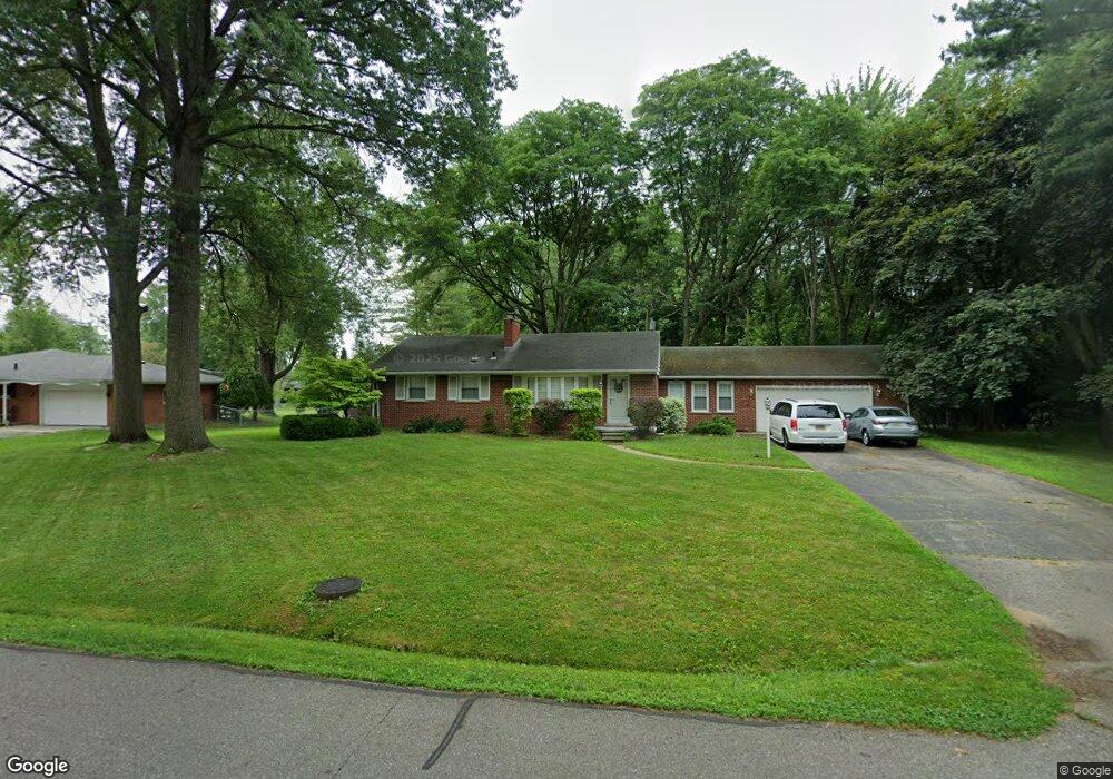
29721 Hoy St Unit Bldg-Unit Livonia, MI 48154
Estimated Value: $321,000 - $372,000
3
Beds
2
Baths
1,394
Sq Ft
$246/Sq Ft
Est. Value
About This Home
This home is located at 29721 Hoy St Unit Bldg-Unit, Livonia, MI 48154 and is currently estimated at $342,814, approximately $245 per square foot. 29721 Hoy St Unit Bldg-Unit is a home located in Wayne County with nearby schools including Roosevelt Elementary School, Emerson Middle School, and Cooper Upper Elementary School.
Ownership History
Date
Name
Owned For
Owner Type
Purchase Details
Closed on
Feb 5, 2018
Sold by
Roussey Jonathan A and Roussey Rebecca E
Bought by
Cupp Stephen M
Current Estimated Value
Purchase Details
Closed on
May 18, 2015
Sold by
Jordan Teri
Bought by
Roussey Jonathan E and Roussey Rebecca A
Purchase Details
Closed on
Jun 24, 2011
Sold by
Schoenherr Steven
Bought by
Harnden James Carter
Home Financials for this Owner
Home Financials are based on the most recent Mortgage that was taken out on this home.
Original Mortgage
$144,516
Interest Rate
4.63%
Mortgage Type
VA
Purchase Details
Closed on
Feb 27, 2008
Sold by
Moore Nancy L
Bought by
Schoenherr Steven
Purchase Details
Closed on
Oct 29, 2004
Sold by
Duffy Michael W and Duffy Mary Margaret E
Bought by
Moore Nancy L
Create a Home Valuation Report for This Property
The Home Valuation Report is an in-depth analysis detailing your home's value as well as a comparison with similar homes in the area
Home Values in the Area
Average Home Value in this Area
Purchase History
| Date | Buyer | Sale Price | Title Company |
|---|---|---|---|
| Cupp Stephen M | $220,000 | Century Title Agency Service | |
| Roussey Jonathan E | $181,800 | Title Connect Llc | |
| Harnden James Carter | $139,900 | None Available | |
| Schoenherr Steven | $130,000 | Multiple | |
| Moore Nancy L | $252,000 | Multiple |
Source: Public Records
Mortgage History
| Date | Status | Borrower | Loan Amount |
|---|---|---|---|
| Previous Owner | Harnden James Carter | $144,516 |
Source: Public Records
Tax History Compared to Growth
Tax History
| Year | Tax Paid | Tax Assessment Tax Assessment Total Assessment is a certain percentage of the fair market value that is determined by local assessors to be the total taxable value of land and additions on the property. | Land | Improvement |
|---|---|---|---|---|
| 2025 | $2,737 | $144,300 | $0 | $0 |
| 2024 | $2,737 | $140,500 | $0 | $0 |
| 2023 | $2,611 | $130,300 | $0 | $0 |
| 2022 | $4,584 | $119,300 | $0 | $0 |
| 2021 | $4,453 | $116,000 | $0 | $0 |
| 2019 | $4,272 | $105,200 | $0 | $0 |
| 2018 | $2,059 | $98,400 | $0 | $0 |
| 2017 | $3,644 | $94,000 | $0 | $0 |
| 2016 | $3,831 | $94,000 | $0 | $0 |
| 2015 | $7,688 | $80,660 | $0 | $0 |
| 2012 | -- | $71,740 | $33,380 | $38,360 |
Source: Public Records
Map
Nearby Homes
- 14962 Beatrice St
- 29831 Oakley St
- 29631 Lyndon St
- 30831 Lyndon St
- 15345 Bainbridge St
- 29106 Broadmoor St
- 28692 Bayberry Park Dr
- 31005 Roycroft St
- 14127 Hillcrest St
- 31221 Lyndon St
- 14270 Sunset St
- 31126 Grennada St
- 14334 Sunbury St
- 14292 Hubbell St
- 14164 Bainbridge St
- 14154 Hubbell St
- 15600 Auburndale St
- 14563 Melrose St
- 30115 Munger Dr
- 14327 Arden St