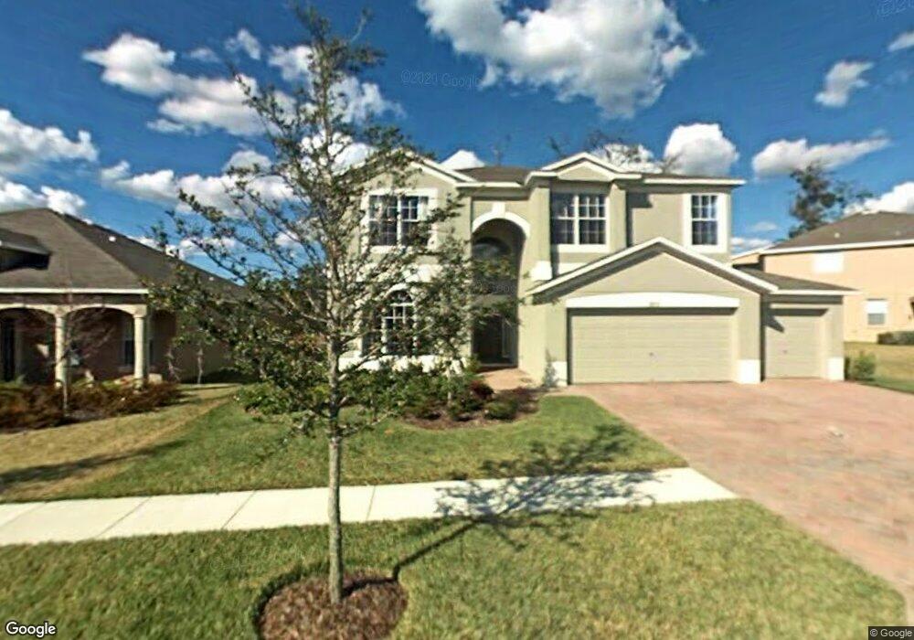
29731 Cedar Waxwing Dr Wesley Chapel, FL 33545
Estimated Value: $565,000 - $595,000
--
Bed
4
Baths
3,406
Sq Ft
$170/Sq Ft
Est. Value
About This Home
This home is located at 29731 Cedar Waxwing Dr, Wesley Chapel, FL 33545 and is currently estimated at $577,520, approximately $169 per square foot. 29731 Cedar Waxwing Dr is a home located in Pasco County with nearby schools including Wesley Chapel Elementary School, Thomas E. Weightman Middle School, and Wesley Chapel High School.
Ownership History
Date
Name
Owned For
Owner Type
Purchase Details
Closed on
Feb 28, 2007
Sold by
M/I Homes Of Tampa Llc
Bought by
Wallington Victor Sedgwick and Wallington Paula Adams
Current Estimated Value
Home Financials for this Owner
Home Financials are based on the most recent Mortgage that was taken out on this home.
Original Mortgage
$274,850
Outstanding Balance
$165,445
Interest Rate
6.25%
Mortgage Type
Purchase Money Mortgage
Estimated Equity
$412,075
Create a Home Valuation Report for This Property
The Home Valuation Report is an in-depth analysis detailing your home's value as well as a comparison with similar homes in the area
Home Values in the Area
Average Home Value in this Area
Purchase History
| Date | Buyer | Sale Price | Title Company |
|---|---|---|---|
| Wallington Victor Sedgwick | $343,618 | M-I Title Agency Ltd Lc |
Source: Public Records
Mortgage History
| Date | Status | Borrower | Loan Amount |
|---|---|---|---|
| Open | Wallington Victor Sedgwick | $274,850 |
Source: Public Records
Tax History Compared to Growth
Tax History
| Year | Tax Paid | Tax Assessment Tax Assessment Total Assessment is a certain percentage of the fair market value that is determined by local assessors to be the total taxable value of land and additions on the property. | Land | Improvement |
|---|---|---|---|---|
| 2025 | $8,596 | $560,184 | $92,224 | $467,960 |
| 2024 | $8,596 | $527,657 | $85,382 | $442,275 |
| 2023 | $7,443 | $481,188 | $65,690 | $415,498 |
| 2022 | $6,216 | $424,799 | $54,742 | $370,057 |
| 2021 | $5,405 | $323,815 | $42,197 | $281,618 |
| 2020 | $5,066 | $316,513 | $22,809 | $293,704 |
| 2019 | $4,707 | $293,838 | $22,809 | $271,029 |
| 2018 | $4,492 | $295,498 | $22,809 | $272,689 |
| 2017 | $4,111 | $256,853 | $19,692 | $237,161 |
| 2016 | $3,780 | $234,689 | $19,692 | $214,997 |
| 2015 | $3,309 | $182,268 | $19,692 | $162,576 |
| 2014 | $3,192 | $179,050 | $19,692 | $159,358 |
Source: Public Records
Map
Nearby Homes
- 6932 Gray Catbird Loop
- 29901 Cedar Waxwing Dr
- 0 Wells
- 29956 New Dutch Ln
- 7308 Boyette Rd
- 29977 Marquette Ave
- 30226 Merilee Place
- 30180 Skylark Dr
- 6627 Ryestone Way
- 6595 Ryestone Way
- 29913 Briarthorn Loop
- 30399 Marquette Ave
- 6510 Tabogi Trail
- 6218 Bridleford Dr
- 30414 Caravelle Ln
- 7537 Rooks Dr
- 6489 Dutton Dr
- 6501 Dutton Dr
- 6584 Dutton Dr
- 30529 Eastport Dr
- 29725 Cedar Waxwing Dr
- 29739 Cedar Waxwing Dr
- 29719 Cedar Waxwing Dr
- 6909 Gray Catbird Loop
- 29736 Cedar Waxwing Dr
- 29728 Cedar Waxwing Dr
- 29742 Cedar Waxwing Dr
- 29720 Cedar Waxwing Dr
- 29715 Cedar Waxwing Dr
- 6915 Gray Catbird Loop
- 29753 Cedar Waxwing Dr
- 29750 Cedar Waxwing Dr
- 6924 Gray Catbird Loop
- 29709 Cedar Waxwing Dr
- 29803 Cedar Waxwing Dr
- 6921 Gray Catbird Loop
- 29804 Cedar Waxwing Dr
- 29703 Cedar Waxwing Dr