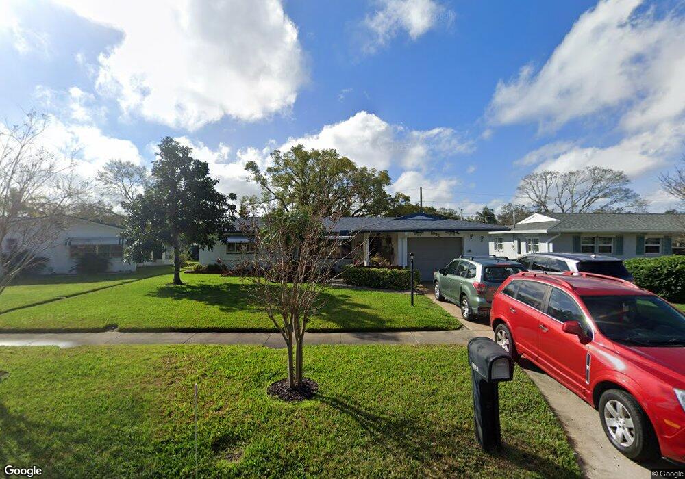
2974 Brookfield Dr Largo, FL 33771
North Largo NeighborhoodEstimated Value: $322,000 - $480,000
Studio
3
Baths
1,288
Sq Ft
$309/Sq Ft
Est. Value
About This Home
This home is located at 2974 Brookfield Dr, Largo, FL 33771 and is currently estimated at $397,454, approximately $308 per square foot. 2974 Brookfield Dr is a home located in Pinellas County with nearby schools including Belcher Elementary School, Largo High School, and Largo Middle School.
Ownership History
Date
Name
Owned For
Owner Type
Purchase Details
Closed on
Jun 18, 2007
Sold by
Jones Thomas D and Jones Elizabeth J
Bought by
Jones Thomas D and Jones Elizabeth J
Current Estimated Value
Purchase Details
Closed on
Dec 28, 1995
Sold by
Paul Joseph P De
Bought by
Jones Thomas P and Jones Betty J
Home Financials for this Owner
Home Financials are based on the most recent Mortgage that was taken out on this home.
Original Mortgage
$30,000
Outstanding Balance
$204
Interest Rate
7.29%
Mortgage Type
New Conventional
Estimated Equity
$397,250
Create a Home Valuation Report for This Property
The Home Valuation Report is an in-depth analysis detailing your home's value as well as a comparison with similar homes in the area
Home Values in the Area
Average Home Value in this Area
Purchase History
| Date | Buyer | Sale Price | Title Company |
|---|---|---|---|
| Jones Thomas D | -- | None Available | |
| Jones Thomas P | $76,000 | -- |
Source: Public Records
Mortgage History
| Date | Status | Borrower | Loan Amount |
|---|---|---|---|
| Open | Jones Thomas P | $30,000 |
Source: Public Records
Tax History
| Year | Tax Paid | Tax Assessment Tax Assessment Total Assessment is a certain percentage of the fair market value that is determined by local assessors to be the total taxable value of land and additions on the property. | Land | Improvement |
|---|---|---|---|---|
| 2025 | $1,240 | $117,199 | -- | -- |
| 2024 | $1,200 | $113,896 | -- | -- |
| 2023 | $1,200 | $110,579 | $0 | $0 |
| 2022 | $1,231 | $107,358 | $0 | $0 |
| 2021 | $1,230 | $104,231 | $0 | $0 |
| 2020 | $1,220 | $102,792 | $0 | $0 |
| 2019 | $1,185 | $100,481 | $0 | $0 |
| 2018 | $1,164 | $98,607 | $0 | $0 |
| 2017 | $1,143 | $96,579 | $0 | $0 |
| 2016 | $1,106 | $94,593 | $0 | $0 |
| 2015 | $1,123 | $93,935 | $0 | $0 |
| 2014 | $1,105 | $93,189 | $0 | $0 |
Source: Public Records
Map
Nearby Homes
- 947 Sousa Dr
- 546 Forest Pkwy E
- 925 Irene Ave
- 2601 Oakwood Dr
- 1012 Irene Ave
- 2952 Webley Dr
- 566 E Park Dr
- 853 Seacrest Dr
- 607 Brandywine Dr Unit 607
- 3075 Rosery Rd NE
- 1110 Irene Ave
- 2453 Roberta St
- 330 Brandy Wine Dr
- 1992 Arvis Cir E
- 1895 Del Robles Terrace
- 401 Brandy Wine Dr
- 2750 E Bay Dr Unit 12B
- 2750 E Bay Dr Unit 12E
- 2750 E Bay Dr Unit 15E
- 732 Keene Rd
- 2946 Brookfield Dr
- 730 Gershwin Dr
- 714 Gershwin Dr
- 2918 Brookfield Dr
- 700 Gershwin Dr
- 2973 Brookfield Dr
- 688 Gershwin Dr
- 2997 Brookfield Dr
- 2894 Brookfield Dr
- 731 Gershwin Dr
- 2917 Brookfield Dr
- 672 Gershwin Dr
- 2872 Brookfield Dr
- 2893 Brookfield Dr
- 713 Gershwin Dr
- 3003 Brookfield Dr
- 2964 Roberta St
- 2996 Roberta St
- 723 Gershwin Dr
- 701 Gershwin Dr
Your Personal Tour Guide
Ask me questions while you tour the home.