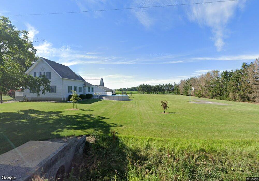
29742 Def Henry Co Line Rd Defiance, OH 43512
Estimated Value: $240,000 - $277,314
4
Beds
2
Baths
2,226
Sq Ft
$118/Sq Ft
Est. Value
About This Home
This home is located at 29742 Def Henry Co Line Rd, Defiance, OH 43512 and is currently estimated at $263,079, approximately $118 per square foot. 29742 Def Henry Co Line Rd is a home located in Defiance County with nearby schools including Tinora Elementary School, Noble Elementary School, and Tinora Middle School.
Ownership History
Date
Name
Owned For
Owner Type
Purchase Details
Closed on
Nov 8, 2023
Sold by
Meyer David L and Meyer Sandra K
Bought by
Meyer David L and Meyer Sandra K
Current Estimated Value
Purchase Details
Closed on
Jan 1, 1992
Bought by
Meyer David L and Meyer Sandra K
Create a Home Valuation Report for This Property
The Home Valuation Report is an in-depth analysis detailing your home's value as well as a comparison with similar homes in the area
Home Values in the Area
Average Home Value in this Area
Purchase History
| Date | Buyer | Sale Price | Title Company |
|---|---|---|---|
| Meyer David L | -- | None Listed On Document | |
| Meyer David L | -- | None Listed On Document | |
| Meyer David L | -- | -- |
Source: Public Records
Tax History Compared to Growth
Tax History
| Year | Tax Paid | Tax Assessment Tax Assessment Total Assessment is a certain percentage of the fair market value that is determined by local assessors to be the total taxable value of land and additions on the property. | Land | Improvement |
|---|---|---|---|---|
| 2024 | $2,462 | $71,160 | $6,620 | $64,540 |
| 2023 | $2,462 | $71,160 | $6,620 | $64,540 |
| 2022 | $2,186 | $53,530 | $6,050 | $47,480 |
| 2021 | $2,186 | $53,530 | $6,050 | $47,480 |
| 2020 | $2,195 | $53,530 | $6,050 | $47,480 |
| 2019 | $1,961 | $48,870 | $5,960 | $42,910 |
| 2018 | $2,017 | $48,870 | $5,960 | $42,910 |
| 2017 | $2,053 | $48,871 | $5,957 | $42,914 |
| 2016 | $1,600 | $42,952 | $5,736 | $37,216 |
| 2015 | $670 | $42,952 | $5,736 | $37,216 |
| 2014 | $670 | $44,002 | $5,736 | $38,266 |
| 2013 | $670 | $44,002 | $5,736 | $38,266 |
| 2012 | $670 | $44,003 | $5,737 | $38,266 |
Source: Public Records
Map
Nearby Homes
- 20401 U S 6
- 19972 County Road X
- 19950 County Road X
- 19913 County Road X
- 29232 Coressel Rd
- 23648 County Rd S
- 26825 Behrens Rd
- 26761 Behrens Rd
- 209 Hawthorn Dr
- 202 Hawthorn Dr
- 1374 Clairmont Ave
- 00 Westmoreland Ave
- 0 Westmoreland Ave
- 2820 County Road 19
- 1113 Clairmont Ave
- 1314 Clairmont Ave
- 6767 Independence Rd
- 1214 Clairmont Ave
- 75 Capri Dr
- 1354 Clairmont Ave
- 20362 County Road S
- 20394 County Road S
- 20390 County Rd S
- S130 County Road 20
- 1066 Walnut Grove Rd
- 1124 Walnut Grove Rd
- S245 County Road 20
- S-448 County Road 20a
- s-613 Co Rd 20a
- S-939 County Rd 20-B
- S671 Co Rd 20a
- 15548 County Rd S
- 18790 County Rd S
- S444 County Road 20
- 19802 County Road S
- 1428 Walnut Grove Rd
- S588 County Road 20a
- 364 County Road 20
- S364 County Road 20
- S448 County Road 20