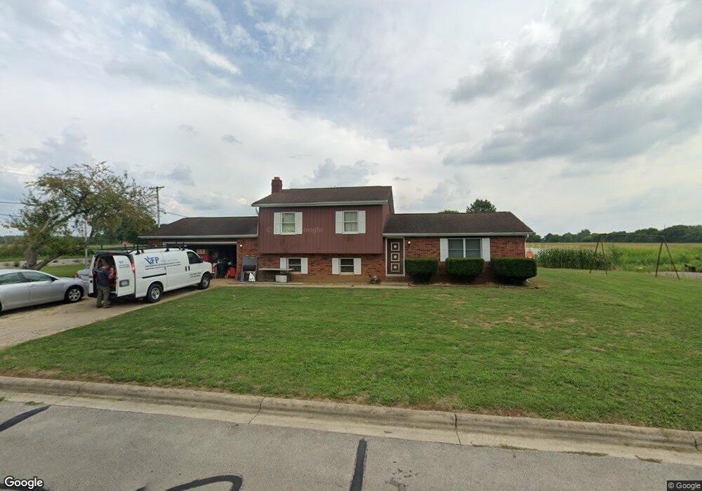
2975 Cornstalk Ave Ashville, OH 43103
Estimated Value: $323,874 - $388,000
3
Beds
3
Baths
1,788
Sq Ft
$192/Sq Ft
Est. Value
About This Home
This home is located at 2975 Cornstalk Ave, Ashville, OH 43103 and is currently estimated at $342,969, approximately $191 per square foot. 2975 Cornstalk Ave is a home located in Pickaway County.
Ownership History
Date
Name
Owned For
Owner Type
Purchase Details
Closed on
Mar 21, 2018
Sold by
Damron Robert L
Bought by
Damron Zachary Doyle
Current Estimated Value
Purchase Details
Closed on
Jan 5, 2010
Sold by
Damron Robert L
Bought by
Damron Zackary D
Home Financials for this Owner
Home Financials are based on the most recent Mortgage that was taken out on this home.
Original Mortgage
$120,000
Interest Rate
4.9%
Mortgage Type
Seller Take Back
Purchase Details
Closed on
Apr 9, 2008
Sold by
Damron Deborah Sue
Bought by
Damron Robert L
Create a Home Valuation Report for This Property
The Home Valuation Report is an in-depth analysis detailing your home's value as well as a comparison with similar homes in the area
Home Values in the Area
Average Home Value in this Area
Purchase History
| Date | Buyer | Sale Price | Title Company |
|---|---|---|---|
| Damron Zachary Doyle | $148,100 | None Available | |
| Damron Zackary D | $120,000 | Attorney | |
| Damron Robert L | -- | Attorney |
Source: Public Records
Mortgage History
| Date | Status | Borrower | Loan Amount |
|---|---|---|---|
| Previous Owner | Damron Zackary D | $120,000 |
Source: Public Records
Tax History Compared to Growth
Tax History
| Year | Tax Paid | Tax Assessment Tax Assessment Total Assessment is a certain percentage of the fair market value that is determined by local assessors to be the total taxable value of land and additions on the property. | Land | Improvement |
|---|---|---|---|---|
| 2024 | $4,154 | $76,490 | $12,440 | $64,050 |
| 2023 | $3,956 | $76,490 | $12,440 | $64,050 |
| 2022 | $3,298 | $56,320 | $10,180 | $46,140 |
| 2021 | $3,414 | $56,320 | $10,180 | $46,140 |
| 2020 | $3,389 | $56,320 | $10,180 | $46,140 |
| 2019 | $2,379 | $49,300 | $10,180 | $39,120 |
| 2018 | $2,546 | $49,300 | $10,180 | $39,120 |
| 2017 | $2,648 | $49,300 | $10,180 | $39,120 |
| 2016 | $2,338 | $50,630 | $10,180 | $40,450 |
| 2015 | $2,239 | $50,630 | $10,180 | $40,450 |
| 2014 | $2,191 | $50,630 | $10,180 | $40,450 |
| 2013 | $2,475 | $50,630 | $10,180 | $40,450 |
Source: Public Records
Map
Nearby Homes
- 16715 Pontiac Place
- 3055 Clifford Ave
- 0 Little Walnut Rd
- 5009 Roese Ave
- 30 Bazler Ln
- 77 Cromley St
- 61 Bortz St
- 94 Richard Ave
- 170 Jefferson Ave
- 5069 Ashville Rd
- 18825 Island Rd
- 5049 Lee Rd
- 5050 S Walnut St
- 307 Honeysuckle St
- 302 Honeysuckle St
- 234 Dowler Dr
- 145 Maple St
- 340 Gary St
- 5231 Ashville-Fairfield Rd
- 5441 Morning Glory St Unit Lot 338
- 16841 Cromley Rd
- 2980 Cornstalk Ave
- 2935 Cornstalk Ave
- 16720 Pontiac Place
- 16725 Pontiac Place
- 2915 Cornstalk Ave
- 16847 Cromley Rd
- 16710 Pontiac Place
- 16700 Pontiac Place
- 2895 Cornstalk Ave
- 16705 Pontiac Place
- 16710 Nokomis Cir
- 16861 Cromley Rd
- 2875 Cornstalk Ave
- 16700 Nokomis Cir
- 2860 Cornstalk Ave
- 2855 Cornstalk Ave
- 16633 Cromley Rd
- 16705 Nokomis Cir
- 2835 Cornstalk Ave