Estimated Value: $568,000 - $619,000
Studio
--
Bath
1,421
Sq Ft
$413/Sq Ft
Est. Value
About This Home
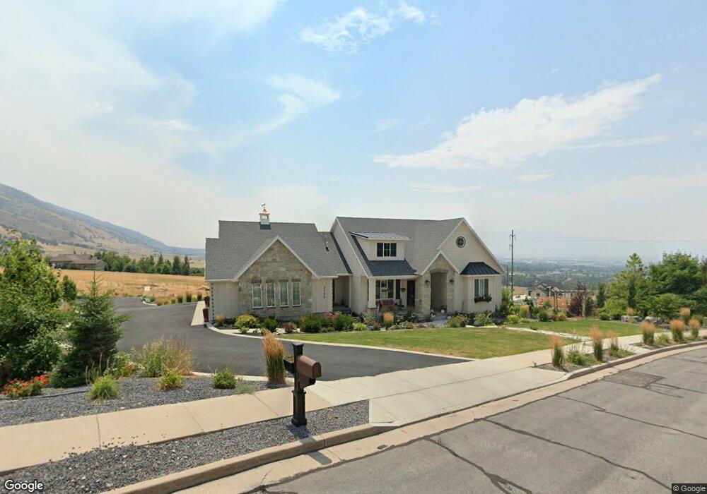
This home is located at 2975 N 1200 E, Logan, UT 84341 and is currently estimated at $587,092, approximately $413 per square foot. 2975 N 1200 E is a home with nearby schools including North Park School, Cedar Ridge School, and North Cache Middle School.
Ownership History
Date
Name
Owned For
Owner Type
Purchase Details
Closed on
Feb 22, 2013
Sold by
Cox Daniel L and Cox Sharon
Bought by
Cox Sharon and Sharon Cox Living Trust
Current Estimated Value
Home Financials for this Owner
Home Financials are based on the most recent Mortgage that was taken out on this home.
Original Mortgage
$168,000
Outstanding Balance
$116,647
Interest Rate
3.34%
Mortgage Type
New Conventional
Estimated Equity
$470,445
Purchase Details
Closed on
Sep 25, 2012
Sold by
Cox Barbara
Bought by
Cox Sharon and Sharon Cox Living Trust
Home Financials for this Owner
Home Financials are based on the most recent Mortgage that was taken out on this home.
Original Mortgage
$70,000
Interest Rate
3.71%
Mortgage Type
Purchase Money Mortgage
Purchase Details
Closed on
Feb 3, 2009
Sold by
Cox Dan L and Cox Sharon J
Bought by
Cox Sharon and Sharon Cox Living Trust
Purchase Details
Closed on
Sep 29, 2006
Sold by
Milligan James H and Kersten Carol Ann
Bought by
Cox Daniel
Home Financials for this Owner
Home Financials are based on the most recent Mortgage that was taken out on this home.
Original Mortgage
$44,207
Interest Rate
10%
Mortgage Type
Purchase Money Mortgage
Create a Home Valuation Report for This Property
The Home Valuation Report is an in-depth analysis detailing your home's value as well as a comparison with similar homes in the area
Home Values in the Area
Average Home Value in this Area
Purchase History
| Date | Buyer | Sale Price | Title Company |
|---|---|---|---|
| Cox Sharon | -- | Hickman Land Title Company | |
| Cox Daniel L | -- | Hickman Land Title Company | |
| Cox Sharon | -- | Accommodation | |
| Cox Sharon | -- | Hickman Land Title Company | |
| Cox Daniel | -- | Hickman Land Title Company |
Source: Public Records
Mortgage History
| Date | Status | Borrower | Loan Amount |
|---|---|---|---|
| Open | Cox Daniel L | $168,000 | |
| Closed | Cox Sharon | $70,000 | |
| Closed | Cox Daniel | $44,207 |
Source: Public Records
Tax History
| Year | Tax Paid | Tax Assessment Tax Assessment Total Assessment is a certain percentage of the fair market value that is determined by local assessors to be the total taxable value of land and additions on the property. | Land | Improvement |
|---|---|---|---|---|
| 2025 | $1,958 | $320,115 | $0 | $0 |
| 2024 | $2,497 | $377,730 | $0 | $0 |
| 2023 | $2,237 | $316,485 | $0 | $0 |
| 2022 | $2,341 | $316,485 | $0 | $0 |
| 2021 | $2,295 | $478,300 | $89,800 | $388,500 |
| 2020 | $1,796 | $353,173 | $89,800 | $263,373 |
| 2019 | $1,900 | $353,173 | $89,800 | $263,373 |
| 2018 | $1,630 | $294,820 | $65,800 | $229,020 |
| 2017 | $1,582 | $150,700 | $0 | $0 |
| 2016 | $1,602 | $150,700 | $0 | $0 |
| 2015 | $1,353 | $127,630 | $0 | $0 |
| 2014 | $1,312 | $127,630 | $0 | $0 |
| 2013 | -- | $137,725 | $0 | $0 |
Source: Public Records
Map
Nearby Homes
- 290 E 450 S
- 1185 E 2500 N
- 105 E 3100 N
- 488 E 250 S
- 307 S 400 E
- 680 S 50 E Unit 112
- 710 E 100 S
- 600 E 100 S
- 520 E 100 S
- 1110 E 100 S Unit 216
- 164 E 200 S
- 1335 E 2300 N
- 2469 N 620 E Unit 3
- 2477 N 620 E Unit 4
- 108 S 900 E
- 1495 E 2300 N
- 1872 N 515 W
- 2640 N Aspen Park Ln
- 2284 N 740 E
- 78 S 1000 E Unit 115
- 3016 N 1200 E
- 1245 E Bentwood Dr Unit 2
- 2943 N 1200 E
- 1252 E Bentwood Dr Unit 12
- 2942 N 1200 E
- 1223 E Bentwood Dr Unit 1
- 1223 E Bentwood Dr Unit 1
- 3089 N 1200 E
- 1271 E 3000 N
- 1282 E 3000 N
- 1295 E Bentwood Dr Unit 5
- 1295 E Bentwood Dr
- 1030 E 2900 N
- 1306 E 3000 N
- 1280 E 3100 N
- 1020 E 2750 N
- 700 S 450 E
- 2960 N 1000 E
- 684 S 450 E
- 2950 N 1000 E
Your Personal Tour Guide
Ask me questions while you tour the home.