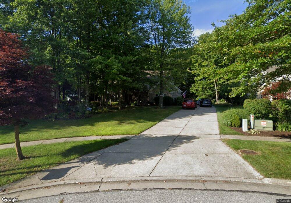
2976 Osborn Ln Twinsburg, OH 44087
Estimated Value: $512,156 - $571,000
4
Beds
3
Baths
2,768
Sq Ft
$193/Sq Ft
Est. Value
About This Home
This home is located at 2976 Osborn Ln, Twinsburg, OH 44087 and is currently estimated at $534,789, approximately $193 per square foot. 2976 Osborn Ln is a home located in Summit County with nearby schools including Wilcox Primary School, Samuel Bissell Elementary School, and Dodge Intermediate School.
Ownership History
Date
Name
Owned For
Owner Type
Purchase Details
Closed on
Jan 3, 2006
Sold by
Heitzmann Suzan V
Bought by
Zucker Norton H and Pleau Thomas
Current Estimated Value
Home Financials for this Owner
Home Financials are based on the most recent Mortgage that was taken out on this home.
Original Mortgage
$200,000
Outstanding Balance
$113,278
Interest Rate
6.4%
Mortgage Type
Fannie Mae Freddie Mac
Estimated Equity
$421,511
Purchase Details
Closed on
May 22, 1997
Sold by
Silvestro Robert J
Bought by
Hietzmann Paul R and Hietzmann Suzan V
Home Financials for this Owner
Home Financials are based on the most recent Mortgage that was taken out on this home.
Original Mortgage
$122,000
Interest Rate
8.25%
Mortgage Type
New Conventional
Create a Home Valuation Report for This Property
The Home Valuation Report is an in-depth analysis detailing your home's value as well as a comparison with similar homes in the area
Home Values in the Area
Average Home Value in this Area
Purchase History
| Date | Buyer | Sale Price | Title Company |
|---|---|---|---|
| Zucker Norton H | $373,000 | Anthem Title | |
| Hietzmann Paul R | $245,000 | -- |
Source: Public Records
Mortgage History
| Date | Status | Borrower | Loan Amount |
|---|---|---|---|
| Open | Zucker Norton H | $200,000 | |
| Previous Owner | Hietzmann Paul R | $122,000 |
Source: Public Records
Tax History Compared to Growth
Tax History
| Year | Tax Paid | Tax Assessment Tax Assessment Total Assessment is a certain percentage of the fair market value that is determined by local assessors to be the total taxable value of land and additions on the property. | Land | Improvement |
|---|---|---|---|---|
| 2025 | $11,058 | $156,580 | $25,368 | $131,212 |
| 2024 | $7,537 | $156,580 | $25,368 | $131,212 |
| 2023 | $11,058 | $156,580 | $25,368 | $131,212 |
| 2022 | $6,564 | $121,660 | $19,663 | $101,997 |
| 2021 | $6,738 | $121,660 | $19,663 | $101,997 |
| 2020 | $6,682 | $121,660 | $19,660 | $102,000 |
| 2019 | $6,555 | $112,110 | $19,660 | $92,450 |
| 2018 | $6,389 | $112,110 | $19,660 | $92,450 |
| 2017 | $5,249 | $112,110 | $19,660 | $92,450 |
| 2016 | $5,320 | $100,880 | $19,660 | $81,220 |
| 2015 | $5,249 | $100,880 | $19,660 | $81,220 |
| 2014 | $5,238 | $100,880 | $19,660 | $81,220 |
| 2013 | $5,587 | $107,700 | $19,660 | $88,040 |
Source: Public Records
Map
Nearby Homes
- 2978 Framingham Ln
- 10169 Timothy Ln
- 2923 Alling Dr
- 2916 Alling Dr
- 3331 Shale Dr
- 4239 Morley Dr
- 3314 Fenmore Ln
- 3320 Blossom Trail
- 10085 Glen Eagle Ln Unit 35AG
- 10393 N Pond Ln
- 10165 Glen Eagle Ln
- 34105 Blue Heron Dr
- 7372 Liberty Rd
- 7460 Hillside Ln
- 10375 W Cobblestone Ln Unit 2
- 2668 Walton Blvd
- 9740 Burton Dr
- 3110 Blue Jaye Ln
- 7260 Annadale Dr
- 7471 Som Center Rd
- 2962 Osborn Ln
- 2987 Hoadley Ln
- 2988 Osborn Ln
- 2967 Osborn Ln
- 10323 Merriam Ln
- 10333 Merriam Ln
- 2999 Hoadley Ln
- 2975 Hoadley Ln
- 10315 Merriam Ln
- 10343 Merriam Ln
- 10307 Merriam Ln
- 2981 Osborn Ln
- 10353 Merriam Ln
- 10299 Merriam Ln
- 2970 Hoadley Ln
- 10326 Covington Ln
- 10326 Covington Ln Unit 20H
- 11460 Covington Ln
- 11460 Covington Ln Unit 26
- 10325 Covington Ln Unit G19