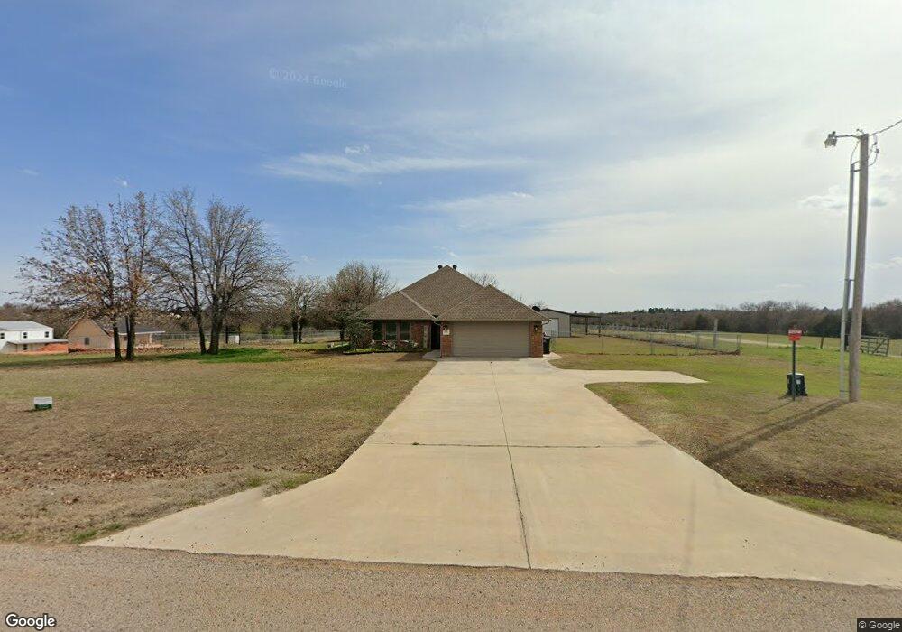
29761 Redskin Rd McLoud, OK 74851
Estimated Value: $254,000 - $343,000
3
Beds
2
Baths
1,560
Sq Ft
$190/Sq Ft
Est. Value
About This Home
This home is located at 29761 Redskin Rd, McLoud, OK 74851 and is currently estimated at $296,212, approximately $189 per square foot. 29761 Redskin Rd is a home with nearby schools including McLoud Intermediate School, McLoud Elementary School, and McLoud Junior High School.
Ownership History
Date
Name
Owned For
Owner Type
Purchase Details
Closed on
Aug 28, 2017
Sold by
Cramer Randal and Cramer Patti E
Bought by
Cramer Ronald G and Cramer Patti E
Current Estimated Value
Purchase Details
Closed on
Jun 9, 2015
Sold by
Cramer Randal and Cramer Patti E
Bought by
Cramer Randal and Cramer Patti E
Home Financials for this Owner
Home Financials are based on the most recent Mortgage that was taken out on this home.
Original Mortgage
$176,585
Interest Rate
3.91%
Mortgage Type
Commercial
Create a Home Valuation Report for This Property
The Home Valuation Report is an in-depth analysis detailing your home's value as well as a comparison with similar homes in the area
Home Values in the Area
Average Home Value in this Area
Purchase History
| Date | Buyer | Sale Price | Title Company |
|---|---|---|---|
| Cramer Ronald G | -- | None Available | |
| Cramer Randal | -- | Stewart Abstract & Title Ok |
Source: Public Records
Mortgage History
| Date | Status | Borrower | Loan Amount |
|---|---|---|---|
| Closed | Cramer Randal | $176,585 |
Source: Public Records
Tax History Compared to Growth
Tax History
| Year | Tax Paid | Tax Assessment Tax Assessment Total Assessment is a certain percentage of the fair market value that is determined by local assessors to be the total taxable value of land and additions on the property. | Land | Improvement |
|---|---|---|---|---|
| 2025 | $1,359 | $16,291 | $2,700 | $13,591 |
| 2024 | $1,305 | $15,817 | $2,700 | $13,117 |
| 2023 | $1,305 | $15,356 | $2,700 | $12,656 |
| 2022 | $1,323 | $15,356 | $2,700 | $12,656 |
| 2021 | $1,721 | $15,356 | $2,700 | $12,656 |
| 2020 | $1,337 | $15,495 | $2,700 | $12,795 |
| 2019 | $1,392 | $15,635 | $2,700 | $12,935 |
| 2018 | $1,492 | $15,774 | $2,700 | $13,074 |
| 2017 | $1,527 | $15,908 | $2,700 | $13,208 |
| 2016 | $1,369 | $15,919 | $2,700 | $13,219 |
| 2015 | $240 | $2,700 | $2,700 | $0 |
| 2014 | $240 | $2,700 | $2,700 | $0 |
Source: Public Records
Map
Nearby Homes
- 22718 Janet Ln Unit HAR
- 29049 Oilfield Trash Rd
- 3888 Ada Ave
- 3880 Louthea Ln
- 21097 Rivermist Dr
- 4332 Titan Terrace
- 22085 Melissa Ln
- 0 S Pottawatomie Rd
- 3833 Dove Ave
- 3816 Ada Ave
- 3881 River Mist Lake Dr
- 21086 River Mist Dr
- 21094 River Mist Dr
- RC Wright Plan at River Mist
- RC Carnegie II Plan at River Mist
- RC Kinsley II Plan at River Mist
- RC Lowell II Plan at River Mist
- RC Coleman Plan at River Mist
- RC Raleigh Plan at River Mist
- RC Foster II Plan at River Mist
- 29831 Redskin Rd
- 29704 Redskin Rd
- 29503 Redskin Rd
- 29702 Redskin Rd
- 1190 S Fishmarket Rd
- 1321 S Fishmarket Rd
- 1161 Fishmarket
- 102 Oakleaf St
- 970 S Fishmarket Rd
- 1584 S Fishmarket Rd
- 1501 S Fishmarket Rd
- 1600 S Fishmarket Rd
- 30874 Redskin Rd
- 29402 Redskin Rd
- 969 S Fishmarket Rd
- 944 S Fishmarket Rd
- 103 Oakleaf St
- 46 Shady Grove Rd
- 11 Shady Grove Rd
- 111 Oakleaf St