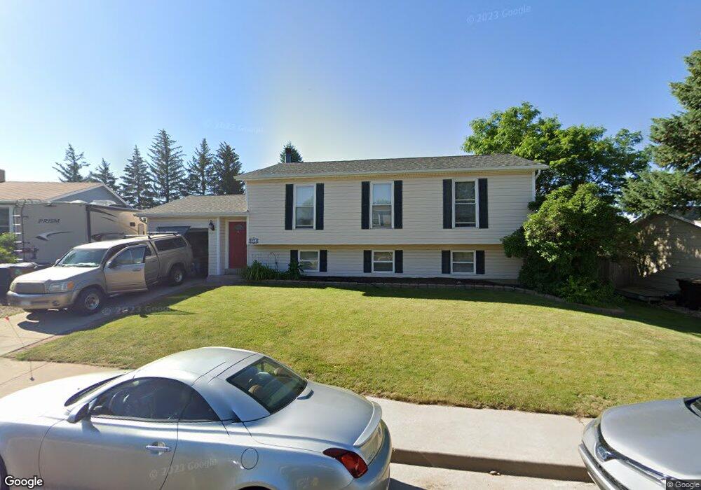
2978 W 11th Avenue Cir Broomfield, CO 80020
Lac Amora NeighborhoodEstimated Value: $494,000 - $573,000
2
Beds
2
Baths
1,875
Sq Ft
$278/Sq Ft
Est. Value
About This Home
This home is located at 2978 W 11th Avenue Cir, Broomfield, CO 80020 and is currently estimated at $520,578, approximately $277 per square foot. 2978 W 11th Avenue Cir is a home located in Broomfield County with nearby schools including Aspen Creek K-8 School, Broomfield High School, and Jefferson Academy Secondary School.
Ownership History
Date
Name
Owned For
Owner Type
Purchase Details
Closed on
Apr 26, 2016
Sold by
Hendershot Mark A and Hendershot Holly E
Bought by
Johnson Lynn A and Johnson Cheryl A
Current Estimated Value
Purchase Details
Closed on
Mar 23, 2007
Sold by
Engel Kevin G and Albertson Kathleen
Bought by
Hendershot Mark A and Hendershot Holly E
Home Financials for this Owner
Home Financials are based on the most recent Mortgage that was taken out on this home.
Original Mortgage
$112,600
Interest Rate
6.3%
Mortgage Type
Purchase Money Mortgage
Purchase Details
Closed on
Jul 31, 2006
Sold by
Mourray David W
Bought by
Albertson Engel and Albertson Kathleen
Purchase Details
Closed on
Nov 2, 1990
Purchase Details
Closed on
Dec 30, 1988
Purchase Details
Closed on
Feb 28, 1984
Create a Home Valuation Report for This Property
The Home Valuation Report is an in-depth analysis detailing your home's value as well as a comparison with similar homes in the area
Home Values in the Area
Average Home Value in this Area
Purchase History
| Date | Buyer | Sale Price | Title Company |
|---|---|---|---|
| Johnson Lynn A | $185,000 | None Available | |
| Hendershot Mark A | $185,000 | Utc Colorado | |
| Albertson Engel | $80,000 | None Available | |
| -- | $73,000 | -- | |
| -- | $63,000 | -- | |
| -- | $79,500 | -- |
Source: Public Records
Mortgage History
| Date | Status | Borrower | Loan Amount |
|---|---|---|---|
| Previous Owner | Hendershot Mark A | $112,600 |
Source: Public Records
Tax History Compared to Growth
Tax History
| Year | Tax Paid | Tax Assessment Tax Assessment Total Assessment is a certain percentage of the fair market value that is determined by local assessors to be the total taxable value of land and additions on the property. | Land | Improvement |
|---|---|---|---|---|
| 2025 | $3,039 | $32,910 | $9,050 | $23,860 |
| 2024 | $3,039 | $32,430 | $8,120 | $24,310 |
| 2023 | $3,033 | $37,470 | $9,380 | $28,090 |
| 2022 | $2,556 | $26,440 | $6,600 | $19,840 |
| 2021 | $2,543 | $27,200 | $6,790 | $20,410 |
| 2020 | $2,373 | $25,220 | $6,440 | $18,780 |
| 2019 | $2,368 | $25,390 | $6,480 | $18,910 |
| 2018 | $2,073 | $21,960 | $4,570 | $17,390 |
| 2017 | $2,041 | $24,280 | $5,050 | $19,230 |
| 2016 | $1,735 | $18,400 | $5,050 | $13,350 |
| 2015 | $1,675 | $15,080 | $5,050 | $10,030 |
| 2014 | $1,404 | $15,080 | $5,050 | $10,030 |
Source: Public Records
Map
Nearby Homes
- 1043 Lilac Ct
- 1087 Lilac St
- 880 Lilac St
- 3132 W 10th Avenue Place
- 1179 Lilac St
- 2150 Ridge Dr
- 2340 Rim Dr
- 2191 Ridge Dr
- 639 Quartz Way
- 1010 Opal St Unit 102
- 1740 W 6th Ave
- 1320 W 12th Ave
- 1148 Opal St Unit 101
- 1176 Opal St Unit 104
- 1176 Opal St Unit 102
- 1196 Opal St Unit 201
- 1190 W 11th Ct
- 1196 Sunset Dr
- 680 Kalmia Way
- 640 Kalmia Way
- 2998 W 11th Avenue Cir
- 2958 W 11th Avenue Cir
- 2979 W 11th Avenue Cir
- 2948 W 11th Avenue Cir
- 2985 W 10th Avenue Cir
- 2999 W 11th Avenue Cir
- 2959 W 11th Ave Cir
- 2965 W 10th Avenue Cir
- 2959 W 11th Avenue Cir
- 2995 W 10th Avenue Cir
- 3008 W 11th Avenue Cir
- 2938 W 11th Avenue Cir
- 1104 Maple Dr
- 2949 W 11th Avenue Cir
- 1101 Lilac Cir
- 3009 W 11th Avenue Cir
- 1114 Maple Dr
- 2956 W 10th Avenue Cir
- 3005 W 10th Avenue Cir
- 3018 W 11th Avenue Cir