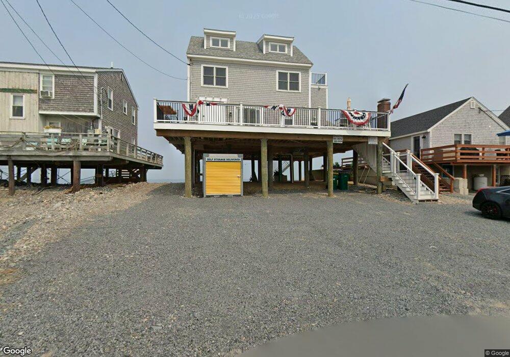
298 Central Ave Unit 1 Scituate, MA 02066
Humarock NeighborhoodEstimated Value: $1,026,000 - $1,491,454
4
Beds
1
Bath
1,296
Sq Ft
$980/Sq Ft
Est. Value
About This Home
This home is located at 298 Central Ave Unit 1, Scituate, MA 02066 and is currently estimated at $1,270,614, approximately $980 per square foot. 298 Central Ave Unit 1 is a home located in Plymouth County with nearby schools including Jenkins Elementary School, Lester J. Gates Middle School, and Scituate High School.
Ownership History
Date
Name
Owned For
Owner Type
Purchase Details
Closed on
Sep 10, 2019
Sold by
Dow John W
Bought by
Mcevoy Jill M
Current Estimated Value
Home Financials for this Owner
Home Financials are based on the most recent Mortgage that was taken out on this home.
Original Mortgage
$378,000
Outstanding Balance
$329,646
Interest Rate
3.6%
Mortgage Type
New Conventional
Estimated Equity
$940,968
Purchase Details
Closed on
Sep 14, 2018
Sold by
Dow Ann M
Bought by
Dow John W
Home Financials for this Owner
Home Financials are based on the most recent Mortgage that was taken out on this home.
Original Mortgage
$300,000
Interest Rate
4.6%
Mortgage Type
New Conventional
Purchase Details
Closed on
Sep 29, 1985
Bought by
Dow John and Dow Ann M
Create a Home Valuation Report for This Property
The Home Valuation Report is an in-depth analysis detailing your home's value as well as a comparison with similar homes in the area
Home Values in the Area
Average Home Value in this Area
Purchase History
| Date | Buyer | Sale Price | Title Company |
|---|---|---|---|
| Mcevoy Jill M | $540,000 | -- | |
| Dow John W | -- | -- | |
| Dow John W | -- | -- | |
| Dow John | -- | -- |
Source: Public Records
Mortgage History
| Date | Status | Borrower | Loan Amount |
|---|---|---|---|
| Open | Mcevoy Jill M | $378,000 | |
| Previous Owner | Dow John W | $300,000 |
Source: Public Records
Tax History Compared to Growth
Tax History
| Year | Tax Paid | Tax Assessment Tax Assessment Total Assessment is a certain percentage of the fair market value that is determined by local assessors to be the total taxable value of land and additions on the property. | Land | Improvement |
|---|---|---|---|---|
| 2025 | $12,631 | $1,264,400 | $737,000 | $527,400 |
| 2024 | $11,326 | $1,093,200 | $615,700 | $477,500 |
| 2023 | $8,284 | $917,100 | $526,800 | $390,300 |
| 2022 | $8,284 | $656,400 | $442,200 | $214,200 |
| 2021 | $8,013 | $601,100 | $421,200 | $179,900 |
| 2020 | $7,711 | $571,200 | $417,600 | $153,600 |
| 2019 | $8,508 | $619,200 | $446,600 | $172,600 |
| 2018 | $9,193 | $659,000 | $491,800 | $167,200 |
| 2017 | $9,285 | $659,000 | $491,800 | $167,200 |
| 2016 | $8,579 | $606,700 | $439,500 | $167,200 |
| 2015 | $7,948 | $606,700 | $439,500 | $167,200 |
Source: Public Records
Map
Nearby Homes
- 176 Central Ave
- 46
- 46 Atlantic Way
- 46 Atlantic Dr
- 174 Central Park Dr
- 180 Central Park Dr
- 44 Atlantic Way
- 182 Central Ave
- 170 Central Park Dr
- 184 Central Ave
- 40 Atlantic Way
- 168 Central Ave
- 186 Central Park Dr
- 38 Atlantic Dr
- 188 Central Ave
- 188 Central Ave Unit 188
- 36 Atlantic Way
- 190 Central Park Dr
- 162 Central Ave
- 162 Central Park Dr