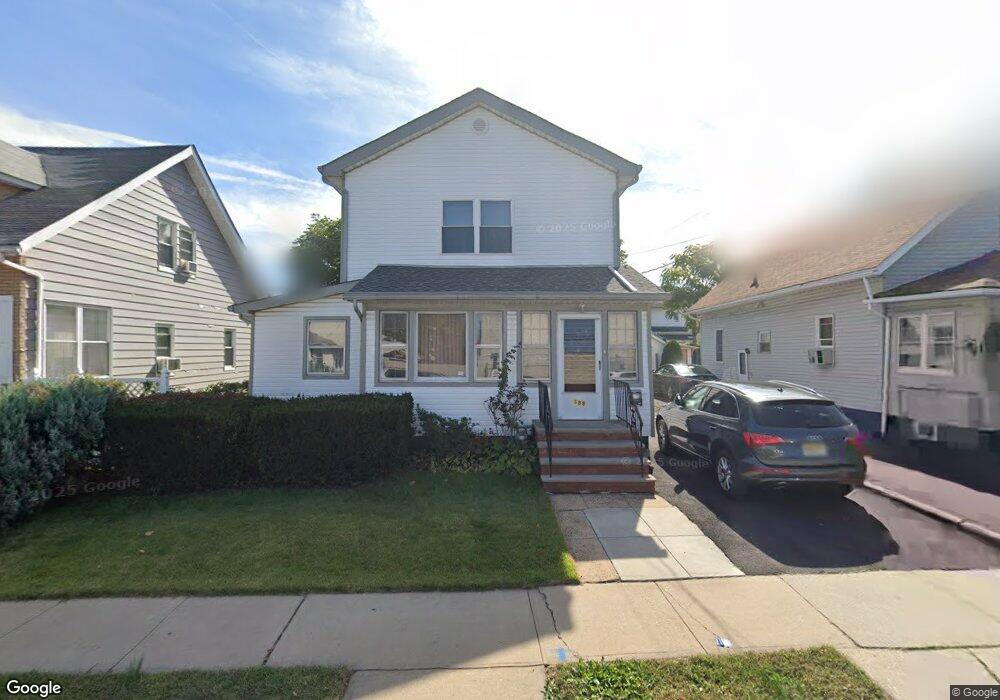
298 Crann St Hillside, NJ 07205
Estimated Value: $423,000 - $548,000
--
Bed
--
Bath
1,604
Sq Ft
$299/Sq Ft
Est. Value
About This Home
This home is located at 298 Crann St, Hillside, NJ 07205 and is currently estimated at $478,949, approximately $298 per square foot. 298 Crann St is a home located in Union County with nearby schools including Abram P. Morris-Saybrook Elementary School, Hurden Looker School, and Calvin Coolidge Elementary School.
Ownership History
Date
Name
Owned For
Owner Type
Purchase Details
Closed on
Jun 30, 1998
Sold by
Lanzafama Helen M
Bought by
Moonsammy Michael and Moonsammy Jane
Current Estimated Value
Home Financials for this Owner
Home Financials are based on the most recent Mortgage that was taken out on this home.
Original Mortgage
$100,800
Interest Rate
7.02%
Create a Home Valuation Report for This Property
The Home Valuation Report is an in-depth analysis detailing your home's value as well as a comparison with similar homes in the area
Home Values in the Area
Average Home Value in this Area
Purchase History
| Date | Buyer | Sale Price | Title Company |
|---|---|---|---|
| Moonsammy Michael | $112,000 | -- |
Source: Public Records
Mortgage History
| Date | Status | Borrower | Loan Amount |
|---|---|---|---|
| Closed | Moonsammy Michael | $100,800 |
Source: Public Records
Tax History Compared to Growth
Tax History
| Year | Tax Paid | Tax Assessment Tax Assessment Total Assessment is a certain percentage of the fair market value that is determined by local assessors to be the total taxable value of land and additions on the property. | Land | Improvement |
|---|---|---|---|---|
| 2025 | $9,103 | $110,300 | $60,000 | $50,300 |
| 2024 | $8,838 | $110,300 | $60,000 | $50,300 |
| 2023 | $8,838 | $110,300 | $60,000 | $50,300 |
| 2022 | $8,757 | $110,300 | $60,000 | $50,300 |
| 2021 | $8,008 | $110,300 | $60,000 | $50,300 |
| 2020 | $8,649 | $110,300 | $60,000 | $50,300 |
| 2019 | $8,481 | $110,300 | $60,000 | $50,300 |
| 2018 | $8,396 | $110,300 | $60,000 | $50,300 |
| 2017 | $8,345 | $110,300 | $60,000 | $50,300 |
| 2016 | $8,335 | $110,300 | $60,000 | $50,300 |
| 2015 | $8,261 | $110,300 | $60,000 | $50,300 |
| 2014 | $8,131 | $110,300 | $60,000 | $50,300 |
Source: Public Records
Map
Nearby Homes
- 292 Crann St
- 314 Fitzpatrick St
- 105 Liberty Ct Unit 105
- 507 Locust Ave
- 220 Silver Ave
- 393 Harvard Ave
- 1322 Marcella Dr
- 386 Yale Ave
- 1375 Brookfall Ave
- 149 Baltimore Ave
- 1393 Cornell Place
- 155 Silver Ave
- 553 Harvard Ave
- 169 Valley View Rd
- 557 Yale Ave
- 1282 Baker St
- 525 Us Highway 22
- 1290 Baker St
- 537 Us Highway 22
- 542 Leo St
- 300 Crann St
- 306 Crann St
- 288 Crann St
- 295 Fitzpatrick St
- 299 Fitzpatrick St
- 303 Fitzpatrick St
- 291 Fitzpatrick St
- 286 Crann St
- 287 Fitzpatrick St
- 305 Fitzpatrick St
- 293 Crann St
- 1171 Liberty Ave
- 280 Crann St
- 310 Crann St Unit 4
- 310 Crann St Unit 1
- 287 Crann St
- 309 Fitzpatrick St
- 283 Fitzpatrick St
- 1151 Liberty Ave
- 283 Crann St