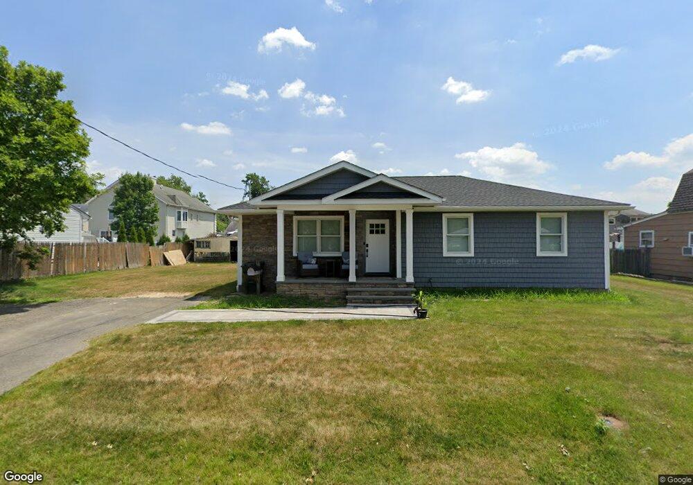
298 Furman Blvd Keyport, NJ 07735
Estimated Value: $437,000 - $535,000
--
Bed
--
Bath
1,432
Sq Ft
$342/Sq Ft
Est. Value
About This Home
This home is located at 298 Furman Blvd, Keyport, NJ 07735 and is currently estimated at $490,446, approximately $342 per square foot. 298 Furman Blvd is a home located in Middlesex County with nearby schools including Old Bridge High School, Icob Academy, and St. Joseph Elementary School.
Ownership History
Date
Name
Owned For
Owner Type
Purchase Details
Closed on
Aug 16, 2021
Sold by
Nunley Michael A and Nunley Michelle
Bought by
Carbone Scott
Current Estimated Value
Purchase Details
Closed on
Sep 26, 1994
Sold by
Anderson Nils
Bought by
Nunley Michael and Nunley Michelle R
Home Financials for this Owner
Home Financials are based on the most recent Mortgage that was taken out on this home.
Original Mortgage
$120,000
Interest Rate
8.5%
Create a Home Valuation Report for This Property
The Home Valuation Report is an in-depth analysis detailing your home's value as well as a comparison with similar homes in the area
Home Values in the Area
Average Home Value in this Area
Purchase History
| Date | Buyer | Sale Price | Title Company |
|---|---|---|---|
| Carbone Scott | $140,000 | All Ahead Title Agency Llc | |
| Carbone Scott | $140,000 | Chicago Title | |
| Nunley Michael | $122,400 | -- |
Source: Public Records
Mortgage History
| Date | Status | Borrower | Loan Amount |
|---|---|---|---|
| Previous Owner | Nunley Michael | $120,000 |
Source: Public Records
Tax History Compared to Growth
Tax History
| Year | Tax Paid | Tax Assessment Tax Assessment Total Assessment is a certain percentage of the fair market value that is determined by local assessors to be the total taxable value of land and additions on the property. | Land | Improvement |
|---|---|---|---|---|
| 2025 | $7,075 | $123,500 | $49,500 | $74,000 |
| 2024 | $6,785 | $123,500 | $49,500 | $74,000 |
| 2023 | $6,785 | $123,500 | $49,500 | $74,000 |
| 2022 | $6,602 | $123,500 | $49,500 | $74,000 |
| 2021 | $6,471 | $129,400 | $49,500 | $79,900 |
| 2020 | $6,708 | $129,400 | $49,500 | $79,900 |
| 2019 | $6,601 | $129,400 | $49,500 | $79,900 |
| 2018 | $6,527 | $129,400 | $49,500 | $79,900 |
| 2017 | $6,324 | $129,400 | $49,500 | $79,900 |
| 2016 | $6,198 | $129,400 | $49,500 | $79,900 |
| 2015 | $6,090 | $129,400 | $49,500 | $79,900 |
| 2014 | $6,016 | $129,400 | $49,500 | $79,900 |
Source: Public Records
Map
Nearby Homes
- 42 Boulevard E
- 363 Ocean Blvd
- 103 Furman Blvd
- 65 Boulevard E
- 125 Raritan Blvd
- 136 Hilltop Blvd
- 106 Boulevard W
- 107 Boulevard W
- 38 Lcpl Phillip E Frank Way Unit 38
- 112 Lcpl Phillip E Frank Way
- 108 W Concourse
- 599 Keyport Ave
- 281 Prospect Ave
- 250 Brookside Ave
- 235 Garfield Ave
- 839 Brookside Ave
- 22 Stemler Dr
- 745 Cliffwood Ave
- 615 Greenwood Ave
- 786 Cliffwood Ave
- 296 Furman Blvd
- 182 Furman Blvd
- 184 Furman Blvd
- 302 Furman Blvd
- 303 Furman Blvd
- 307 Furman Blvd
- 284 Furman Blvd
- 206 Furman Blvd
- 252 Raritan Blvd
- 202 Furman Blvd
- 254 Raritan Blvd
- 250 Raritan Blvd
- 295 Furman Blvd
- 256 Raritan Blvd
- 211 Furman Blvd
- 293 Furman Blvd
- 247 Raritan Blvd
- 266 Raritan Blvd
- 200 Furman Blvd
- 245 Raritan Blvd