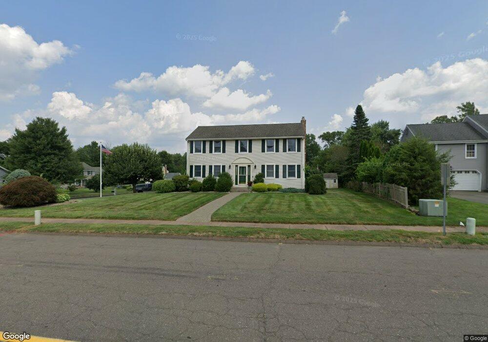
298 Highcrest Rd Wethersfield, CT 06109
Estimated Value: $486,000 - $550,000
4
Beds
3
Baths
1,920
Sq Ft
$274/Sq Ft
Est. Value
About This Home
This home is located at 298 Highcrest Rd, Wethersfield, CT 06109 and is currently estimated at $526,125, approximately $274 per square foot. 298 Highcrest Rd is a home located in Hartford County with nearby schools including Highcrest School, Silas Deane Middle School, and Wethersfield High School.
Ownership History
Date
Name
Owned For
Owner Type
Purchase Details
Closed on
Jul 20, 1990
Sold by
Landers Daniel
Bought by
Okeefe Colleen
Current Estimated Value
Home Financials for this Owner
Home Financials are based on the most recent Mortgage that was taken out on this home.
Original Mortgage
$167,000
Interest Rate
9.94%
Create a Home Valuation Report for This Property
The Home Valuation Report is an in-depth analysis detailing your home's value as well as a comparison with similar homes in the area
Home Values in the Area
Average Home Value in this Area
Purchase History
We collect this data history from publicly available records. To have your information removed, we recommend requesting removal directly through your county’s website.
| Date | Buyer | Sale Price | Title Company |
|---|---|---|---|
| Okeefe Colleen | $230,000 | -- |
Source: Public Records
Mortgage History
We collect this data history from publicly available records. To have your information removed, we recommend requesting removal directly through your county’s website.
| Date | Status | Borrower | Loan Amount |
|---|---|---|---|
| Closed | Okeefe Colleen | $80,000 | |
| Closed | Okeefe Colleen | $167,000 | |
| Closed | Okeefe Colleen | $167,000 |
Source: Public Records
Tax History
| Year | Tax Paid | Tax Assessment Tax Assessment Total Assessment is a certain percentage of the fair market value that is determined by local assessors to be the total taxable value of land and additions on the property. | Land | Improvement |
|---|---|---|---|---|
| 2025 | $14,829 | $359,750 | $112,840 | $246,910 |
| 2024 | $10,140 | $234,610 | $93,020 | $141,590 |
| 2023 | $9,802 | $234,610 | $93,020 | $141,590 |
| 2022 | $9,638 | $234,610 | $93,020 | $141,590 |
| 2021 | $9,542 | $234,610 | $93,020 | $141,590 |
| 2020 | $9,546 | $234,610 | $93,020 | $141,590 |
| 2019 | $9,558 | $234,610 | $93,020 | $141,590 |
| 2018 | $8,898 | $218,200 | $85,000 | $133,200 |
| 2017 | $8,678 | $218,200 | $85,000 | $133,200 |
| 2016 | $8,409 | $218,200 | $85,000 | $133,200 |
| 2015 | $8,333 | $218,200 | $85,000 | $133,200 |
| 2014 | $8,017 | $218,200 | $85,000 | $133,200 |
Source: Public Records
Map
Nearby Homes
- 62 Butternut Cir
- 268 Fox Hill Rd
- 72 Old Post Rd
- 155 Old Common Rd
- 508 Highland St
- 25 Amato Dr
- 501 Highland St
- 1211 Maple St
- 107 Knollwood Rd
- 129 Cloverdale Cir
- 152 Surrey Dr
- 46 Stonegate Dr
- 80 Little Oak Ln
- 5 Westmont Rd
- 748 Maple St
- 101 Collier Rd
- 6 Vinnie Dr
- 80 Grist Mill Rd
- 75 Barry Place
- 61 Luca Ln
- 306 Highcrest Rd
- 16 Sage Rd
- 286 Highcrest Rd
- 309 Hang Dog Ln
- 20 Sage Rd
- 293 Highcrest Rd
- 275 Hang Dog Ln
- 15 Sage Rd
- 285 Highcrest Rd
- 278 Highcrest Rd
- 19 Sage Rd
- 294 Hang Dog Ln
- 321 Hang Dog Ln
- 6 Goff Brook Cir
- 284 Hang Dog Ln
- 314 Hang Dog Ln
- 270 Highcrest Rd
- 265 Hang Dog Ln
- 20 Stockade Cir
- 276 Hang Dog Ln
Your Personal Tour Guide
Ask me questions while you tour the home.