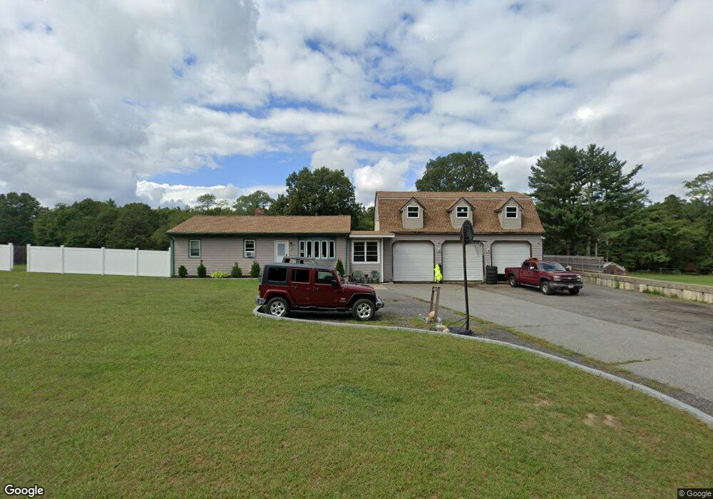
298 Indian Town Rd Westport, MA 02790
Estimated Value: $532,607 - $674,000
3
Beds
2
Baths
1,260
Sq Ft
$475/Sq Ft
Est. Value
About This Home
This home is located at 298 Indian Town Rd, Westport, MA 02790 and is currently estimated at $598,152, approximately $474 per square foot. 298 Indian Town Rd is a home located in Bristol County with nearby schools including North End Elementary School, Morton Middle School, and B M C Durfee High School.
Ownership History
Date
Name
Owned For
Owner Type
Purchase Details
Closed on
Dec 7, 2004
Sold by
Galhardo Claudette M and Galhardo Mark A
Bought by
Galhardo Mark A
Current Estimated Value
Home Financials for this Owner
Home Financials are based on the most recent Mortgage that was taken out on this home.
Original Mortgage
$270,000
Outstanding Balance
$134,856
Interest Rate
5.69%
Mortgage Type
Purchase Money Mortgage
Estimated Equity
$463,296
Purchase Details
Closed on
Jul 18, 2003
Sold by
Galhardo Claudette M and Galhardo Gregory
Bought by
Galhardo Claudette M and Galhardo Gregory
Home Financials for this Owner
Home Financials are based on the most recent Mortgage that was taken out on this home.
Original Mortgage
$199,000
Interest Rate
5.52%
Purchase Details
Closed on
Jul 25, 1977
Bought by
Galhardo Mark A
Create a Home Valuation Report for This Property
The Home Valuation Report is an in-depth analysis detailing your home's value as well as a comparison with similar homes in the area
Home Values in the Area
Average Home Value in this Area
Purchase History
| Date | Buyer | Sale Price | Title Company |
|---|---|---|---|
| Galhardo Mark A | -- | -- | |
| Galhardo Claudette M | -- | -- | |
| Galhardo Mark A | -- | -- |
Source: Public Records
Mortgage History
| Date | Status | Borrower | Loan Amount |
|---|---|---|---|
| Open | Galhardo Mark A | $270,000 | |
| Previous Owner | Galhardo Mark A | $29,700 | |
| Previous Owner | Galhardo Mark A | $199,000 |
Source: Public Records
Tax History Compared to Growth
Tax History
| Year | Tax Paid | Tax Assessment Tax Assessment Total Assessment is a certain percentage of the fair market value that is determined by local assessors to be the total taxable value of land and additions on the property. | Land | Improvement |
|---|---|---|---|---|
| 2025 | $5,625 | $491,300 | $189,400 | $301,900 |
| 2024 | $5,260 | $457,800 | $182,200 | $275,600 |
| 2023 | $5,234 | $426,600 | $158,000 | $268,600 |
| 2022 | $4,740 | $375,600 | $147,900 | $227,700 |
| 2021 | $4,842 | $350,100 | $148,400 | $201,700 |
| 2020 | $4,799 | $332,100 | $148,700 | $183,400 |
| 2019 | $4,693 | $321,900 | $151,000 | $170,900 |
| 2018 | $4,617 | $315,800 | $151,000 | $164,800 |
| 2017 | $4,222 | $301,600 | $138,800 | $162,800 |
| 2016 | $4,034 | $296,000 | $138,800 | $157,200 |
| 2015 | $3,894 | $297,700 | $138,800 | $158,900 |
| 2014 | $3,629 | $288,500 | $129,600 | $158,900 |
Source: Public Records
Map
Nearby Homes
- 309 Yellow Hill Rd
- 128 Old Bedford Rd
- 3 Diane Way
- 55 Lynch Ln
- 1276 Old Fall River Rd
- 44 Fenmore St
- 168 Windsor St
- 2 Donna Marie Dr
- 19 Charles Joseph Dr
- 1796 Locust St
- 36 Fordney St
- 200 David St
- 85 Reney St
- 125 Angell St
- 89 Lafayette St
- 350 Doherty St
- 219 Earle St Unit 3
- 217 Earle St Unit 2
- 215 Earle St Unit 1
- 172 Earle St
- 300 Indian Town Rd
- 289 Indian Town Rd
- 295A Indian Town Rd
- 295 Indian Town Rd
- 320 Indian Town Rd
- 296 Indian Town Rd
- 296B Indian Town Rd
- 297 Indian Town Rd
- 400 Indian Town Rd
- 294 Indian Town Rd
- 15 Mohawk Dr
- 285 Indian Town Rd
- 521 Indian Town Rd
- 292 Indian Town Rd
- 292 Indian Town Rd
- 81 Mohawk Dr
- 551 Indian Town Rd
- 551 Indian Town Rd
- 581 Indian Town Rd
- 141 Mohawk Dr