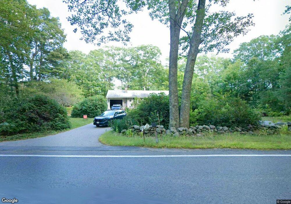
298 Pommogussett Rd Rutland, MA 01543
Estimated Value: $403,838 - $463,000
2
Beds
1
Bath
1,302
Sq Ft
$333/Sq Ft
Est. Value
About This Home
This home is located at 298 Pommogussett Rd, Rutland, MA 01543 and is currently estimated at $432,960, approximately $332 per square foot. 298 Pommogussett Rd is a home located in Worcester County with nearby schools including Wachusett Regional High School.
Ownership History
Date
Name
Owned For
Owner Type
Purchase Details
Closed on
Jul 30, 2024
Sold by
Ferguson Michael J and Hall Michelle L
Bought by
Clough
Current Estimated Value
Purchase Details
Closed on
Aug 21, 2022
Sold by
Ferguson Michael J
Bought by
Ferguson Michael J and Hall Michelle L
Purchase Details
Closed on
Apr 13, 2007
Sold by
Clough Donna M and Ferguson Donna M
Bought by
Clough Donna M and Ferguson Donna M
Purchase Details
Closed on
Apr 14, 1989
Sold by
Boucher Richard
Bought by
Clough Donna M
Home Financials for this Owner
Home Financials are based on the most recent Mortgage that was taken out on this home.
Original Mortgage
$5,000
Interest Rate
10.97%
Create a Home Valuation Report for This Property
The Home Valuation Report is an in-depth analysis detailing your home's value as well as a comparison with similar homes in the area
Home Values in the Area
Average Home Value in this Area
Purchase History
| Date | Buyer | Sale Price | Title Company |
|---|---|---|---|
| Clough | -- | None Available | |
| Clough | -- | None Available | |
| Ferguson Michael J | -- | None Available | |
| Ferguson Michael J | -- | None Available | |
| Clough Donna M | -- | -- | |
| Clough Donna M | -- | -- | |
| Clough Donna M | $131,000 | -- |
Source: Public Records
Mortgage History
| Date | Status | Borrower | Loan Amount |
|---|---|---|---|
| Previous Owner | Clough Donna M | $30,753 | |
| Previous Owner | Clough Donna M | $68,000 | |
| Previous Owner | Clough Donna M | $5,000 | |
| Previous Owner | Clough Donna M | $65,000 |
Source: Public Records
Tax History Compared to Growth
Tax History
| Year | Tax Paid | Tax Assessment Tax Assessment Total Assessment is a certain percentage of the fair market value that is determined by local assessors to be the total taxable value of land and additions on the property. | Land | Improvement |
|---|---|---|---|---|
| 2025 | $4,914 | $345,100 | $93,100 | $252,000 |
| 2024 | $4,731 | $319,000 | $88,900 | $230,100 |
| 2023 | $4,330 | $315,600 | $83,800 | $231,800 |
| 2022 | $4,194 | $265,600 | $70,600 | $195,000 |
| 2021 | $3,965 | $237,400 | $70,600 | $166,800 |
| 2020 | $3,908 | $221,900 | $66,900 | $155,000 |
| 2019 | $3,820 | $213,500 | $63,700 | $149,800 |
| 2018 | $3,689 | $203,500 | $63,700 | $139,800 |
| 2017 | $3,624 | $197,800 | $63,700 | $134,100 |
| 2016 | $3,253 | $187,300 | $60,900 | $126,400 |
| 2015 | $3,050 | $172,800 | $60,900 | $111,900 |
| 2014 | $2,957 | $172,800 | $60,900 | $111,900 |
Source: Public Records
Map
Nearby Homes
- 2 Simon Davis Dr
- 35 Brintnal Dr
- 73 Brintnal Dr
- 101 Brintnal Dr
- 40 Brunelle Dr
- 175 Glenwood Rd
- 81 Glenwood Place
- 16 Richards Ave
- 271 Glenwood Rd
- 55 Pommogussett Rd
- 25 Watson Ln
- 5 Miles Rd
- 147 E County Rd Unit 149
- 32 Pommogussett Rd Unit 1
- 51 Woodside Ave
- 47 Woodside Ave
- 10 Soucy Dr
- 28 Forest Hill Dr
- 45 Old Colony Rd
- Lot 24R Quail Run
- 1 Rebecca Ann Dr
- 314 Pommogussett Rd
- 5 Rebecca Ann Dr
- 293 Pommogussett Rd
- 293 Pommogussett Rd Unit 1
- 315 Pommogussett Rd
- 2 Rebecca Ann Dr
- 68-B Campbell St
- 319 Pommogussett Rd
- 318 Pommogussett Rd
- 11 Rebecca Ann Dr
- 8 Rebecca Ann Dr
- 6 Rebecca Ann Dr
- 321 Pommogussett Rd
- 280 Pommogussett Rd Unit A
- 19 Crestview Dr
- 322 Pommogussett Rd
- 17 Rebecca Ann Dr
- 15 Rebecca Ann Dr
- 12 Rebecca Ann Dr