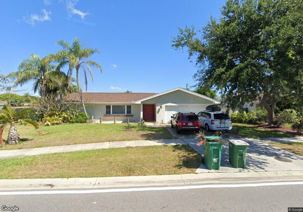
298 Roosevelt Ave Satellite Beach, FL 32937
Estimated Value: $585,000 - $731,000
4
Beds
2
Baths
1,868
Sq Ft
$344/Sq Ft
Est. Value
About This Home
This home is located at 298 Roosevelt Ave, Satellite Beach, FL 32937 and is currently estimated at $642,829, approximately $344 per square foot. 298 Roosevelt Ave is a home located in Brevard County with nearby schools including Spessard L. Holland Elementary School, Satellite Senior High School, and DeLaura Middle School.
Ownership History
Date
Name
Owned For
Owner Type
Purchase Details
Closed on
Jan 24, 2014
Sold by
Georges James N and Ward Mary C
Bought by
Parker Brad and Parker Rachel
Current Estimated Value
Home Financials for this Owner
Home Financials are based on the most recent Mortgage that was taken out on this home.
Original Mortgage
$120,000
Outstanding Balance
$33,937
Interest Rate
4.44%
Estimated Equity
$608,892
Purchase Details
Closed on
May 23, 2003
Sold by
Valdes James E and Valdes Sandra J
Bought by
Georges James N and Ward Mary C
Home Financials for this Owner
Home Financials are based on the most recent Mortgage that was taken out on this home.
Original Mortgage
$182,500
Interest Rate
5.79%
Create a Home Valuation Report for This Property
The Home Valuation Report is an in-depth analysis detailing your home's value as well as a comparison with similar homes in the area
Home Values in the Area
Average Home Value in this Area
Purchase History
| Date | Buyer | Sale Price | Title Company |
|---|---|---|---|
| Parker Brad | $270,000 | Supreme Title Closings Llc | |
| Georges James N | $182,500 | Security First Title Partner |
Source: Public Records
Mortgage History
| Date | Status | Borrower | Loan Amount |
|---|---|---|---|
| Open | Parker Brad | $120,000 | |
| Previous Owner | Georges James N | $182,500 |
Source: Public Records
Tax History Compared to Growth
Tax History
| Year | Tax Paid | Tax Assessment Tax Assessment Total Assessment is a certain percentage of the fair market value that is determined by local assessors to be the total taxable value of land and additions on the property. | Land | Improvement |
|---|---|---|---|---|
| 2025 | $4,420 | $277,240 | -- | -- |
| 2024 | $4,359 | $269,430 | -- | -- |
| 2023 | $4,359 | $261,590 | $0 | $0 |
| 2022 | $4,097 | $253,980 | $0 | $0 |
| 2021 | $4,240 | $246,590 | $0 | $0 |
| 2020 | $4,231 | $243,190 | $0 | $0 |
| 2019 | $4,174 | $235,920 | $0 | $0 |
| 2018 | $4,183 | $231,530 | $0 | $0 |
| 2017 | $3,971 | $226,770 | $0 | $0 |
| 2016 | $3,990 | $222,110 | $88,000 | $134,110 |
| 2015 | $4,090 | $220,570 | $77,000 | $143,570 |
| 2014 | $2,295 | $142,680 | $71,500 | $71,180 |
Source: Public Records
Map
Nearby Homes
- 200 Jason Ct
- 240 Sheridan Ave
- 325 Park Ave
- 348 Sherwood Ave
- 130 Roosevelt Ave Unit 207
- 355 Jackson Ave
- 129 Seawind Dr Unit 25
- 225 Hedgecock Ct
- 320 Glenwood Ave
- 445 Park Ave
- 1175 Highway A1a Unit 405
- 1175 Highway A1a Unit 506
- 298 Harwood Ave
- 1125 Highway A1a Unit 903
- 1125 Highway A1a Unit 501
- 1125 Highway A1a Unit 504
- 1085 Highway A1a Unit 1202
- 230 Harwood Ave
- 527 Wilson Ave
- 1273 Highway A1a Unit 308
- 290 Roosevelt Ave
- 285 Sheridan Ave
- 300 Roosevelt Ave
- 280 Roosevelt Ave
- 275 Sheridan Ave
- 205 Jason Ct
- 205 Orange Street Satellite Beach
- 205 Orange St
- 305 Sheridan Ave
- 210 Jason Ct
- 270 Roosevelt Ave
- 215 Jason Ct
- 310 Roosevelt Ave
- 290 Sheridan Ave
- 215 Orange St
- 200 Carole Ct
- 280 Sheridan Ave
- 220 Jason Ct
- 210 Carole Ct
- 300 Sheridan Ave