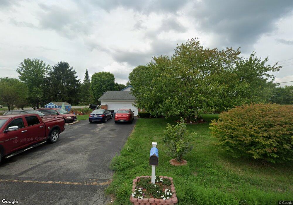
2980 Cornstalk Ave Ashville, OH 43103
Estimated Value: $286,876 - $321,000
3
Beds
2
Baths
1,619
Sq Ft
$189/Sq Ft
Est. Value
About This Home
This home is located at 2980 Cornstalk Ave, Ashville, OH 43103 and is currently estimated at $306,469, approximately $189 per square foot. 2980 Cornstalk Ave is a home located in Pickaway County.
Ownership History
Date
Name
Owned For
Owner Type
Purchase Details
Closed on
Nov 16, 2004
Sold by
Williams Jeffrey L and Williams Sharma L
Bought by
Langevin Thomas E and Langevin Christine
Current Estimated Value
Home Financials for this Owner
Home Financials are based on the most recent Mortgage that was taken out on this home.
Original Mortgage
$155,000
Outstanding Balance
$88,412
Interest Rate
7.99%
Mortgage Type
Purchase Money Mortgage
Estimated Equity
$218,057
Purchase Details
Closed on
Nov 15, 2002
Sold by
Shrf Robin G Collins Pr
Bought by
Williams Jeffrey L and Williams Sharma L
Home Financials for this Owner
Home Financials are based on the most recent Mortgage that was taken out on this home.
Original Mortgage
$76,400
Interest Rate
6.1%
Mortgage Type
New Conventional
Purchase Details
Closed on
Mar 1, 1988
Purchase Details
Closed on
Sep 1, 1987
Create a Home Valuation Report for This Property
The Home Valuation Report is an in-depth analysis detailing your home's value as well as a comparison with similar homes in the area
Home Values in the Area
Average Home Value in this Area
Purchase History
| Date | Buyer | Sale Price | Title Company |
|---|---|---|---|
| Langevin Thomas E | $183,000 | Lighthouse Title Services | |
| Williams Jeffrey L | $95,000 | -- | |
| -- | $64,000 | -- | |
| -- | $52,000 | -- |
Source: Public Records
Mortgage History
| Date | Status | Borrower | Loan Amount |
|---|---|---|---|
| Open | Langevin Thomas E | $155,000 | |
| Closed | Williams Jeffrey L | $76,400 |
Source: Public Records
Tax History Compared to Growth
Tax History
| Year | Tax Paid | Tax Assessment Tax Assessment Total Assessment is a certain percentage of the fair market value that is determined by local assessors to be the total taxable value of land and additions on the property. | Land | Improvement |
|---|---|---|---|---|
| 2024 | -- | $64,690 | $10,730 | $53,960 |
| 2023 | $2,304 | $64,690 | $10,730 | $53,960 |
| 2022 | $1,818 | $47,650 | $8,780 | $38,870 |
| 2021 | $1,821 | $47,650 | $8,780 | $38,870 |
| 2020 | $1,822 | $47,650 | $8,780 | $38,870 |
| 2019 | $1,579 | $41,480 | $8,780 | $32,700 |
| 2018 | $1,637 | $41,480 | $8,780 | $32,700 |
| 2017 | $1,679 | $41,480 | $8,780 | $32,700 |
| 2016 | $1,588 | $39,530 | $8,780 | $30,750 |
| 2015 | $1,548 | $39,530 | $8,780 | $30,750 |
| 2014 | $3,418 | $39,530 | $8,780 | $30,750 |
| 2013 | $3,486 | $39,530 | $8,780 | $30,750 |
Source: Public Records
Map
Nearby Homes
- 16715 Pontiac Place
- 3055 Clifford Ave
- 0 Little Walnut Rd
- 5009 Roese Ave
- 77 Cromley St
- 30 Bazler Ln
- 61 Bortz St
- 94 Richard Ave
- 170 Jefferson Ave
- 5069 Ashville Rd
- 18825 Island Rd
- 5049 Lee Rd
- 5050 S Walnut St
- 307 Honeysuckle St
- 302 Honeysuckle St
- 234 Dowler Dr
- 145 Maple St
- 340 Gary St
- 5231 Ashville-Fairfield Rd
- 5441 Morning Glory St Unit Lot 338
- 16720 Pontiac Place
- 2975 Cornstalk Ave
- 16725 Pontiac Place
- 16710 Pontiac Place
- 2935 Cornstalk Ave
- 16700 Pontiac Place
- 16841 Cromley Rd
- 16705 Pontiac Place
- 2915 Cornstalk Ave
- 16710 Nokomis Cir
- 2895 Cornstalk Ave
- 16633 Cromley Rd
- 16700 Nokomis Cir
- 16847 Cromley Rd
- 2875 Cornstalk Ave
- 2860 Cornstalk Ave
- 16705 Nokomis Cir
- 2855 Cornstalk Ave
- 16861 Cromley Rd
- 2840 Cornstalk Ave