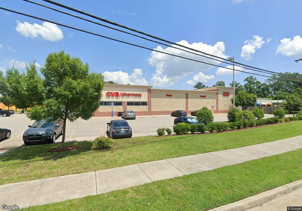
2981 S Military Hwy Chesapeake, VA 23323
Deep Creek NeighborhoodEstimated Value: $9,399,734
--
Bed
--
Bath
12,117
Sq Ft
$776/Sq Ft
Est. Value
About This Home
This home is located at 2981 S Military Hwy, Chesapeake, VA 23323 and is currently estimated at $9,399,734, approximately $775 per square foot. 2981 S Military Hwy is a home located in Chesapeake City with nearby schools including G.A. Treakle Elementary School, Deep Creek Middle School, and Deep Creek High.
Ownership History
Date
Name
Owned For
Owner Type
Purchase Details
Closed on
Aug 5, 2014
Sold by
Ds Chesapeake Va Landlord Llc
Bought by
Tic Weatherford Houston 6 Llc
Current Estimated Value
Home Financials for this Owner
Home Financials are based on the most recent Mortgage that was taken out on this home.
Original Mortgage
$2,650,000
Outstanding Balance
$2,019,107
Interest Rate
4.09%
Mortgage Type
Commercial
Estimated Equity
$7,380,627
Purchase Details
Closed on
Feb 8, 2012
Sold by
Dana Thomas W
Bought by
Cvs 10013 Va Llc
Purchase Details
Closed on
Oct 30, 2006
Sold by
1001 Mortgage Assocs
Bought by
2981 Military L L C
Create a Home Valuation Report for This Property
The Home Valuation Report is an in-depth analysis detailing your home's value as well as a comparison with similar homes in the area
Home Values in the Area
Average Home Value in this Area
Purchase History
| Date | Buyer | Sale Price | Title Company |
|---|---|---|---|
| Tic Weatherford Houston 6 Llc | $5,319,000 | -- | |
| Cvs 10013 Va Llc | $1,650,000 | -- | |
| 2981 Military L L C | $862,000 | -- |
Source: Public Records
Mortgage History
| Date | Status | Borrower | Loan Amount |
|---|---|---|---|
| Open | Tic Weatherford Houston 6 Llc | $2,650,000 |
Source: Public Records
Tax History Compared to Growth
Tax History
| Year | Tax Paid | Tax Assessment Tax Assessment Total Assessment is a certain percentage of the fair market value that is determined by local assessors to be the total taxable value of land and additions on the property. | Land | Improvement |
|---|---|---|---|---|
| 2025 | $44,415 | $4,194,600 | $880,600 | $3,314,000 |
| 2024 | $44,415 | $4,397,500 | $921,000 | $3,476,500 |
| 2023 | $37,531 | $4,428,200 | $921,000 | $3,507,200 |
| 2022 | $37,002 | $3,663,600 | $844,300 | $2,819,300 |
| 2021 | $31,393 | $2,989,800 | $614,000 | $2,375,800 |
| 2020 | $30,291 | $2,884,900 | $614,000 | $2,270,900 |
| 2019 | $30,083 | $2,865,000 | $614,000 | $2,251,000 |
| 2018 | $26,690 | $2,541,900 | $537,300 | $2,004,600 |
| 2017 | $25,495 | $2,428,100 | $537,300 | $1,890,800 |
| 2016 | $19,809 | $1,886,600 | $460,500 | $1,426,100 |
| 2015 | $4,676 | $1,781,200 | $460,500 | $1,320,700 |
| 2014 | $18,501 | $1,762,000 | $441,300 | $1,320,700 |
Source: Public Records
Map
Nearby Homes
- 928 Michael Dr
- 2036 Maywood St
- 2249 Tennessee Dr
- 1525 Shell Rd
- 2404 Livesay Rd
- 1435 Winslow Ave
- 1400 Winslow Ave
- 1444 Culpepper Ave
- 1463 Rivers Edge Trace
- 1317 Richwood Ave
- 309 Paperbark Trail
- 1241 N River Dr
- 1220 Boxwood Dr
- 2817 Camelot Blvd
- 1113 White Pine Dr
- 1308 Boxwood Dr
- 604 Treemont Ct
- Swan Plan at Shell Place
- Sandpiper Plan at Shell Place
- Pelican Plan at Shell Place
- 2977 S Military Hwy
- 2046 Broadmoor Ave
- 2052 Broadmoor Ave
- 2040 Broadmoor Ave
- 917 Canal Dr
- 2969 S Military Hwy
- 2974 S Military Hwy
- 841 Canal Dr
- 2980 S Military Hwy
- 904 Poplar Ave
- 2965 S Military Hwy
- 3013 S Military Hwy
- 2968 S Military Hwy
- 869 Canal Dr
- 2033 Broadmoor Ave
- 908 Poplar Ave
- 2032 Broadmoor Ave
- 919 Canal Dr
- 912 Poplar Ave
- 3000 S Military Hwy