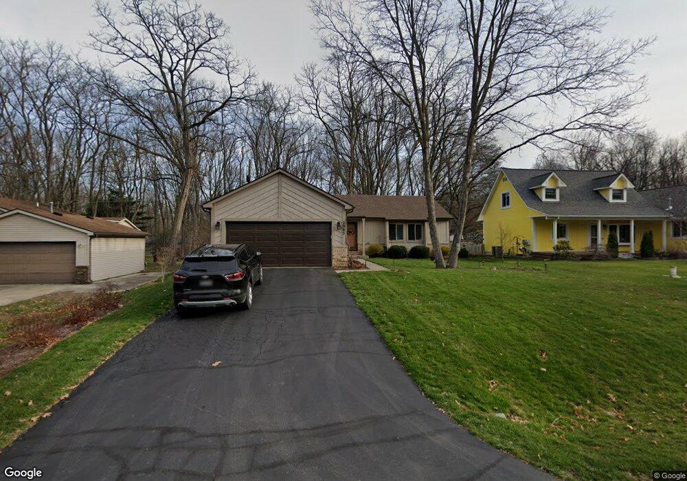
2983 Wilson Ave Pinckney, MI 48169
Estimated Value: $346,000 - $357,000
--
Bed
1
Bath
1,154
Sq Ft
$304/Sq Ft
Est. Value
About This Home
This home is located at 2983 Wilson Ave, Pinckney, MI 48169 and is currently estimated at $350,931, approximately $304 per square foot. 2983 Wilson Ave is a home located in Livingston County with nearby schools including Country Elementary School, Navigator School, and Pathfinder School.
Ownership History
Date
Name
Owned For
Owner Type
Purchase Details
Closed on
Jun 25, 2019
Sold by
Julia A Jones Ret
Bought by
Daniels Kirk
Current Estimated Value
Purchase Details
Closed on
Oct 16, 2012
Sold by
Yedinak Delynn R
Bought by
Yedinak Delynn R
Purchase Details
Closed on
Oct 3, 2002
Sold by
Yedinak Michael D
Bought by
Yedinak Delynn R
Home Financials for this Owner
Home Financials are based on the most recent Mortgage that was taken out on this home.
Original Mortgage
$115,000
Interest Rate
6.18%
Purchase Details
Closed on
Dec 21, 1994
Sold by
Clark Gilbert R
Bought by
Yedinak Michael D and Yedinak R
Home Financials for this Owner
Home Financials are based on the most recent Mortgage that was taken out on this home.
Original Mortgage
$100,800
Interest Rate
9.27%
Mortgage Type
New Conventional
Create a Home Valuation Report for This Property
The Home Valuation Report is an in-depth analysis detailing your home's value as well as a comparison with similar homes in the area
Home Values in the Area
Average Home Value in this Area
Purchase History
| Date | Buyer | Sale Price | Title Company |
|---|---|---|---|
| Daniels Kirk | $283,000 | -- | |
| Yedinak Delynn R | -- | -- | |
| Yedinak Delynn R | -- | -- | |
| Yedinak Michael D | $112,000 | -- |
Source: Public Records
Mortgage History
| Date | Status | Borrower | Loan Amount |
|---|---|---|---|
| Previous Owner | Yedinak Delynn R | $115,000 | |
| Previous Owner | Yedinak Michael D | $100,800 |
Source: Public Records
Tax History Compared to Growth
Tax History
| Year | Tax Paid | Tax Assessment Tax Assessment Total Assessment is a certain percentage of the fair market value that is determined by local assessors to be the total taxable value of land and additions on the property. | Land | Improvement |
|---|---|---|---|---|
| 2025 | $2,867 | $129,230 | $0 | $0 |
| 2024 | $730 | $120,850 | $0 | $0 |
| 2023 | $696 | $110,390 | $0 | $0 |
| 2022 | $1,363 | $89,170 | $0 | $0 |
| 2021 | $1,966 | $89,170 | $0 | $0 |
| 2020 | $1,936 | $87,380 | $0 | $0 |
| 2019 | $1,922 | $83,320 | $0 | $0 |
| 2018 | $1,898 | $71,610 | $0 | $0 |
| 2017 | $1,824 | $71,610 | $0 | $0 |
| 2016 | $1,756 | $68,070 | $0 | $0 |
| 2014 | $1,525 | $62,640 | $0 | $0 |
| 2012 | $1,525 | $60,070 | $0 | $0 |
Source: Public Records
Map
Nearby Homes
- 10499 Michael Blvd
- 10350 Half Moon Dr
- 9993 Tioga Trail Unit 154
- 2540 Lister Dr
- 9970 Whispering Woods Dr
- 3380 McCluskey
- 9771 Tioga Trail Unit 171
- 3590 Habitat Trail Unit 25
- 11410 Tall Shadows Ct
- 3558 Windwheel Point Dr
- 3450 Hooker Rd
- 11527 Mcgregor Rd
- 11770 Woodview
- 00 Colony
- 11026 Colony Rd
- 11589 Lombardy Ct
- 9418 Charlie Brown Ln
- 2939 Indian Trail
- 11109 Wynns Rd
- 4106 Shoreview Ln
- 2995 Wilson Ave
- 2971 Wilson Ave
- 0 Hill St
- 2959 Wilson Ave
- 10521 Hill St
- 2947 Wilson Ave
- 2984 Wilson Ave
- 2984 Ward Ave
- 10578 Hill St
- 10480 Hill St
- 2972 Wilson Ave
- 2972 Ward Ave
- 10495 Hill St
- 10561 Hill St
- 2960 Wilson Ave
- 2960 Ward Ave
- 0 Michael Blvd Unit 218011221
- 0 Michael Blvd Unit 5233780
- 0 Michael Blvd Unit 5364314
- 0 Michael Blvd Unit 211022882