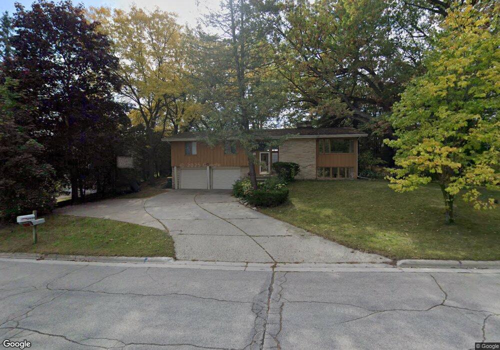
2984 Albert Dr Green Bay, WI 54311
Schmitt Park NeighborhoodEstimated Value: $303,399 - $360,000
4
Beds
2
Baths
1,663
Sq Ft
$202/Sq Ft
Est. Value
About This Home
This home is located at 2984 Albert Dr, Green Bay, WI 54311 and is currently estimated at $336,350, approximately $202 per square foot. 2984 Albert Dr is a home located in Brown County with nearby schools including Baird Elementary School, Preble High School, and John Dewey Academy of Learning.
Ownership History
Date
Name
Owned For
Owner Type
Purchase Details
Closed on
Jun 20, 2006
Sold by
Blanchard Marcia D
Bought by
Meder Randall A and Meder Margaret H
Current Estimated Value
Home Financials for this Owner
Home Financials are based on the most recent Mortgage that was taken out on this home.
Original Mortgage
$121,600
Outstanding Balance
$71,746
Interest Rate
6.73%
Mortgage Type
Purchase Money Mortgage
Estimated Equity
$264,604
Purchase Details
Closed on
Feb 18, 2005
Sold by
Kropidlowski Jeffery L and Kropidlowski Rebecca L
Bought by
Blanchard Marcia D
Home Financials for this Owner
Home Financials are based on the most recent Mortgage that was taken out on this home.
Original Mortgage
$118,400
Interest Rate
5%
Mortgage Type
Purchase Money Mortgage
Create a Home Valuation Report for This Property
The Home Valuation Report is an in-depth analysis detailing your home's value as well as a comparison with similar homes in the area
Home Values in the Area
Average Home Value in this Area
Purchase History
| Date | Buyer | Sale Price | Title Company |
|---|---|---|---|
| Meder Randall A | $152,000 | Land Office Title Corp | |
| Blanchard Marcia D | $148,000 | -- |
Source: Public Records
Mortgage History
| Date | Status | Borrower | Loan Amount |
|---|---|---|---|
| Open | Meder Randall A | $121,600 | |
| Previous Owner | Blanchard Marcia D | $118,400 |
Source: Public Records
Tax History Compared to Growth
Tax History
| Year | Tax Paid | Tax Assessment Tax Assessment Total Assessment is a certain percentage of the fair market value that is determined by local assessors to be the total taxable value of land and additions on the property. | Land | Improvement |
|---|---|---|---|---|
| 2024 | $4,506 | $240,900 | $45,200 | $195,700 |
| 2023 | $4,308 | $240,900 | $45,200 | $195,700 |
| 2022 | $4,209 | $240,900 | $45,200 | $195,700 |
| 2021 | $3,643 | $150,200 | $33,600 | $116,600 |
| 2020 | $3,459 | $150,200 | $33,600 | $116,600 |
| 2019 | $3,349 | $150,200 | $33,600 | $116,600 |
| 2018 | $3,272 | $150,200 | $33,600 | $116,600 |
| 2017 | $3,233 | $150,200 | $33,600 | $116,600 |
| 2016 | $3,182 | $150,200 | $33,600 | $116,600 |
| 2015 | $3,281 | $150,200 | $33,600 | $116,600 |
| 2014 | $3,377 | $150,200 | $33,600 | $116,600 |
| 2013 | $3,377 | $150,200 | $33,600 | $116,600 |
Source: Public Records
Map
Nearby Homes
- 3032 Humboldt Rd
- 3038 Bay View Dr
- 1014 Laverne Dr
- 1019 Mt Mary Dr
- 910 Pine Ridge Dr
- 980 Queoff St
- 2800 Humboldt Rd
- 1123 Saint Charles Dr
- 3199 Humboldt Rd
- 1000 Mount Hood Ct
- 2780 Humboldt Rd
- 2686 Humboldt Rd Unit 1
- 2686 Humboldt Rd Unit 12
- 1115 Bay Mist Dr
- 1211 Bay Mist Dr
- 0 Largo Ridge Dr Unit 50299111
- 0 Largo Ridge Dr Unit 50316072
- 1216 Bay Mist Dr
- 3327 Largo Ridge Dr
- 3329 Largo Ridge Dr
- 2994 Albert Dr
- 2976 Albert Dr
- 662 Laverne Dr
- 670 Laverne Dr
- 3002 Albert Dr Unit 3004
- 2987 Albert Dr
- 656 Laverne Dr
- 674 Laverne Dr
- 2999 Albert Dr
- 2981 Albert Dr
- 3012 Albert Dr Unit 3014
- 2975 Albert Dr
- 3016 Albert Dr Unit 3018
- 819 Marvin Ln
- 3015 Albert Dr
- 725 Forest Hill Dr
- 3011 Humboldt Rd Unit 3013
- 904 Cedarview Ct
- 665 Laverne Dr
- 661 Laverne Dr