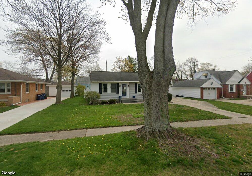
2984 Dawes Rd Muskegon, MI 49441
Roosevelt Park NeighborhoodEstimated Value: $185,000 - $212,000
3
Beds
1
Bath
864
Sq Ft
$225/Sq Ft
Est. Value
About This Home
This home is located at 2984 Dawes Rd, Muskegon, MI 49441 and is currently estimated at $193,994, approximately $224 per square foot. 2984 Dawes Rd is a home located in Muskegon County with nearby schools including Mona Shores High School, Edgewood Elementary Academy, and Dr. Martin Luther King Academy.
Ownership History
Date
Name
Owned For
Owner Type
Purchase Details
Closed on
Jun 13, 2023
Sold by
Broadbent Susan L and Broadbent James L
Bought by
Broadbent Family Revocable Trust
Current Estimated Value
Purchase Details
Closed on
May 20, 2015
Sold by
Broadbent Susan
Bought by
Broadbent Susan and Broadbent James
Home Financials for this Owner
Home Financials are based on the most recent Mortgage that was taken out on this home.
Original Mortgage
$64,000
Interest Rate
3.65%
Mortgage Type
New Conventional
Purchase Details
Closed on
May 17, 2013
Sold by
Hansen Scott A and Hansen Gary P
Bought by
Broadbent Susan
Purchase Details
Closed on
Jul 11, 1983
Sold by
Hansen Laurin H and Hansen Paulida M
Bought by
Hansen Laurin H and Hansen Paulida M
Create a Home Valuation Report for This Property
The Home Valuation Report is an in-depth analysis detailing your home's value as well as a comparison with similar homes in the area
Home Values in the Area
Average Home Value in this Area
Purchase History
| Date | Buyer | Sale Price | Title Company |
|---|---|---|---|
| Broadbent Family Revocable Trust | -- | None Listed On Document | |
| Broadbent Susan | -- | Premier Lakeshore Title Agen | |
| Broadbent Susan | -- | None Available | |
| Hansen Laurin H | -- | Burton Abstract & Title Co |
Source: Public Records
Mortgage History
| Date | Status | Borrower | Loan Amount |
|---|---|---|---|
| Previous Owner | Broadbent Susan | $64,000 |
Source: Public Records
Tax History Compared to Growth
Tax History
| Year | Tax Paid | Tax Assessment Tax Assessment Total Assessment is a certain percentage of the fair market value that is determined by local assessors to be the total taxable value of land and additions on the property. | Land | Improvement |
|---|---|---|---|---|
| 2025 | $1,862 | $79,000 | $0 | $0 |
| 2024 | $715 | $70,800 | $0 | $0 |
| 2023 | $683 | $63,800 | $0 | $0 |
| 2022 | $1,698 | $55,600 | $0 | $0 |
| 2021 | $1,617 | $50,700 | $0 | $0 |
| 2020 | $1,599 | $46,500 | $0 | $0 |
| 2019 | $1,569 | $42,800 | $0 | $0 |
| 2018 | $1,532 | $39,400 | $0 | $0 |
| 2017 | $1,497 | $38,500 | $0 | $0 |
| 2016 | $569 | $34,300 | $0 | $0 |
| 2015 | -- | $29,700 | $0 | $0 |
| 2014 | -- | $32,800 | $0 | $0 |
| 2013 | -- | $31,100 | $0 | $0 |
Source: Public Records
Map
Nearby Homes
- 1377 Princeton Rd
- 1059 W Summit Ave
- 1521 Cornell Rd
- 1448 Marlboro Rd
- 1480 Marlboro Rd
- 2881 Cornell Ct
- 3246 Royal Oak Rd
- 893 Post Rd
- 1582 Haverhill Rd
- 868 Post Rd
- 3320 Davis Rd
- 1650 Bonneville Dr
- 1405 Winchester Dr
- 1689 Bonneville Dr
- 1045 Le Roux Rd Unit 178
- 1564 Montague Ave
- 1752 Bonneville Dr
- 2552 Wickham Dr
- 1543 Randolph Ave
- 1733 Woodside Rd
- 2990 Dawes Rd
- 2996 Dawes Rd
- 2972 Dawes Rd
- 2963 Dawes Rd
- 3002 Dawes Rd
- 3013 Westland Rd
- 3019 Westland Rd
- 3025 Westland Rd
- 2995 Dawes Rd
- 3001 Westland Rd
- 2999 Dawes Rd
- 3007 Westland Rd
- 3008 Dawes Rd
- 2966 Dawes Rd
- 3031 Westland Rd
- 3005 Dawes Rd
- 2995 Westland Rd
- 1313 Princeton Rd
- 3037 Westland Rd
- 3014 Dawes Rd