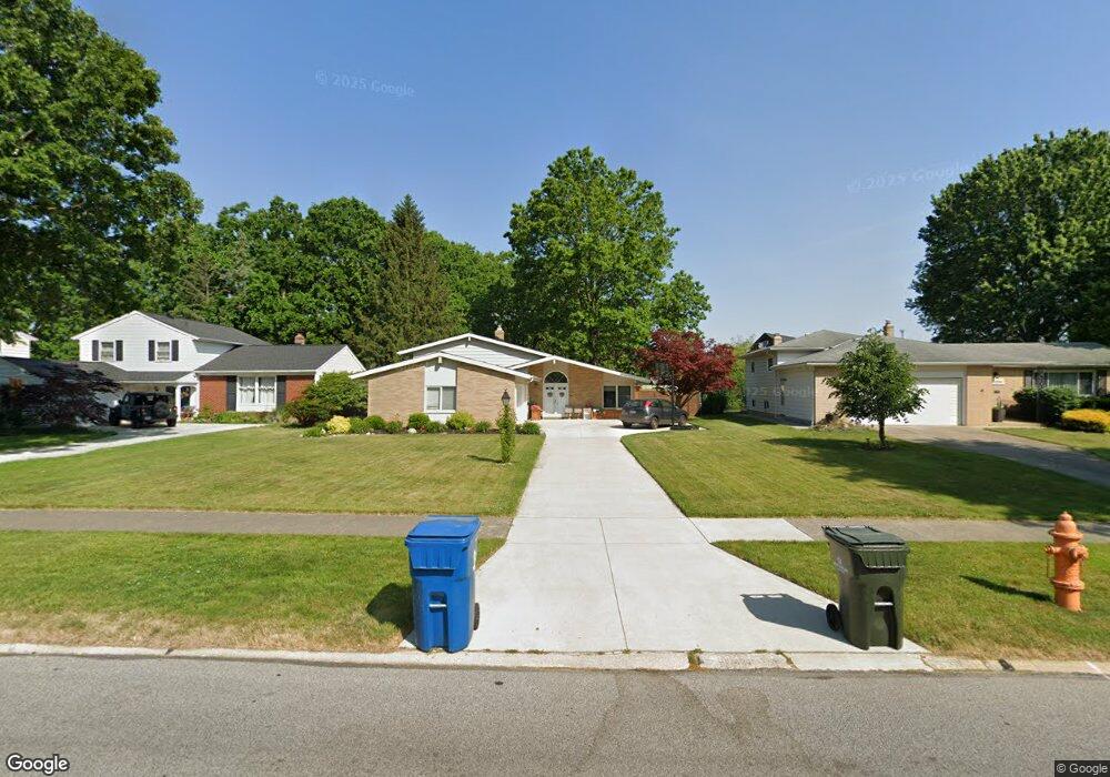
29840 Cambridge Dr North Olmsted, OH 44070
Estimated Value: $341,332 - $381,000
3
Beds
3
Baths
2,957
Sq Ft
$120/Sq Ft
Est. Value
About This Home
This home is located at 29840 Cambridge Dr, North Olmsted, OH 44070 and is currently estimated at $354,583, approximately $119 per square foot. 29840 Cambridge Dr is a home located in Cuyahoga County with nearby schools including Chestnut Intermediate Elementary School, Pine Intermediate School, and North Olmsted Middle School.
Ownership History
Date
Name
Owned For
Owner Type
Purchase Details
Closed on
Aug 25, 2011
Sold by
Oneill Brian Daniel and Oneill Mary Lou
Bought by
Snyder Jason J and Snyder Renee A
Current Estimated Value
Home Financials for this Owner
Home Financials are based on the most recent Mortgage that was taken out on this home.
Original Mortgage
$162,766
Outstanding Balance
$112,731
Interest Rate
4.5%
Mortgage Type
FHA
Estimated Equity
$241,852
Purchase Details
Closed on
May 29, 2001
Sold by
Oneill Brian D and Lou Mary
Bought by
Oneill Brian Daniel and Oneill Mary Lou
Purchase Details
Closed on
May 29, 1987
Sold by
Cook Ii E Holbrook
Bought by
Oneill Brian D
Purchase Details
Closed on
Aug 11, 1977
Sold by
Cook Ii Cook E and Cook Betty M
Bought by
Cook Ii E Holbrook
Purchase Details
Closed on
Jan 1, 1975
Bought by
Cook Ii Cook E and Cook Betty M
Create a Home Valuation Report for This Property
The Home Valuation Report is an in-depth analysis detailing your home's value as well as a comparison with similar homes in the area
Home Values in the Area
Average Home Value in this Area
Purchase History
| Date | Buyer | Sale Price | Title Company |
|---|---|---|---|
| Snyder Jason J | $167,000 | Barristers Title Agency | |
| Oneill Brian Daniel | -- | -- | |
| Oneill Brian D | $85,000 | -- | |
| Cook Ii E Holbrook | -- | -- | |
| Cook Ii Cook E | -- | -- |
Source: Public Records
Mortgage History
| Date | Status | Borrower | Loan Amount |
|---|---|---|---|
| Open | Snyder Jason J | $162,766 |
Source: Public Records
Tax History Compared to Growth
Tax History
| Year | Tax Paid | Tax Assessment Tax Assessment Total Assessment is a certain percentage of the fair market value that is determined by local assessors to be the total taxable value of land and additions on the property. | Land | Improvement |
|---|---|---|---|---|
| 2024 | $6,512 | $95,025 | $18,025 | $77,000 |
| 2023 | $6,078 | $74,420 | $14,180 | $60,240 |
| 2022 | $6,046 | $74,410 | $14,180 | $60,240 |
| 2021 | $5,472 | $74,410 | $14,180 | $60,240 |
| 2020 | $5,279 | $63,600 | $12,110 | $51,490 |
| 2019 | $5,137 | $181,700 | $34,600 | $147,100 |
| 2018 | $5,210 | $63,600 | $12,110 | $51,490 |
| 2017 | $4,935 | $55,450 | $10,540 | $44,910 |
| 2016 | $4,892 | $55,450 | $10,540 | $44,910 |
| 2015 | $4,776 | $55,450 | $10,540 | $44,910 |
| 2014 | $4,776 | $53,830 | $10,220 | $43,610 |
Source: Public Records
Map
Nearby Homes
- 6221 Brighton Dr
- 6281 Christman Dr
- 6321 Brighton Dr
- 6305 Christman Dr
- 30247 Lorain Rd
- 29408 Stewart Dr
- 0 Stearns Rd
- 30630 Lorain Rd
- 6617 Sutton Dr
- 5833 Stearns Rd
- 29667 Bretton Ridge Dr
- 6723 Warrington Dr
- 6151 Sherwood Dr
- 28628 Aspen Dr
- 29861 Wellington Dr
- 5461 Wellesley Ave
- 28521 Aspen Dr
- 5502 Quail Run
- 29600 Westminster Dr
- 6127 Mackenzie Rd
- 29872 Cambridge Dr
- 29820 Cambridge Dr
- 29904 Cambridge Dr
- 29800 Cambridge Dr
- 29871 Cambridge Dr
- 29930 Cambridge Dr
- 6184 Christman Dr
- 6212 Christman Dr
- 6197 Brighton Dr
- 6209 Brighton Dr
- 6170 Christman Dr
- 6226 Christman Dr
- 6255 Surrey Dr
- 6156 Christman Dr
- 6256 Surrey Dr
- 6235 Brighton Dr
- 6240 Christman Dr
- 6142 Christman Dr
- 6187 Brighton Dr
- 6269 Surrey Dr