Estimated Value: $472,000 - $606,751
--
Bed
--
Bath
--
Sq Ft
10
Acres
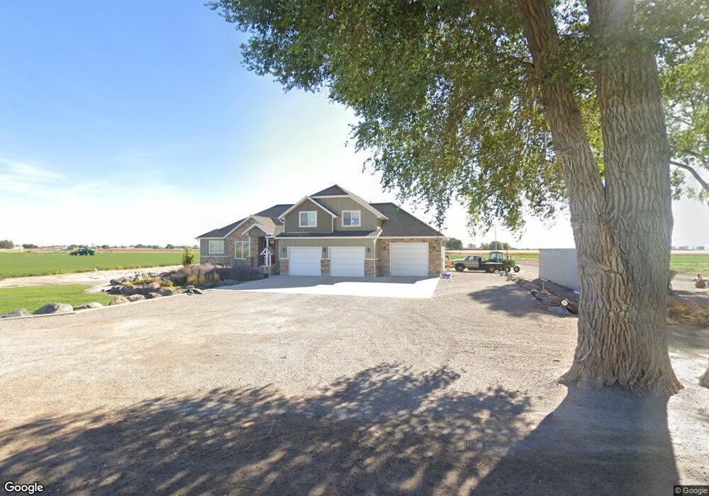
About This Home
This home is located at 2985 S 3250 W, Delta, UT 84624 and is currently estimated at $546,250. 2985 S 3250 W is a home.
Ownership History
Date
Name
Owned For
Owner Type
Purchase Details
Closed on
Oct 1, 2012
Sold by
Smith Darren Curtis and Smith Kezlynn Jean
Bought by
Smith Darren C and Smith Kezlynn J
Current Estimated Value
Home Financials for this Owner
Home Financials are based on the most recent Mortgage that was taken out on this home.
Original Mortgage
$170,000
Outstanding Balance
$72,907
Interest Rate
3.58%
Estimated Equity
$473,343
Purchase Details
Closed on
Nov 16, 2010
Sold by
Smith Robin R and Smith Linda Rae
Bought by
Smith Darren Curtis and Smith Kezlynn Jean
Create a Home Valuation Report for This Property
The Home Valuation Report is an in-depth analysis detailing your home's value as well as a comparison with similar homes in the area
Home Values in the Area
Average Home Value in this Area
Purchase History
| Date | Buyer | Sale Price | Title Company |
|---|---|---|---|
| Smith Darren C | -- | First American Title Insuran | |
| Smith Darren Curtis | -- | -- |
Source: Public Records
Mortgage History
| Date | Status | Borrower | Loan Amount |
|---|---|---|---|
| Open | Smith Darren C | $170,000 |
Source: Public Records
Tax History Compared to Growth
Tax History
| Year | Tax Paid | Tax Assessment Tax Assessment Total Assessment is a certain percentage of the fair market value that is determined by local assessors to be the total taxable value of land and additions on the property. | Land | Improvement |
|---|---|---|---|---|
| 2025 | $3,408 | $420,413 | $24,245 | $396,168 |
| 2024 | $3,408 | $356,764 | $19,382 | $337,382 |
| 2023 | $4,124 | $356,764 | $19,382 | $337,382 |
| 2022 | $2,593 | $228,867 | $18,016 | $210,851 |
| 2021 | $1,957 | $166,330 | $16,276 | $150,054 |
| 2020 | $1,846 | $158,835 | $16,249 | $142,586 |
| 2019 | $1,720 | $149,393 | $16,312 | $133,081 |
| 2018 | $1,604 | $143,051 | $16,807 | $126,244 |
| 2017 | $1,594 | $136,282 | $13,570 | $122,712 |
| 2016 | $1,523 | $136,282 | $13,570 | $122,712 |
| 2015 | $1,524 | $136,282 | $8,800 | $127,482 |
| 2014 | -- | $136,534 | $8,800 | $127,734 |
| 2013 | -- | $140,139 | $8,800 | $131,339 |
Source: Public Records
Map
Nearby Homes
- 0 Tbd 3000 Rd S Unit LotWP001
- 6177 S 3000 Rd W
- 3480 S 4000 W
- 3770 S 4000 Rd W
- 17000 W 2500 Rd S
- 16700 W 2500 South Rd
- 16800 W 2500 South Rd
- 470 S 2750 W Unit 6
- 460 S 2750 W Unit 7
- 490 S 2750 W Unit 5
- 465 S 2750 W Unit 4
- 6500 S 3000 West Rd
- 6500 W 2000 S
- 3885 W 4500 S
- 168 N 100 Rd W
- 289 W Center St S
- 1040 W Center St
- 700 Acres
- 1500 S 10000 W
- 6000 N 10000 W
- 3092 W 3000 S
- 3019 W 3000 S
- 3115 W 4000 S
- 3338 S 3250 W
- 2880 W 3000 S
- 3108 W 2500 S
- 1000 W 3500 Rd S
- 2875 W 2500 S
- 2860 W 2500 S
- 2995 S 4000 W
- 2850 W 2500 S
- 3150 S 2500 Rd W
- 2716 W 2500 S
- 2750 S 2500 W
- 2583 W 2500 S
- 3845 W 3500 S
- 3370 S 4000 West St W
- 3370 S 4000 Rd W
- 2490 W 2500 S
- 3300 S 4000 Rd W Unit 3