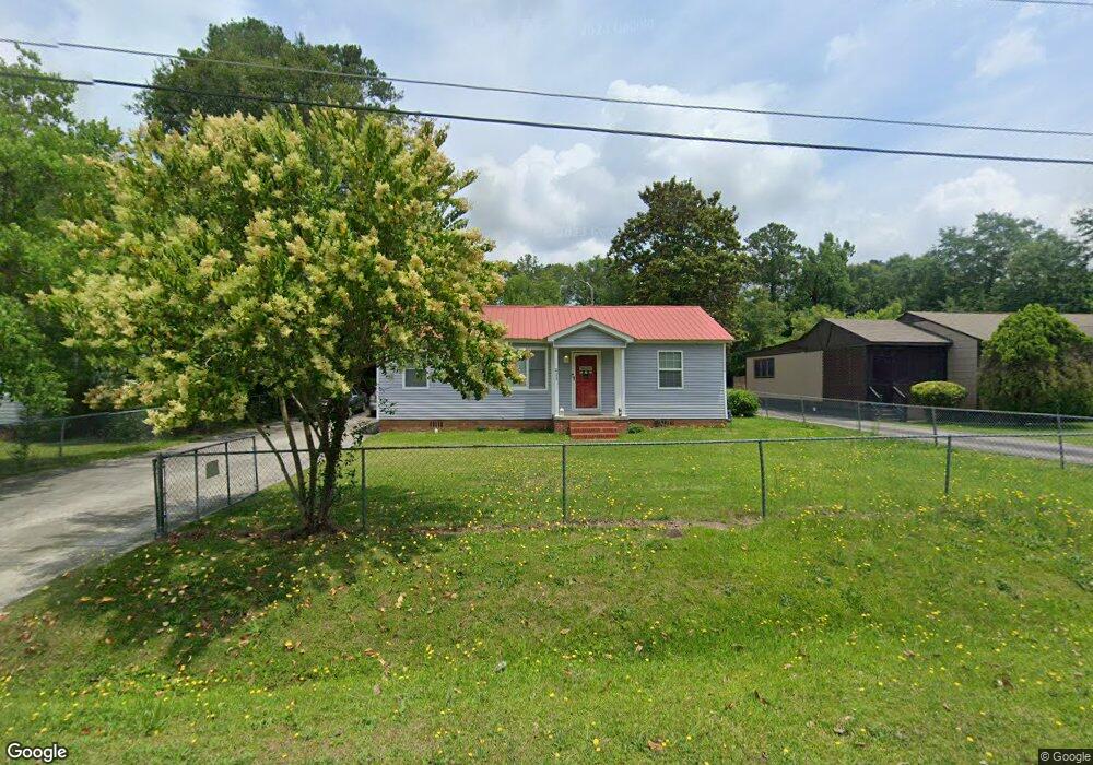
2986 Emerson Cir Macon, GA 31206
Estimated Value: $60,000 - $73,000
3
Beds
1
Bath
1,025
Sq Ft
$64/Sq Ft
Est. Value
About This Home
This home is located at 2986 Emerson Cir, Macon, GA 31206 and is currently estimated at $65,474, approximately $63 per square foot. 2986 Emerson Cir is a home located in Bibb County with nearby schools including Veterans Elementary School, Southwest High School, and Gilead Christian Academy.
Ownership History
Date
Name
Owned For
Owner Type
Purchase Details
Closed on
Jan 20, 2022
Sold by
Kim Baker
Bought by
Bread Of Life Distributing Llc
Current Estimated Value
Purchase Details
Closed on
May 21, 2008
Sold by
Consolidated Loan Co Of Albany Inc
Bought by
Eason Christopher and Eason Kimberly
Purchase Details
Closed on
Nov 15, 2006
Sold by
Eason Kim H
Bought by
Eason Kim H and Eason Chritopher
Home Financials for this Owner
Home Financials are based on the most recent Mortgage that was taken out on this home.
Original Mortgage
$30,000
Interest Rate
6.27%
Mortgage Type
New Conventional
Purchase Details
Closed on
Nov 3, 2006
Sold by
Sharpe Lynn F
Bought by
Eason Kim H
Home Financials for this Owner
Home Financials are based on the most recent Mortgage that was taken out on this home.
Original Mortgage
$30,000
Interest Rate
6.27%
Mortgage Type
New Conventional
Create a Home Valuation Report for This Property
The Home Valuation Report is an in-depth analysis detailing your home's value as well as a comparison with similar homes in the area
Home Values in the Area
Average Home Value in this Area
Purchase History
| Date | Buyer | Sale Price | Title Company |
|---|---|---|---|
| Bread Of Life Distributing Llc | $43,000 | None Listed On Document | |
| Eason Christopher | -- | None Available | |
| Eason Kim H | -- | None Avilabale | |
| Eason Kim H | $45,000 | None Available |
Source: Public Records
Mortgage History
| Date | Status | Borrower | Loan Amount |
|---|---|---|---|
| Previous Owner | Eason Kim H | $30,000 |
Source: Public Records
Tax History Compared to Growth
Tax History
| Year | Tax Paid | Tax Assessment Tax Assessment Total Assessment is a certain percentage of the fair market value that is determined by local assessors to be the total taxable value of land and additions on the property. | Land | Improvement |
|---|---|---|---|---|
| 2025 | $439 | $17,882 | $3,260 | $14,622 |
| 2024 | $454 | $17,882 | $3,260 | $14,622 |
| 2023 | $437 | $17,742 | $3,120 | $14,622 |
| 2022 | $424 | $12,238 | $1,638 | $10,600 |
| 2021 | $296 | $7,801 | $1,638 | $6,163 |
| 2020 | $303 | $7,801 | $1,638 | $6,163 |
| 2019 | $305 | $7,801 | $1,638 | $6,163 |
| 2018 | $648 | $7,801 | $1,638 | $6,163 |
| 2017 | $292 | $7,801 | $1,638 | $6,163 |
| 2016 | $270 | $7,800 | $1,638 | $6,163 |
| 2015 | $382 | $7,800 | $1,638 | $6,163 |
| 2014 | $375 | $19,988 | $3,639 | $16,350 |
Source: Public Records
Map
Nearby Homes
- 2765 Alden St
- 2868 Barrett Ave
- 2972 Richard Dr
- 3078 Alfred Dr
- 2995 Virginia Dr
- 2770 Bonnie Ave
- 2769 Nancy Dr
- 2768 Nancy Dr
- 2801 Deeb Dr
- 2704 Reynolds Dr
- 5711 Sterling Place
- 2960 Jadan Place
- 5746 Sterling Place
- 5756 Edwina Dr
- 5780 Edwina Dr
- 3913 Blair Ct
- 2830 Village Green Dr
- 2824 Village Green Dr
- 2841 Shamrock Dr
- 4738 Bloomfield Rd
- 2982 Emerson Cir
- 2990 Emerson Cir
- 2994 Emerson Cir
- 2978 Emerson Cir
- 2981 Emerson Cir
- 2985 Emerson Cir
- 2989 Emerson Cir
- 2974 Emerson Cir
- 2974 Emerson Cir Unit 201
- 2971 Emerson Cir
- 5299 Nisbet Dr
- 5293 Nisbet Dr
- 5307 Nisbet Dr
- 2966 Emerson Cir
- 2970 Emerson Cir
- 5311 Nisbet Dr
- 2953 Emerson Cir
- 5317 Nisbet Dr
- 5302 Nisbet Dr