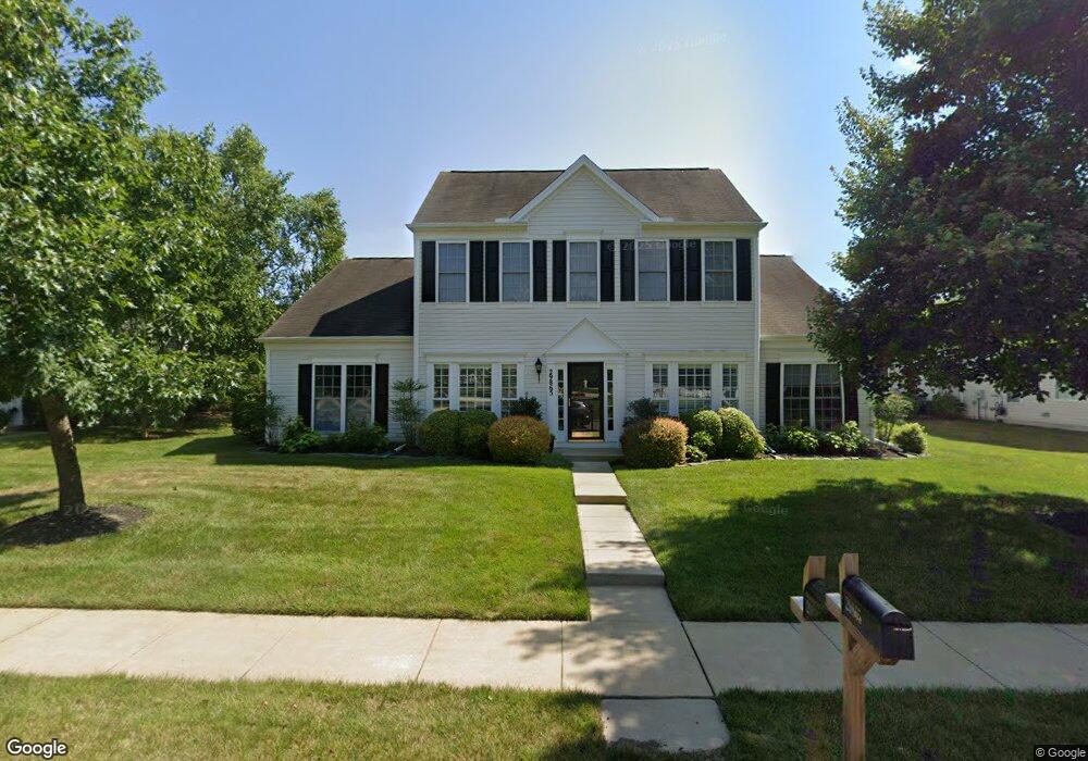
29865 Peirce Way Easton, MD 21601
Estimated Value: $491,617 - $538,000
--
Bed
3
Baths
2,342
Sq Ft
$220/Sq Ft
Est. Value
About This Home
This home is located at 29865 Peirce Way, Easton, MD 21601 and is currently estimated at $515,654, approximately $220 per square foot. 29865 Peirce Way is a home located in Talbot County with nearby schools including Easton Elementary School, Easton Middle School, and Easton High School.
Ownership History
Date
Name
Owned For
Owner Type
Purchase Details
Closed on
Mar 27, 2007
Sold by
Lyons Lc
Bought by
Bester C. Craig and Bester Grace E
Current Estimated Value
Home Financials for this Owner
Home Financials are based on the most recent Mortgage that was taken out on this home.
Original Mortgage
$222,980
Outstanding Balance
$136,149
Interest Rate
6.33%
Mortgage Type
Purchase Money Mortgage
Estimated Equity
$379,505
Purchase Details
Closed on
Mar 16, 2007
Sold by
Lyons Lc
Bought by
Bester C. Craig and Bester Grace E
Home Financials for this Owner
Home Financials are based on the most recent Mortgage that was taken out on this home.
Original Mortgage
$222,980
Outstanding Balance
$136,149
Interest Rate
6.33%
Mortgage Type
Purchase Money Mortgage
Estimated Equity
$379,505
Create a Home Valuation Report for This Property
The Home Valuation Report is an in-depth analysis detailing your home's value as well as a comparison with similar homes in the area
Home Values in the Area
Average Home Value in this Area
Purchase History
| Date | Buyer | Sale Price | Title Company |
|---|---|---|---|
| Bester C. Craig | $422,980 | -- | |
| Bester C. Craig | $422,980 | -- |
Source: Public Records
Mortgage History
| Date | Status | Borrower | Loan Amount |
|---|---|---|---|
| Open | Bester C. Craig | $222,980 | |
| Closed | Bester C. Craig | $222,980 |
Source: Public Records
Tax History Compared to Growth
Tax History
| Year | Tax Paid | Tax Assessment Tax Assessment Total Assessment is a certain percentage of the fair market value that is determined by local assessors to be the total taxable value of land and additions on the property. | Land | Improvement |
|---|---|---|---|---|
| 2025 | $2,251 | $407,433 | $0 | $0 |
| 2024 | $2,251 | $375,100 | $91,200 | $283,900 |
| 2023 | $2,093 | $352,267 | $0 | $0 |
| 2022 | $1,896 | $329,433 | $0 | $0 |
| 2021 | $1,746 | $306,600 | $105,400 | $201,200 |
| 2020 | $1,746 | $306,600 | $105,400 | $201,200 |
| 2019 | $1,746 | $306,600 | $105,400 | $201,200 |
| 2018 | $1,686 | $318,000 | $105,400 | $212,600 |
| 2017 | $1,573 | $305,667 | $0 | $0 |
| 2016 | $1,436 | $293,333 | $0 | $0 |
| 2015 | $1,514 | $281,000 | $0 | $0 |
| 2014 | $1,514 | $281,000 | $0 | $0 |
Source: Public Records
Map
Nearby Homes
- 29865 Hillary Ave
- 7371 Michael Ave
- 29830 Hillary Ave
- 7400 Michael Ave
- 29728 Sullivan Dr
- 29744 Dustin Ave
- 29768 Hillary Ave
- 29676 Janets Way
- 7389 Karen Ave
- 29678 Sullivan Dr
- 29638 Janets Way
- 29653 Lyons Dr
- 29770 Lyons Dr
- 29748 Lyons Dr
- 7453 Jeffreys Way
- 7444 Jeffreys Way
- 29606 Charles Dr
- 29595 Dutchmans Ln Unit 602
- 29529 Dutchmans Ln
- 7347 Shirley Dr
- 29857 Peirce Way
- 29873 Peirce Way
- 29860 Hillary Ave
- 29854 Hillary Ave
- 29881 Peirce Way
- 29868 Hillary Ave
- 29846 Hillary Ave
- 29876 Hillary Ave
- 7364 Michael Ave
- 29839 Peirce Way
- 29847 Peirce Way
- 29889 Peirce Way
- 7356 Michael Ave
- 7370 Michael Ave
- 29884 Hillary Ave
- 7354 Leo Ave
- 29842 Hillary Ave
- 7374 Michael Ave
- 29831 Peirce Way
- 7362 Leo Ave