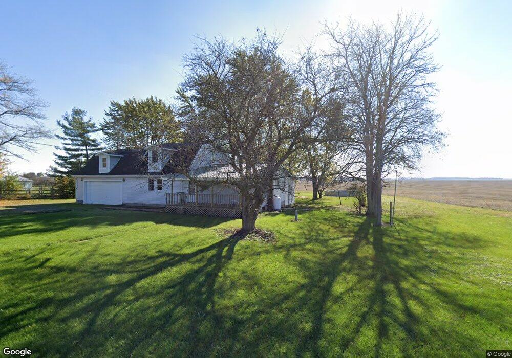
29878 State Route 67 Waynesfield, OH 45896
Estimated Value: $244,248 - $280,000
3
Beds
1
Bath
2,360
Sq Ft
$111/Sq Ft
Est. Value
About This Home
This home is located at 29878 State Route 67, Waynesfield, OH 45896 and is currently estimated at $261,312, approximately $110 per square foot. 29878 State Route 67 is a home located in Auglaize County with nearby schools including Waynesfield-Goshen Local Elementary School and Waynesfield-Goshen Local High School.
Ownership History
Date
Name
Owned For
Owner Type
Purchase Details
Closed on
Jan 5, 2022
Sold by
Kaufman Donald and Kaufman Cynthia
Bought by
Myers Nicholas R and Myers Chelsie
Current Estimated Value
Home Financials for this Owner
Home Financials are based on the most recent Mortgage that was taken out on this home.
Original Mortgage
$169,375
Outstanding Balance
$156,121
Interest Rate
3.12%
Mortgage Type
FHA
Estimated Equity
$105,191
Purchase Details
Closed on
Jun 1, 1990
Create a Home Valuation Report for This Property
The Home Valuation Report is an in-depth analysis detailing your home's value as well as a comparison with similar homes in the area
Home Values in the Area
Average Home Value in this Area
Purchase History
| Date | Buyer | Sale Price | Title Company |
|---|---|---|---|
| Myers Nicholas R | $172,500 | Scout Title Ltd | |
| -- | $15,000 | -- |
Source: Public Records
Mortgage History
| Date | Status | Borrower | Loan Amount |
|---|---|---|---|
| Open | Myers Nicholas R | $169,375 |
Source: Public Records
Tax History Compared to Growth
Tax History
| Year | Tax Paid | Tax Assessment Tax Assessment Total Assessment is a certain percentage of the fair market value that is determined by local assessors to be the total taxable value of land and additions on the property. | Land | Improvement |
|---|---|---|---|---|
| 2024 | $3,978 | $63,240 | $5,730 | $57,510 |
| 2023 | $2,211 | $63,240 | $5,730 | $57,510 |
| 2022 | $2,075 | $50,240 | $5,200 | $45,040 |
| 2021 | $1,022 | $50,240 | $5,200 | $45,040 |
| 2020 | $2,033 | $50,243 | $5,205 | $45,038 |
| 2019 | $1,656 | $41,868 | $4,337 | $37,531 |
| 2018 | $1,609 | $41,868 | $4,337 | $37,531 |
| 2017 | $1,603 | $41,868 | $4,337 | $37,531 |
| 2016 | $1,590 | $42,949 | $4,130 | $38,819 |
| 2015 | $1,591 | $42,949 | $4,130 | $38,819 |
| 2014 | $1,593 | $42,949 | $4,130 | $38,819 |
| 2013 | $1,769 | $42,949 | $4,130 | $38,819 |
Source: Public Records
Map
Nearby Homes
- 0 Ohio 235
- 2444 County Road 200
- 14918 Township Road 55
- 25836 Ohio 67
- 202 W Mulberry St
- 105 Guthrie St
- 8150 Amherst Rd
- 15527 State Route 235
- 13793 Ohio 235 Unit 75
- 16161 Ash Ave
- 11588 Blackhawk Path
- 16235 Maple Ave
- 11298 Northlake Dr
- 11377 Township Road 266 Unit 99
- 11377 Township Road 266 Unit 34
- 11377 Township Road 266 Unit 28
- 11377 Township Road 266 Unit 109
- 11377 Township Rd 266 Unit 66
- 11377 Township Rd 266 Unit 30
- 11377 Township Rd 266 Unit 59
- 29898 Ohio 67
- 29898 State Route 67
- 29965 State Route 67
- 29988 State Route 67
- 29988 State Route 67
- 17031 County Road 15
- 29996 State Route 67
- 29983 State Route 67
- 17002 State Route 117
- 17106 State Route 117
- 14872 County Road 15
- 17233 State Route 117
- 15017 State Route 117
- 29772 Ohio 67
- 14888 State Route 117
- 17313 State Route 117
- 15104 Bellfontaine Rd
- 14508 County Road 15
- 15265 State Route 117