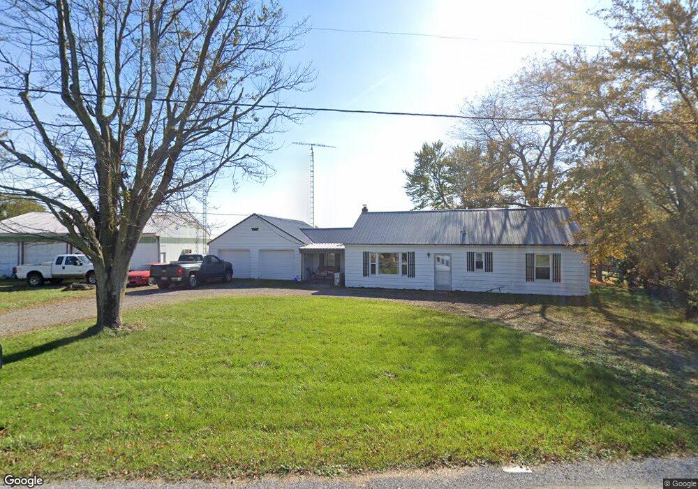
29898 State Route 67 Waynesfield, OH 45896
Estimated Value: $151,000 - $185,000
3
Beds
1
Bath
1,040
Sq Ft
$160/Sq Ft
Est. Value
About This Home
This home is located at 29898 State Route 67, Waynesfield, OH 45896 and is currently estimated at $166,770, approximately $160 per square foot. 29898 State Route 67 is a home located in Auglaize County with nearby schools including Waynesfield-Goshen Local Elementary School and Waynesfield-Goshen Local High School.
Ownership History
Date
Name
Owned For
Owner Type
Purchase Details
Closed on
May 19, 2015
Sold by
Ulrey Frank A and Ulrey Debra A
Bought by
Kaufman Donald and Kaufman Cynthia
Current Estimated Value
Home Financials for this Owner
Home Financials are based on the most recent Mortgage that was taken out on this home.
Original Mortgage
$48,800
Outstanding Balance
$38,145
Interest Rate
4.09%
Mortgage Type
New Conventional
Estimated Equity
$128,625
Purchase Details
Closed on
Feb 16, 2011
Sold by
Estate Of Nelson H Ulrey
Bought by
Ulrey Cora E
Create a Home Valuation Report for This Property
The Home Valuation Report is an in-depth analysis detailing your home's value as well as a comparison with similar homes in the area
Home Values in the Area
Average Home Value in this Area
Purchase History
| Date | Buyer | Sale Price | Title Company |
|---|---|---|---|
| Kaufman Donald | $61,000 | Attorney | |
| Ulrey Cora E | -- | None Available |
Source: Public Records
Mortgage History
| Date | Status | Borrower | Loan Amount |
|---|---|---|---|
| Open | Kaufman Donald | $48,800 |
Source: Public Records
Tax History Compared to Growth
Tax History
| Year | Tax Paid | Tax Assessment Tax Assessment Total Assessment is a certain percentage of the fair market value that is determined by local assessors to be the total taxable value of land and additions on the property. | Land | Improvement |
|---|---|---|---|---|
| 2024 | $2,612 | $41,520 | $8,490 | $33,030 |
| 2023 | $1,496 | $41,520 | $8,490 | $33,030 |
| 2022 | $1,306 | $30,510 | $7,920 | $22,590 |
| 2021 | $1,292 | $30,510 | $7,920 | $22,590 |
| 2020 | $645 | $30,503 | $7,917 | $22,586 |
| 2019 | $1,048 | $25,421 | $6,598 | $18,823 |
| 2018 | $1,001 | $24,949 | $6,598 | $18,351 |
| 2017 | $989 | $24,949 | $6,598 | $18,351 |
| 2016 | $916 | $23,857 | $6,283 | $17,574 |
| 2015 | $916 | $23,857 | $6,283 | $17,574 |
| 2014 | $579 | $23,857 | $6,283 | $17,574 |
| 2013 | $437 | $18,796 | $4,848 | $13,948 |
Source: Public Records
Map
Nearby Homes
- 0 Ohio 235
- 2444 County Road 200
- 14918 Township Road 55
- 25836 Ohio 67
- 202 W Mulberry St
- 105 Guthrie St
- 8150 Amherst Rd
- 15527 State Route 235
- 13793 Ohio 235 Unit 75
- 16161 Ash Ave
- 11588 Blackhawk Path
- 16235 Maple Ave
- 11298 Northlake Dr
- 11377 Township Road 266 Unit 99
- 11377 Township Road 266 Unit 34
- 11377 Township Road 266 Unit 28
- 11377 Township Road 266 Unit 109
- 11377 Township Rd 266 Unit 66
- 11377 Township Rd 266 Unit 30
- 11377 Township Rd 266 Unit 59
- 29898 Ohio 67
- 29878 State Route 67
- 29965 State Route 67
- 29988 State Route 67
- 29988 State Route 67
- 17031 County Road 15
- 29996 State Route 67
- 29983 State Route 67
- 17002 State Route 117
- 17106 State Route 117
- 14872 County Road 15
- 17233 State Route 117
- 15017 State Route 117
- 29772 Ohio 67
- 14888 State Route 117
- 15104 Bellfontaine Rd
- 17313 State Route 117
- 14508 County Road 15
- 15265 State Route 117