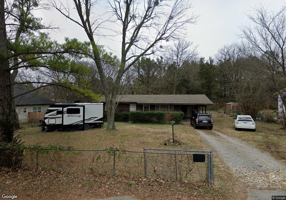
299 Bloyd St West Fork, AR 72774
Estimated Value: $183,096 - $241,000
--
Bed
1
Bath
1,224
Sq Ft
$174/Sq Ft
Est. Value
About This Home
This home is located at 299 Bloyd St, West Fork, AR 72774 and is currently estimated at $213,024, approximately $174 per square foot. 299 Bloyd St is a home located in Washington County with nearby schools including West Fork Elementary School, West Fork Middle School, and West Fork High School.
Ownership History
Date
Name
Owned For
Owner Type
Purchase Details
Closed on
Jan 13, 2010
Sold by
Aman Ron
Bought by
Pemberton Daryl J
Current Estimated Value
Home Financials for this Owner
Home Financials are based on the most recent Mortgage that was taken out on this home.
Original Mortgage
$94,705
Outstanding Balance
$61,327
Interest Rate
4.76%
Mortgage Type
New Conventional
Estimated Equity
$151,697
Purchase Details
Closed on
Feb 21, 1996
Bought by
Seablom Richard A
Purchase Details
Closed on
Sep 28, 1971
Bought by
O'Neal William and O'Neal Betty
Create a Home Valuation Report for This Property
The Home Valuation Report is an in-depth analysis detailing your home's value as well as a comparison with similar homes in the area
Home Values in the Area
Average Home Value in this Area
Purchase History
| Date | Buyer | Sale Price | Title Company |
|---|---|---|---|
| Pemberton Daryl J | $93,000 | Landtrust Title & Closing In | |
| Seablom Richard A | -- | -- | |
| O'Neal William | $14,000 | -- |
Source: Public Records
Mortgage History
| Date | Status | Borrower | Loan Amount |
|---|---|---|---|
| Open | Pemberton Daryl J | $94,705 |
Source: Public Records
Tax History Compared to Growth
Tax History
| Year | Tax Paid | Tax Assessment Tax Assessment Total Assessment is a certain percentage of the fair market value that is determined by local assessors to be the total taxable value of land and additions on the property. | Land | Improvement |
|---|---|---|---|---|
| 2025 | $371 | $29,130 | $6,000 | $23,130 |
| 2024 | $427 | $29,130 | $6,000 | $23,130 |
| 2023 | $464 | $29,130 | $6,000 | $23,130 |
| 2022 | $472 | $19,420 | $4,000 | $15,420 |
| 2021 | $435 | $19,420 | $4,000 | $15,420 |
| 2020 | $398 | $19,420 | $4,000 | $15,420 |
| 2019 | $362 | $13,870 | $3,000 | $10,870 |
| 2018 | $387 | $13,870 | $3,000 | $10,870 |
| 2017 | $366 | $13,870 | $3,000 | $10,870 |
| 2016 | $366 | $13,870 | $3,000 | $10,870 |
| 2015 | $366 | $13,870 | $3,000 | $10,870 |
| 2014 | $357 | $13,700 | $4,000 | $9,700 |
Source: Public Records
Map
Nearby Homes
- 503 Clark Ave
- 497 Clark Ave
- Springs 1445 Plan at Rolling Plains
- Eureka 1536 Plan at Rolling Plains
- Oak 1463 Plan at Rolling Plains
- Magnolia 1556 Plan at Rolling Plains
- Ashton 1496 Plan at Rolling Plains
- Ouachita 1669 Plan at Rolling Plains
- Osage 1567 Plan at Rolling Plains
- Maple 1659 Plan at Rolling Plains
- 378 Hidden Creek Place
- 222 Rivendale Dr
- 340 W Smith St
- 260 Culp Trail
- 393 W Smith St
- 365 W Smith St
- 359 W Smith St
- 339 W Smith St
- 327 W Smith St
- 385 W Smith St
- 285 Bloyd St
- 519 Center Ave
- 283 Bloyd St
- 279 Bloyd St
- 282 Bloyd St
- 510 Center Ave
- 315 Bloyd St
- 502 Center Ave
- 271 Bloyd St
- 516 Clark Ave
- 543 Mcknight Ave
- 292 Kelley Place
- 500 Center Ave
- 517 Mcknight Ave
- 510 Clark Ave
- 503 Mcknight Ave
- 266 Kelley Place
- 0 Kasey Ln Unit 585116
- 0 Kasey Ln Unit 585117
- 327 Hidden Creek Place