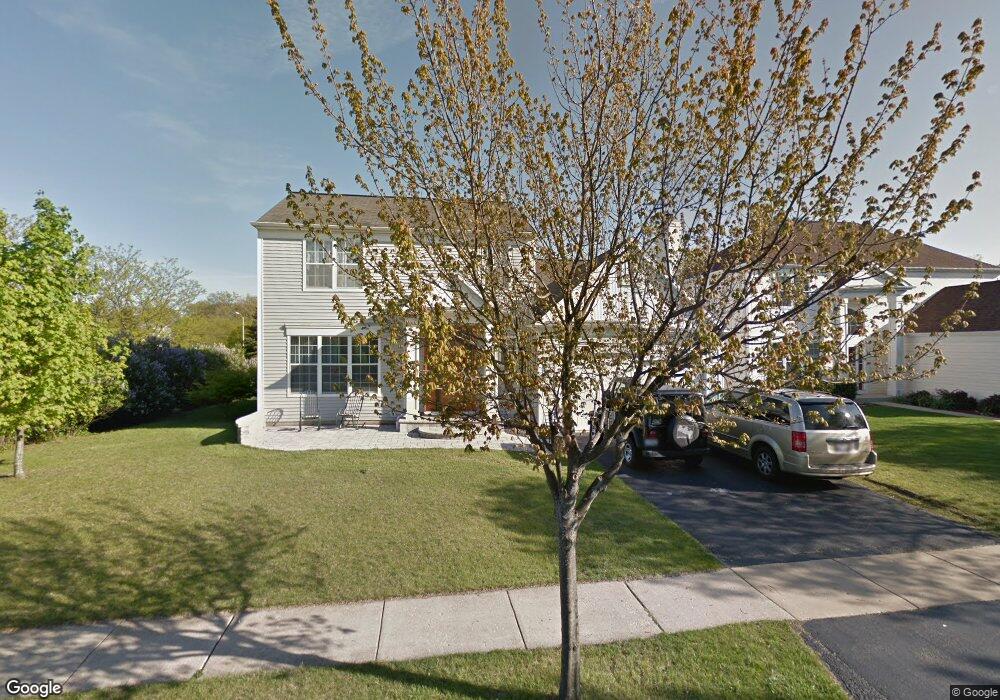
299 Carters Grove Ct Grayslake, IL 60030
Estimated Value: $412,112 - $428,000
3
Beds
3
Baths
1,880
Sq Ft
$224/Sq Ft
Est. Value
About This Home
This home is located at 299 Carters Grove Ct, Grayslake, IL 60030 and is currently estimated at $421,778, approximately $224 per square foot. 299 Carters Grove Ct is a home located in Lake County with nearby schools including Frederick School, Meadowview School, and Grayslake Middle School.
Ownership History
Date
Name
Owned For
Owner Type
Purchase Details
Closed on
Jan 26, 2011
Sold by
Niemi Thomas L and Niemi Margie
Bought by
Niemi Thomas L and Niemi Margie
Current Estimated Value
Purchase Details
Closed on
Dec 2, 1993
Sold by
Pulte Home Corp
Bought by
Niemi Thomas L and Niemi Margie
Home Financials for this Owner
Home Financials are based on the most recent Mortgage that was taken out on this home.
Original Mortgage
$122,000
Interest Rate
6.82%
Create a Home Valuation Report for This Property
The Home Valuation Report is an in-depth analysis detailing your home's value as well as a comparison with similar homes in the area
Home Values in the Area
Average Home Value in this Area
Purchase History
| Date | Buyer | Sale Price | Title Company |
|---|---|---|---|
| Niemi Thomas L | -- | None Available | |
| Niemi Thomas L | $115,000 | -- |
Source: Public Records
Mortgage History
| Date | Status | Borrower | Loan Amount |
|---|---|---|---|
| Closed | Niemi Thomas L | $122,000 |
Source: Public Records
Tax History Compared to Growth
Tax History
| Year | Tax Paid | Tax Assessment Tax Assessment Total Assessment is a certain percentage of the fair market value that is determined by local assessors to be the total taxable value of land and additions on the property. | Land | Improvement |
|---|---|---|---|---|
| 2024 | $10,109 | $107,495 | $20,092 | $87,403 |
| 2023 | $10,141 | $93,958 | $17,562 | $76,396 |
| 2022 | $10,141 | $90,565 | $14,600 | $75,965 |
| 2021 | $10,022 | $87,048 | $14,033 | $73,015 |
| 2020 | $10,018 | $82,824 | $13,352 | $69,472 |
| 2019 | $9,671 | $79,463 | $12,810 | $66,653 |
| 2018 | $10,521 | $86,057 | $19,040 | $67,017 |
| 2017 | $10,408 | $80,949 | $17,910 | $63,039 |
| 2016 | $9,989 | $74,725 | $16,533 | $58,192 |
| 2015 | $9,734 | $68,267 | $15,104 | $53,163 |
| 2014 | $9,539 | $66,747 | $15,404 | $51,343 |
| 2012 | $9,386 | $69,710 | $16,088 | $53,622 |
Source: Public Records
Map
Nearby Homes
- 20295 W Washington St
- 872 Tylerton Cir
- 1050 Williamsburg Cir
- 268 Normandy Ln
- 618 Barron Blvd
- 21238 W Washington St
- 418 Flanders Ln
- 1333 Belle Haven Dr
- 34625 N Il Route 83
- 745 Dillon Ct
- 633 Dove Ct Unit 4
- 820 Amelia Ct
- 65 Pimlico Ct
- 1501 Belle Haven Dr
- 873 Essex Cir
- 219 Galway St
- 1414 Remington Ct
- 1409 Doolittle Ln
- 1045 Manchester Cir
- 707 Crossland Dr
- 291 Carters Grove Ct
- 285 Carters Grove Ct
- 300 Carters Grove Ct
- 292 Carters Grove Ct
- 277 Carters Grove Ct
- 284 Carters Grove Ct
- 269 Carters Grove Ct
- 276 Carters Grove Ct
- 304 Rock Hall Cir
- 308 Rock Hall Cir Unit 1
- 876 Chesapeake Blvd
- 314 Rock Hall Cir
- 847 Chesapeake Blvd
- 268 Carters Grove Ct Unit 2
- 261 Carters Grove Ct
- 320 Rock Hall Cir
- 855 Chesapeake Blvd
- 496 Rock Hall Cir
- 863 Chesapeake Blvd
- 260 Carters Grove Ct