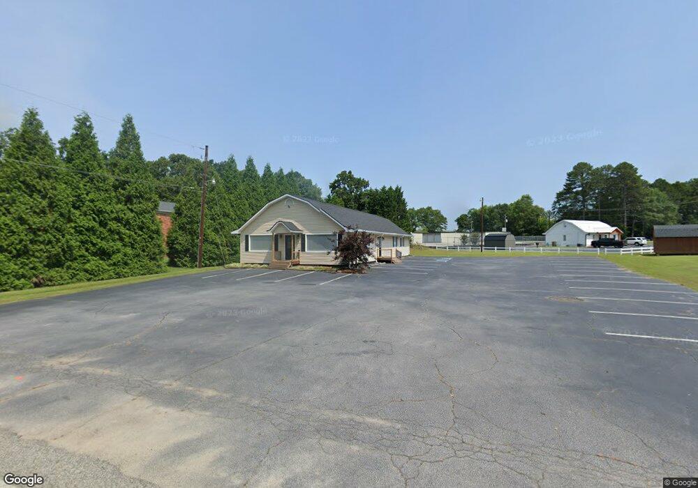
299 Cedar Creek Rd Winder, GA 30680
Estimated Value: $391,693
--
Bed
--
Bath
2,400
Sq Ft
$163/Sq Ft
Est. Value
About This Home
This home is located at 299 Cedar Creek Rd, Winder, GA 30680 and is currently estimated at $391,693, approximately $163 per square foot. 299 Cedar Creek Rd is a home located in Barrow County with nearby schools including County Line Elementary School, Russell Middle School, and Winder-Barrow High School.
Ownership History
Date
Name
Owned For
Owner Type
Purchase Details
Closed on
Jul 21, 2016
Sold by
Manders James E and Manders Faye S
Bought by
Barrow County Farm Bureau Inc
Current Estimated Value
Purchase Details
Closed on
May 14, 2004
Sold by
Stafford Thomas J
Bought by
Manders James E and Manders Faye S
Home Financials for this Owner
Home Financials are based on the most recent Mortgage that was taken out on this home.
Original Mortgage
$210,000
Interest Rate
5.49%
Mortgage Type
Commercial
Create a Home Valuation Report for This Property
The Home Valuation Report is an in-depth analysis detailing your home's value as well as a comparison with similar homes in the area
Home Values in the Area
Average Home Value in this Area
Purchase History
| Date | Buyer | Sale Price | Title Company |
|---|---|---|---|
| Barrow County Farm Bureau Inc | $180,000 | -- | |
| Manders James E | $185,000 | -- |
Source: Public Records
Mortgage History
| Date | Status | Borrower | Loan Amount |
|---|---|---|---|
| Previous Owner | Manders James E | $210,000 |
Source: Public Records
Tax History Compared to Growth
Tax History
| Year | Tax Paid | Tax Assessment Tax Assessment Total Assessment is a certain percentage of the fair market value that is determined by local assessors to be the total taxable value of land and additions on the property. | Land | Improvement |
|---|---|---|---|---|
| 2024 | $1,886 | $73,254 | $21,600 | $51,654 |
| 2023 | $1,913 | $73,254 | $21,600 | $51,654 |
| 2022 | $2,200 | $73,254 | $21,600 | $51,654 |
| 2021 | $2,313 | $73,898 | $24,000 | $49,898 |
| 2020 | $2,319 | $73,898 | $24,000 | $49,898 |
| 2019 | $2,360 | $73,898 | $24,000 | $49,898 |
| 2018 | $2,269 | $72,532 | $24,000 | $48,532 |
| 2017 | $1,970 | $67,663 | $24,000 | $43,663 |
| 2016 | $1,864 | $59,954 | $24,000 | $35,954 |
| 2015 | $1,873 | $59,954 | $24,000 | $35,954 |
| 2014 | $1,605 | $49,394 | $13,440 | $35,954 |
| 2013 | -- | $46,232 | $11,760 | $34,472 |
Source: Public Records
Map
Nearby Homes
- 24 Caison Dr
- 121 Cannondale Dr
- 108 Cannondale Dr
- 72 Garrison Dr
- 66 Garrison Dr
- 98 Cannondale Dr
- 62 Garrison Dr
- 49 Cannondale Dr
- 16 Garrison Dr
- 244 Bayou Ln Unit 1
- 110 Mears St
- 74 Cannon Trace Dr
- 221 Highway 211 NW
- 128 Mcneal Rd
- The Cary A Plan at Lake Shore
- The Marion A Plan at Lake Shore
- 0 Bill Rutledge Rd Unit 10591503
- 0 Bill Rutledge Rd Unit 7630436
- 281 Hillside Dr
- 281 Springdale Dr
- 140 Cedar Creek Rd
- 301 Cedar Creek Rd
- 301 Cedar Creek Rd Unit 7 D
- 301 Cedar Creek Rd Unit 7 B
- 0 Cedar Creek Rd Unit 7147203
- 0 Cedar Creek Rd Unit 3278093
- 0 Cedar Creek Rd Unit 8800879
- 0 Cedar Creek Rd Unit 8594734
- 0 Cedar Creek Rd Unit 8110617
- 0 Cedar Creek Rd Unit 3005853
- 0 Cedar Creek Rd Unit 7441916
- 0 Cedar Creek Rd Unit 8055768
- 0 Cedar Creek Rd Unit 8381010
- 0 Cedar Creek Rd Unit 9014694
- 292 Highway 211 NW
- 311 Cedar Creek Rd
- 311 Cedar Creek Rd Unit 9
- 306 Cedar Creek Rd
- 285 Georgia 211
- 289 Highway 211 NW