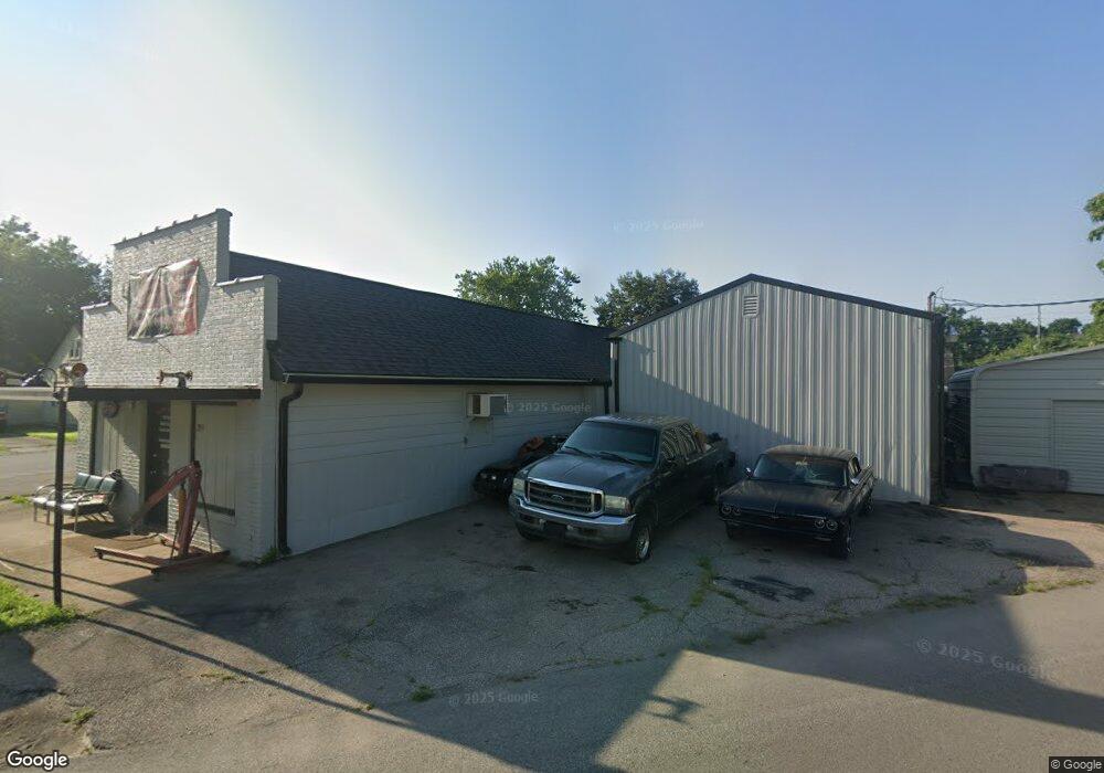
299 Cincinnati St Franklin, IN 46131
Estimated Value: $86,859
Studio
--
Bath
2,224
Sq Ft
$39/Sq Ft
Est. Value
About This Home
This home is located at 299 Cincinnati St, Franklin, IN 46131 and is currently estimated at $86,859, approximately $39 per square foot. 299 Cincinnati St is a home located in Johnson County with nearby schools including Northwood Elementary School, Franklin Community Middle School, and Custer Baker Intermediate School.
Ownership History
Date
Name
Owned For
Owner Type
Purchase Details
Closed on
Dec 10, 2021
Sold by
Richard Parks
Bought by
Graham Robin Michelle and Graham Scott A
Current Estimated Value
Purchase Details
Closed on
Nov 30, 2018
Sold by
Fletcher Thelma C
Bought by
Parks Richard
Purchase Details
Closed on
May 20, 2013
Sold by
Johnson Terry C
Bought by
Fletcher Thelma C
Purchase Details
Closed on
Oct 15, 2010
Sold by
Franklin House Of Prayer Holiness Church
Bought by
Johnson Terry C
Create a Home Valuation Report for This Property
The Home Valuation Report is an in-depth analysis detailing your home's value as well as a comparison with similar homes in the area
Home Values in the Area
Average Home Value in this Area
Purchase History
| Date | Buyer | Sale Price | Title Company |
|---|---|---|---|
| Graham Robin Michelle | -- | New Title Company Name | |
| Parks Richard | -- | None Available | |
| Fletcher Thelma C | -- | None Available | |
| Johnson Terry C | -- | None Available |
Source: Public Records
Tax History
| Year | Tax Paid | Tax Assessment Tax Assessment Total Assessment is a certain percentage of the fair market value that is determined by local assessors to be the total taxable value of land and additions on the property. | Land | Improvement |
|---|---|---|---|---|
| 2025 | $1,413 | $54,500 | $20,600 | $33,900 |
| 2024 | $1,413 | $51,100 | $21,100 | $30,000 |
| 2023 | $1,480 | $51,100 | $21,100 | $30,000 |
| 2022 | $1,565 | $51,100 | $21,100 | $30,000 |
| 2021 | $1,408 | $43,600 | $21,100 | $22,500 |
| 2020 | $1,347 | $41,700 | $19,200 | $22,500 |
| 2019 | $1,347 | $41,700 | $19,200 | $22,500 |
| 2018 | $1,272 | $41,700 | $19,200 | $22,500 |
| 2017 | $1,293 | $43,100 | $19,200 | $23,900 |
| 2016 | $1,590 | $53,000 | $19,200 | $33,800 |
| 2014 | $1,581 | $52,700 | $19,200 | $33,500 |
| 2013 | $1,581 | $40,500 | $7,000 | $33,500 |
Source: Public Records
Map
Nearby Homes
- 601 Duane St
- 698 Yandes St
- 348 Ohio St
- 750 Hurricane St
- 298 N Water St
- 147 E King St
- 450 E Madison St
- 0 W 900 Hwy Unit 202537998
- 484 E Jefferson St
- 227 E Jefferson St
- 222 Lynhurst St
- 1110 Hillview Dr
- 178 S Water St Unit F
- 76 E Wayne St Unit B
- 252 S Main St
- 1102 E Jefferson St
- 153 N Vaught St
- 1908 Porter Dr
- 21 S Dawn Dr
- 497 Fleetwood Ln