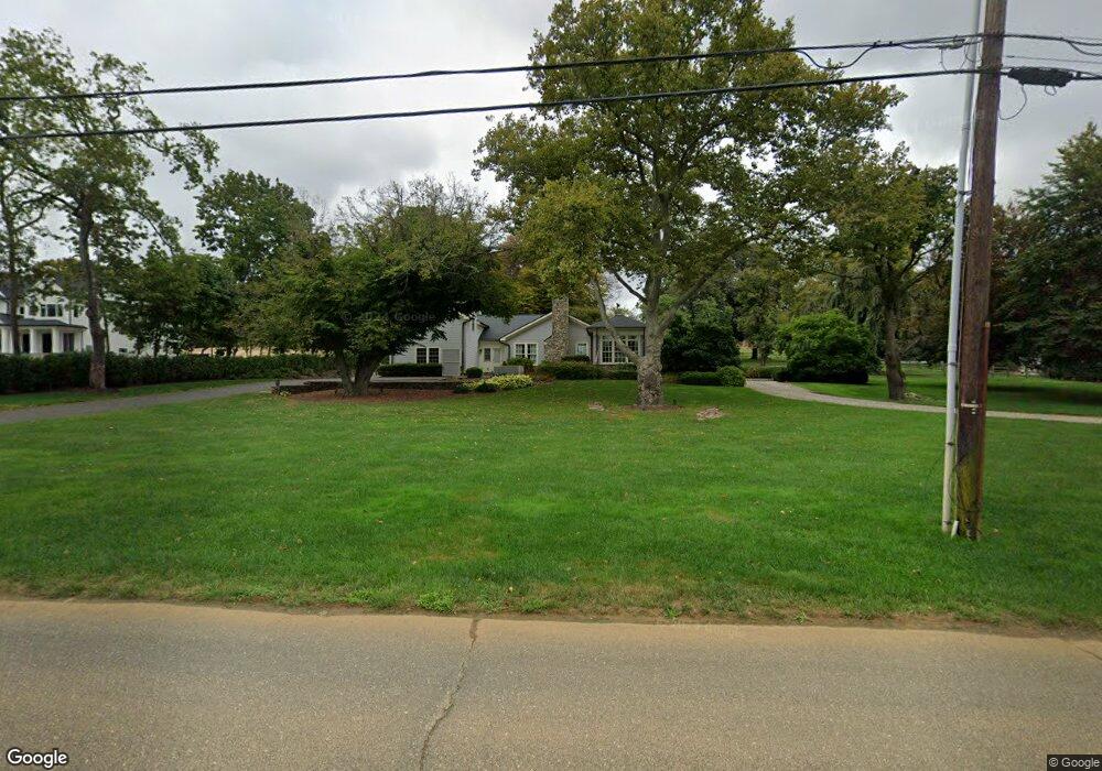
299 Cooper Rd Red Bank, NJ 07701
New Monmouth NeighborhoodEstimated Value: $1,420,000 - $2,136,000
3
Beds
4
Baths
3,412
Sq Ft
$557/Sq Ft
Est. Value
About This Home
This home is located at 299 Cooper Rd, Red Bank, NJ 07701 and is currently estimated at $1,900,334, approximately $556 per square foot. 299 Cooper Rd is a home located in Monmouth County with nearby schools including Fairview Elementary School, Bayshore Middle School, and Middletown High School North.
Ownership History
Date
Name
Owned For
Owner Type
Purchase Details
Closed on
Dec 17, 2021
Sold by
Barry James P and Estate Of James P Barry
Bought by
Cruz Jason
Current Estimated Value
Purchase Details
Closed on
Jul 13, 2020
Sold by
Feeney David W and Feeney Elizabeth B
Bought by
Barry James P
Home Financials for this Owner
Home Financials are based on the most recent Mortgage that was taken out on this home.
Original Mortgage
$1,000,000
Interest Rate
3.2%
Mortgage Type
New Conventional
Purchase Details
Closed on
Feb 6, 2016
Sold by
Steven Raia Family Partnership Lp
Bought by
Feeney David W and Feeney Elizabeth B
Purchase Details
Closed on
Oct 8, 2013
Sold by
Mealia Harry O and Mealia James P O
Bought by
Steven Raia Family Partnership Lp
Create a Home Valuation Report for This Property
The Home Valuation Report is an in-depth analysis detailing your home's value as well as a comparison with similar homes in the area
Home Values in the Area
Average Home Value in this Area
Purchase History
| Date | Buyer | Sale Price | Title Company |
|---|---|---|---|
| Cruz Jason | $1,527,000 | Trident Abstract Ttl Agcy Ll | |
| Barry James P | $1,250,000 | Mega Title Llc | |
| Feeney David W | $1,250,000 | Old Republic National Title | |
| Steven Raia Family Partnership Lp | $1,400,000 | Agent For Commonwealth |
Source: Public Records
Mortgage History
| Date | Status | Borrower | Loan Amount |
|---|---|---|---|
| Previous Owner | Barry James P | $1,000,000 |
Source: Public Records
Tax History Compared to Growth
Tax History
| Year | Tax Paid | Tax Assessment Tax Assessment Total Assessment is a certain percentage of the fair market value that is determined by local assessors to be the total taxable value of land and additions on the property. | Land | Improvement |
|---|---|---|---|---|
| 2025 | $26,716 | $1,735,800 | $997,000 | $738,800 |
| 2024 | $27,471 | $1,624,100 | $898,800 | $725,300 |
| 2023 | $27,471 | $1,580,600 | $864,200 | $716,400 |
| 2022 | $26,000 | $1,370,800 | $789,000 | $581,800 |
| 2021 | $26,000 | $1,250,000 | $789,000 | $461,000 |
| 2020 | $27,805 | $1,300,500 | $789,000 | $511,500 |
| 2019 | $27,524 | $1,303,200 | $789,000 | $514,200 |
| 2018 | $27,722 | $1,279,300 | $789,000 | $490,300 |
| 2017 | $29,071 | $1,368,700 | $789,000 | $579,700 |
| 2016 | $28,726 | $1,348,000 | $789,000 | $559,000 |
| 2015 | $27,935 | $1,307,800 | $789,000 | $518,800 |
| 2014 | $25,342 | $1,157,700 | $789,000 | $368,700 |
Source: Public Records
Map
Nearby Homes
- 310 Cooper Rd Unit C
- 4 Breana Ct
- 152 Chapel Hill Rd
- 39 Market St
- 839 Arthur Dr
- 458 Navesink River Rd
- 139 Statesir Place
- 78 Crestview Dr
- 508 Abby Rd Unit 508
- 35 Fairview Dr
- 51 Blossom Cove Rd
- 19 Statesir Place
- 583 Navesink River Rd
- 238 Martin Place
- 37 Delaware Ave
- 9 Wesleyan St
- 833 Lincoln St
- 44 Monroe St
- 3504 James Ct Unit 159
- 43 Roosevelt Cir W
- 295 Cooper Rd
- 303 Cooper Rd
- 291 Cooper Rd
- 24 Hillandale Dr
- 621 Patterson Ln
- 15 Hillandale Dr
- 286 Cooper Rd
- 29 Independence Rd
- 295 Cooper Rd
- 25 Hillandale Dr
- 310 Cooper Rd Unit A
- 310 Cooper Rd Unit Main House
- 310 Cooper Rd Unit D
- 310 Cooper Rd
- 35 Hillandale Dr
- 280 Cooper Rd
- 283 Cooper Rd
- 45 Hillandale Dr
- 531 Patterson Ln
- 521 Patterson Ln