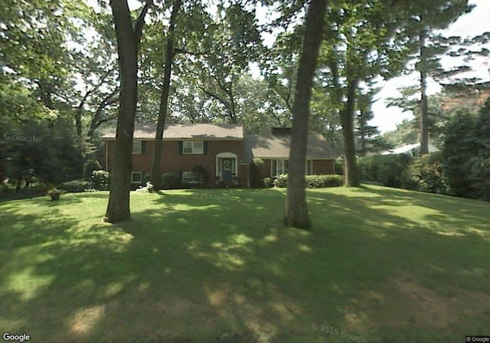
299 Ellington Rd Longmeadow, MA 01106
Estimated Value: $611,000 - $686,000
4
Beds
3
Baths
1,958
Sq Ft
$326/Sq Ft
Est. Value
About This Home
This home is located at 299 Ellington Rd, Longmeadow, MA 01106 and is currently estimated at $638,263, approximately $325 per square foot. 299 Ellington Rd is a home located in Hampden County with nearby schools including Blueberry Hill, Williams Middle School, and Longmeadow High School.
Ownership History
Date
Name
Owned For
Owner Type
Purchase Details
Closed on
Oct 27, 2009
Sold by
Healy Jennifer and Healy John
Bought by
Healy Jennifer
Current Estimated Value
Purchase Details
Closed on
Aug 1, 2006
Sold by
Paren Dennis A and Paren Maria S
Bought by
Healy Jennifer and Healy John
Home Financials for this Owner
Home Financials are based on the most recent Mortgage that was taken out on this home.
Original Mortgage
$308,000
Interest Rate
6.67%
Mortgage Type
Purchase Money Mortgage
Purchase Details
Closed on
Sep 3, 1999
Sold by
Pappas Vasil J
Bought by
Paren Dennis A and Paren Maria S
Home Financials for this Owner
Home Financials are based on the most recent Mortgage that was taken out on this home.
Original Mortgage
$200,000
Interest Rate
7.5%
Mortgage Type
Purchase Money Mortgage
Create a Home Valuation Report for This Property
The Home Valuation Report is an in-depth analysis detailing your home's value as well as a comparison with similar homes in the area
Home Values in the Area
Average Home Value in this Area
Purchase History
| Date | Buyer | Sale Price | Title Company |
|---|---|---|---|
| Healy Jennifer | -- | -- | |
| Healy Jennifer | $385,000 | -- | |
| Paren Dennis A | $275,000 | -- |
Source: Public Records
Mortgage History
| Date | Status | Borrower | Loan Amount |
|---|---|---|---|
| Previous Owner | Paren Dennis A | $326,000 | |
| Previous Owner | Healy Jennifer | $308,000 | |
| Previous Owner | Paren Dennis A | $200,000 |
Source: Public Records
Tax History
| Year | Tax Paid | Tax Assessment Tax Assessment Total Assessment is a certain percentage of the fair market value that is determined by local assessors to be the total taxable value of land and additions on the property. | Land | Improvement |
|---|---|---|---|---|
| 2025 | $12,370 | $585,700 | $259,100 | $326,600 |
| 2024 | $12,059 | $583,100 | $259,100 | $324,000 |
| 2023 | $10,745 | $468,800 | $185,800 | $283,000 |
| 2022 | $9,979 | $405,000 | $185,800 | $219,200 |
| 2021 | $10,124 | $409,200 | $199,100 | $210,100 |
| 2020 | $9,936 | $410,400 | $214,000 | $196,400 |
| 2019 | $9,887 | $410,400 | $214,000 | $196,400 |
| 2018 | $10,707 | $439,900 | $292,100 | $147,800 |
| 2017 | $10,241 | $434,300 | $292,100 | $142,200 |
| 2016 | $9,841 | $404,500 | $268,000 | $136,500 |
| 2015 | $9,491 | $401,800 | $265,300 | $136,500 |
Source: Public Records
Map
Nearby Homes
- 114 Park Dr
- 153 Porter Lake Dr Unit 153
- 58 Englewood Rd
- 32 Edgewood Ave
- 112 Grassy Gutter Rd
- 50 Elmwood Ave
- 124 Tecumseh Dr
- 1155 Dickinson St
- 20 Kimberly Cir
- 0 Dennis Rd
- 96 Firglade Ave
- 283 Longhill St
- 785 Dickinson St
- 70 Tennyson Dr
- 12 Carroll St
- 64 Magnolia Cir
- 332-334 Forest Park Ave
- 58 Appleton St
- 115 Tiffany St
- 53 Ashford Rd
Your Personal Tour Guide
Ask me questions while you tour the home.