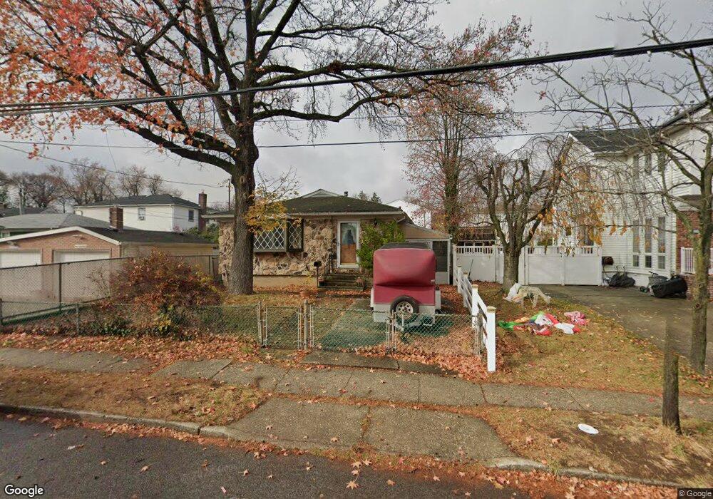
299 Greencroft Ave Staten Island, NY 10308
Great Kills NeighborhoodEstimated Value: $665,000 - $747,000
--
Bed
4
Baths
1,332
Sq Ft
$526/Sq Ft
Est. Value
About This Home
This home is located at 299 Greencroft Ave, Staten Island, NY 10308 and is currently estimated at $700,159, approximately $525 per square foot. 299 Greencroft Ave is a home located in Richmond County with nearby schools including P.S. 53 The Barbara Esselborn School, Myra S. Barnes Intermediate School 24, and New Dorp High School.
Ownership History
Date
Name
Owned For
Owner Type
Purchase Details
Closed on
Apr 25, 2012
Sold by
Stio Dorothy and Schweizer Dorothy
Bought by
Stio Peter and Stio Dorothy
Current Estimated Value
Home Financials for this Owner
Home Financials are based on the most recent Mortgage that was taken out on this home.
Original Mortgage
$577,500
Interest Rate
3.9%
Mortgage Type
Reverse Mortgage Home Equity Conversion Mortgage
Create a Home Valuation Report for This Property
The Home Valuation Report is an in-depth analysis detailing your home's value as well as a comparison with similar homes in the area
Home Values in the Area
Average Home Value in this Area
Purchase History
| Date | Buyer | Sale Price | Title Company |
|---|---|---|---|
| Stio Peter | -- | None Available |
Source: Public Records
Mortgage History
| Date | Status | Borrower | Loan Amount |
|---|---|---|---|
| Closed | Stio Peter | $577,500 |
Source: Public Records
Tax History Compared to Growth
Tax History
| Year | Tax Paid | Tax Assessment Tax Assessment Total Assessment is a certain percentage of the fair market value that is determined by local assessors to be the total taxable value of land and additions on the property. | Land | Improvement |
|---|---|---|---|---|
| 2025 | $6,855 | $47,280 | $8,402 | $38,878 |
| 2024 | $6,855 | $38,640 | $10,281 | $28,359 |
| 2023 | $6,879 | $33,871 | $9,778 | $24,093 |
| 2022 | $6,378 | $35,940 | $11,640 | $24,300 |
| 2021 | $2,158 | $37,500 | $11,640 | $25,860 |
| 2020 | $2,046 | $36,360 | $11,640 | $24,720 |
| 2019 | $2,015 | $32,160 | $11,640 | $20,520 |
| 2018 | $1,924 | $28,226 | $10,084 | $18,142 |
| 2017 | $1,898 | $26,629 | $11,557 | $15,072 |
| 2016 | $1,730 | $25,122 | $9,926 | $15,196 |
| 2015 | $1,525 | $23,700 | $9,720 | $13,980 |
| 2014 | $1,525 | $23,700 | $9,720 | $13,980 |
Source: Public Records
Map
Nearby Homes
- 7 Cottage Ave
- 289 Maybury Ave
- 21 Coral Ct
- 76 Whitman Ave
- 177 Hillside Terrace
- 51 Yacht Club Cove Unit 51
- 51 Yacht Club Cove St Unit 51
- 23 Melrose Place
- 14 Yacht Club Cove St Unit 14
- 309 Cleveland Ave
- 45 Fairlawn Loop
- 16 Florence St
- 142 Great Kills Rd Unit A
- 0 Dent Rd
- 346 Cleveland Ave
- 5 Osprey Ct
- 71 Grandview Terrace
- 163 Keegans Ln
- 7 Trent St
- 268 Nelson Ave
- 299 Greencroft Ave
- 295-299 Greencroft Ave
- 295 Greencroft Ave
- 281 Great Kills Rd
- 285 Great Kills Rd
- 277 Great Kills Rd
- 302 Maybury Ave
- 302 Maybury Ave Unit 2family
- 289 Greencroft Ave
- 298 Maybury Ave
- 28 Greencroft Ln
- 273 Great Kills Rd
- 294 Maybury Ave
- 287 Greencroft Ave
- 26 Greencroft Ln
- 300 Greencroft Ave
- 269 Great Kills Rd
- 295 Great Kills Rd
- 302 Greencroft Ave
- 29 Greencroft Ln