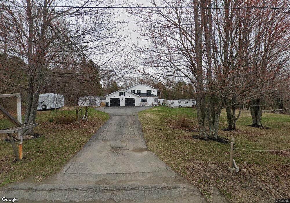
299 Kenduskeag Rd Levant, ME 04456
Estimated Value: $317,000 - $420,000
4
Beds
2
Baths
2,740
Sq Ft
$142/Sq Ft
Est. Value
About This Home
This home is located at 299 Kenduskeag Rd, Levant, ME 04456 and is currently estimated at $388,013, approximately $141 per square foot. 299 Kenduskeag Rd is a home located in Penobscot County with nearby schools including Suzanne M. Smith Elementary School and Caravel Middle School.
Ownership History
Date
Name
Owned For
Owner Type
Purchase Details
Closed on
Dec 1, 2009
Sold by
Ryder Wayne and Ryder Donna
Bought by
Ames Suellen M
Current Estimated Value
Home Financials for this Owner
Home Financials are based on the most recent Mortgage that was taken out on this home.
Original Mortgage
$152,000
Outstanding Balance
$99,245
Interest Rate
4.92%
Mortgage Type
Unknown
Estimated Equity
$288,768
Create a Home Valuation Report for This Property
The Home Valuation Report is an in-depth analysis detailing your home's value as well as a comparison with similar homes in the area
Home Values in the Area
Average Home Value in this Area
Purchase History
| Date | Buyer | Sale Price | Title Company |
|---|---|---|---|
| Ames Suellen M | -- | -- |
Source: Public Records
Mortgage History
| Date | Status | Borrower | Loan Amount |
|---|---|---|---|
| Open | Ames Suellen M | $152,000 |
Source: Public Records
Tax History Compared to Growth
Tax History
| Year | Tax Paid | Tax Assessment Tax Assessment Total Assessment is a certain percentage of the fair market value that is determined by local assessors to be the total taxable value of land and additions on the property. | Land | Improvement |
|---|---|---|---|---|
| 2024 | $3,177 | $288,800 | $43,300 | $245,500 |
| 2023 | $3,128 | $266,200 | $43,300 | $222,900 |
| 2022 | $3,196 | $182,600 | $33,700 | $148,900 |
| 2021 | $3,196 | $182,600 | $33,700 | $148,900 |
| 2020 | $3,196 | $182,600 | $33,700 | $148,900 |
| 2019 | $3,595 | $182,600 | $33,700 | $148,900 |
| 2018 | $2,563 | $183,100 | $33,700 | $149,400 |
| 2017 | $2,288 | $169,500 | $33,700 | $135,800 |
| 2016 | $2,119 | $169,500 | $33,700 | $135,800 |
| 2015 | $2,119 | $169,500 | $33,700 | $135,800 |
| 2014 | $2,119 | $169,500 | $33,700 | $135,800 |
Source: Public Records
Map
Nearby Homes
- 38 Island Farm Rd
- 70 Clark Rd
- 9A Clark Rd
- 493 Townhouse Rd
- 5 Deer Run Ln
- 3729 Union St
- 3768 Union St
- 35 Birchbrook Ln Unit 35A
- 3922 Union St
- 3935 Union St
- Lot 7-46-9 Clewley Rd
- 50 Pember Rd
- 9 Thibodeau Dr
- 35 Townhouse Rd
- 67 Stacey Ln
- 36 Center St
- 12 Grace Snow Dr
- 20 Sandy Dr
- 4 Chestnut Ln
- Lot 15-15 Stetson Rd E
- 305 Kenduskeag Rd
- 287 Kenduskeag Rd
- 282 Kenduskeag Rd
- 0 Kenduskeag Levant Rd Unit 1110958
- 0 Kenduskeag Levant Rd Unit 1101243
- 321 Kenduskeag Rd
- 358 Kenduskeag Levant Rd
- 318 Kenduskeag Rd
- 352 Kenduskeag Levant Rd
- 362 Kenduskeag-Levant Rd
- 388 Kenduskeag-Levant Rd
- 380 Kenduskeag Levant Rd
- 383 Kenduskeag Levant Rd
- 228 Kenduskeag Rd
- M2L3 Levant Rd
- 181 Kenduskeag Rd
- 417 Kenduskeag Levant Rd
- Lot #5 Kenduskeag-Levant Rd
- Lot #3 Kenduskeag-Levant Rd
- 32 Sawyer Rd