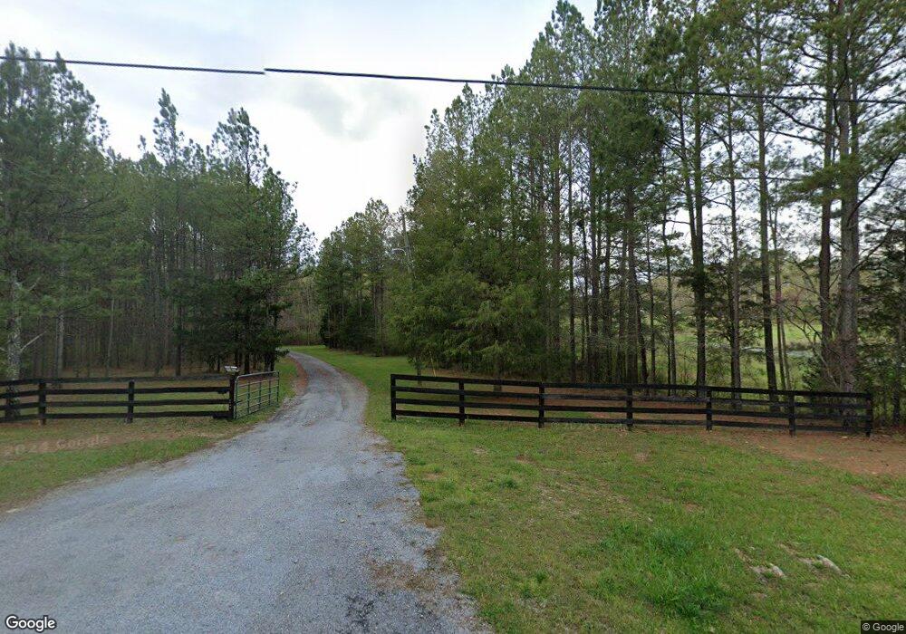
299 McGee Bend Rd SW Cave Spring, GA 30124
Estimated Value: $254,811 - $306,000
--
Bed
2
Baths
1,764
Sq Ft
$159/Sq Ft
Est. Value
About This Home
This home is located at 299 McGee Bend Rd SW, Cave Spring, GA 30124 and is currently estimated at $280,406, approximately $158 per square foot. 299 McGee Bend Rd SW is a home with nearby schools including Coosa Middle School and Coosa High School.
Ownership History
Date
Name
Owned For
Owner Type
Purchase Details
Closed on
Oct 26, 2004
Bought by
P and R
Current Estimated Value
Purchase Details
Closed on
Nov 18, 2003
Sold by
Lovett Paul and Lovett Martha H
Bought by
Salmon Randy and Salmon Deborah L
Purchase Details
Closed on
Aug 26, 1993
Bought by
P and R
Purchase Details
Closed on
Sep 29, 1986
Sold by
Lovett Paul L
Bought by
Lovett Paul and Lovett Martha H
Purchase Details
Closed on
Feb 23, 1972
Bought by
P and R
Purchase Details
Closed on
Feb 22, 1972
Bought by
Lovett Paul L
Create a Home Valuation Report for This Property
The Home Valuation Report is an in-depth analysis detailing your home's value as well as a comparison with similar homes in the area
Home Values in the Area
Average Home Value in this Area
Purchase History
| Date | Buyer | Sale Price | Title Company |
|---|---|---|---|
| P | $4,000 | -- | |
| Salmon Randy | $143,000 | -- | |
| P | -- | -- | |
| Lovett Paul | -- | -- | |
| P | -- | -- | |
| Lovett Paul L | $1,000 | -- |
Source: Public Records
Tax History Compared to Growth
Tax History
| Year | Tax Paid | Tax Assessment Tax Assessment Total Assessment is a certain percentage of the fair market value that is determined by local assessors to be the total taxable value of land and additions on the property. | Land | Improvement |
|---|---|---|---|---|
| 2024 | $1,206 | $77,066 | $11,032 | $66,034 |
| 2023 | $1,828 | $75,534 | $11,032 | $64,502 |
| 2022 | $1,648 | $63,269 | $8,749 | $54,520 |
| 2021 | $1,427 | $50,777 | $6,289 | $44,488 |
| 2020 | $1,386 | $48,741 | $5,566 | $43,175 |
| 2019 | $1,327 | $47,352 | $5,566 | $41,786 |
| 2018 | $1,263 | $45,166 | $4,844 | $40,322 |
| 2017 | $1,245 | $44,469 | $4,844 | $39,625 |
| 2016 | $1,256 | $44,336 | $4,840 | $39,496 |
| 2015 | $1,230 | $44,336 | $4,840 | $39,496 |
| 2014 | $1,230 | $44,336 | $4,840 | $39,496 |
Source: Public Records
Map
Nearby Homes
- 0 McGee Bend Rd SW Unit 10351960
- 0 Old Blacks Bluff Rd SW Unit 10652523
- 47 Boyd Rd SW
- 3686 Blacks Bluff Rd SW
- 8006 Blacks Bluff Rd SW
- 3104 Morton Bend Rd SW
- 0 Melson Rd SW Unit 7676052
- 0 Melson Rd SW Unit 10636997
- 0 George Rd SW Unit 10567389
- 0 George Rd SW Unit 7618177
- 8203 Blacks Bluff Rd SW
- 0 Mill Rd Unit 10629874
- 0 Mill Rd Unit 7670319
- 8876 Cave Spring
- 8876 Cave Spring Rd SW
- 0 Ausburn Rd SW Unit 10611100
- 57 Mill St
- 5598 Fosters Mill Rd
- 0 Morton Bend Rd SW Unit 7665378
- 0 Morton Bend Rd SW Unit 10638763
- 313 McGee Bend Rd SW
- 255 McGee Bend Rd SW
- 329 McGee Bend Rd SW
- 246 McGee Bend Rd SW
- 333 McGee Bend Rd SW
- 281 McGee Bend Rd SW
- 200 McGee Bend Rd SW
- 266 McGee Bend Rd SW
- 375 McGee Bend Rd SW
- 350 McGee Bend Rd SW
- 386 McGee Bend Rd SW Unit 7
- 386 McGee Bend Rd SW
- 1088 McGee Bend Rd SW
- 1088 McGee Bend Rd SW
- 131 McGee Bend Rd SW
- 131 McGee Bend Rd SW
- 424 McGee Bend Rd SW
- 436 McGee Bend Rd SW
- 158 McGee Bend Rd SW
- 101 McGee Bend Rd SW
