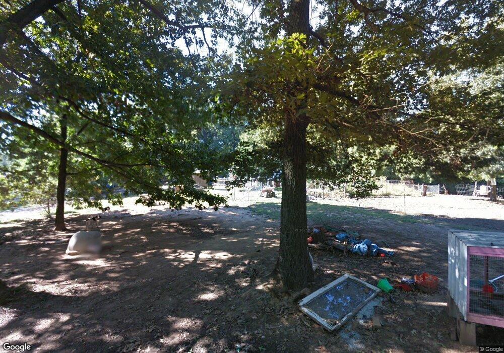
299 W Williams Dr Equality, IL 62934
Estimated Value: $55,088
--
Bed
--
Bath
--
Sq Ft
1
Acres
About This Home
This home is located at 299 W Williams Dr, Equality, IL 62934 and is currently estimated at $55,088. 299 W Williams Dr is a home with nearby schools including Gallatin Elementary School, Gallatin Junior High School, and Gallatin High School.
Ownership History
Date
Name
Owned For
Owner Type
Purchase Details
Closed on
Jan 29, 2021
Sold by
Siler and Christina
Bought by
Drone Quinton J
Current Estimated Value
Home Financials for this Owner
Home Financials are based on the most recent Mortgage that was taken out on this home.
Original Mortgage
$84,600
Outstanding Balance
$75,626
Interest Rate
2.67%
Mortgage Type
Construction
Estimated Equity
-$20,538
Purchase Details
Closed on
Dec 15, 2014
Bought by
Siler Richard and Siler Christina
Create a Home Valuation Report for This Property
The Home Valuation Report is an in-depth analysis detailing your home's value as well as a comparison with similar homes in the area
Home Values in the Area
Average Home Value in this Area
Purchase History
| Date | Buyer | Sale Price | Title Company |
|---|---|---|---|
| Drone Quinton J | $90,000 | Attorney Only | |
| Siler Richard | -- | -- | |
| Siler Richard | -- | -- |
Source: Public Records
Mortgage History
| Date | Status | Borrower | Loan Amount |
|---|---|---|---|
| Open | Drone Quinton J | $84,600 |
Source: Public Records
Tax History Compared to Growth
Tax History
| Year | Tax Paid | Tax Assessment Tax Assessment Total Assessment is a certain percentage of the fair market value that is determined by local assessors to be the total taxable value of land and additions on the property. | Land | Improvement |
|---|---|---|---|---|
| 2024 | $491 | $6,351 | $594 | $5,757 |
| 2023 | $456 | $6,351 | $594 | $5,757 |
| 2022 | $471 | $6,049 | $566 | $5,483 |
| 2021 | $468 | $5,930 | $555 | $5,375 |
| 2020 | $466 | $5,990 | $561 | $5,429 |
| 2019 | $464 | $5,990 | $561 | $5,429 |
| 2018 | $465 | $5,799 | $543 | $5,256 |
| 2017 | $470 | $5,370 | $503 | $4,867 |
| 2015 | $374 | $4,965 | $465 | $4,500 |
| 2014 | $374 | $4,965 | $465 | $4,500 |
| 2013 | $518 | $12,921 | $465 | $12,456 |
| 2012 | -- | $12,133 | $437 | $11,696 |
Source: Public Records
Map
Nearby Homes
- 0000 W Davis St
- 208 N Calhoun St
- 1000 Pearce Rd
- 3485 Coyle Ln
- 000 Kedron Rd
- 1810 Highway 142 S
- 103 N Baltimore St
- 802 Dillard St
- 806 & 808 Boyd St
- 8860 Shawnee Hill Rd
- 1504 Grove St
- 851 Madison St
- 1604 and 1600 Mahoney St
- 1105 Organ St
- 2213 Locust St
- 1116 Latham St
- 2301 N Main St
- 1414 Roosevelt Ave
- 1220 Lincoln St
- 950 Cook Rd
- 537 N Calhoun St
- 527 N Calhoun St
- 545 N Calhoun St
- 517 N Calhoun St
- 220 Ty Williams Dr
- 121 W Taswell St
- 566 N Calhoun St
- 138 W Davis St
- 575 N Calhoun St
- 550 N Calhoun St
- 534 N Calhoun St
- 516 N Calhoun St
- 552 N Calhoun St
- 498 N McDuffy St
- 601 N Calhoun St
- 461 N Calhoun St
- 167 W Davis St
- 153 W Davis St
- 177 W Davis St
- 470 N Calhoun St
